TopoQuest Logo
Do you find TopoQuest useful?
Help keep TopoQuest running and adding new maps/features by donating!
Bitcoin:  19c7KJd3qBynnjoSw5npx9KScwjBe4ifkT
Litecoin:  LXs6TkuXGGXo1vDsWCkWVdjQX94eUKd6ui
Home View Maps Find Maps Find Places Resources & Links


Ellington SE, Missouri Topographic Map

USGS Map Title: Ellington SE, MO
USGS Map MRC: 37090A7
DRG (GeoTIFF) Download: o37090a7.tif


Neighboring USGS Topographic Map Quads:


  Ellington, MO  
37090B8
 

  Clearwater Dam, MO  
37090B7
 

  Piedmont, MO  
37090B6
 

  Garwood, MO  
37090A8
 

  Ellington SE, MO  
37090A7
 

  Mill Spring, MO  
37090A6
 

  Big Spring, MO  
36090H8
 

  Hunter, MO  
36090H7
 

  Ellsinore, MO  
36090H6


Map MRC Location:

N38°
W91°
N38°
W90°
H8 H7 H6 H5 H4 H3 H2 H1
G8 G7 G6 G5 G4 G3 G2 G1
F8 F7 F6 F5 F4 F3 F2 F1
E8 E7 E6 E5 E4 E3 E2 E1
D8 D7 D6 D5 D4 D3 D2 D1
C8 C7 C6 C5 C4 C3 C2 C1
B8 B7 B6 B5 B4 B3 B2 B1
A8 A7 A6 A5 A4 A3 A2 A1
N37°
W91°
N37°
W90°

Ellington SE, MO USGS 1:24K Topographic Map Preview:
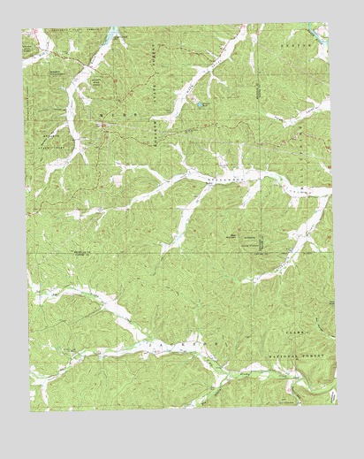
Ellington SE, MO USGS Topographic Map
Click on map above to begin viewing in our Map Viewer.

This topographic map contains these locations and features:
Feature Name Type Latitude Longitude GNIS ID View Map
Alwood CemeteryCemeteryN37.0789°W90.7929°748581View Map
Bear MountainSummitN37.0548°W90.7896°748737View Map
Chilton (historical)Populated PlaceN37.0681°W90.7518°740366View Map
Clyburn ValleyValleyN37.0681°W90.7529°749391View Map
Copeland CemeteryCemeteryN37.1223°W90.8712°749466View Map
Devils Kitchen MineMineN37.0012°W90.7748°749644View Map
Devils RunStreamN37.0087°W90.7628°749647View Map
Devils Run School (historical)SchoolN37.0078°W90.7671°747843View Map
Dog HollowValleyN37.0412°W90.8740°749674View Map
Dry Hill ChurchChurchN37.0195°W90.8576°749724View Map
Dry Hill SchoolSchoolN37.0198°W90.8615°747840View Map
DuncanLocaleN37.0737°W90.7890°740090View Map
Elm BranchStreamN37.0109°W90.7940°749827View Map
Elm Branch School (historical)SchoolN37.0095°W90.8215°747841View Map
Flying 'J' Ranch AirportAirportN37.0391°W90.8559°758973View Map
Free Union Church (historical)ChurchN37.0189°W90.8121°747842View Map
Garwood Volunteer Fire DepartmentBuildingN37.0639°W90.8747°2621489View Map
HadleyPopulated PlaceN37.0728°W90.7982°750186View Map
Hurricane HollowValleyN37.0989°W90.8571°750431View Map
Oak Grove ChurchChurchN37.0906°W90.8079°751378View Map
Oak Grove School (historical)SchoolN37.0898°W90.8071°730453View Map
Oak Spring BranchStreamN37.0009°W90.8123°751397View Map
Potter CemeteryCemeteryN37.1087°W90.8546°751731View Map
Roland ChurchChurchN37.1167°W90.8565°751948View Map
Roland SchoolSchoolN37.1170°W90.8557°747839View Map
Sanders HollowValleyN37.0942°W90.8571°752029View Map
South Fork Big Brushy CreekStreamN37.0192°W90.8187°752252View Map
South Fork Greenwood ValleyValleyN37.0731°W90.7985°739907View Map
Sweazea PondLakeN37.0990°W90.8033°752459View Map
Twin PondsLakeN37.0325°W90.7505°752645View Map
Webb CemeteryCemeteryN37.0970°W90.8148°752788View Map

Note: Coordinates in the location and feature list above are referenced to NAD83 datum.


Copyright (C) 2008-2024 Ryan Niemi / Sunset Dynamics ... All Rights Reserved