TopoQuest Logo
Do you find TopoQuest useful?
Help keep TopoQuest running and adding new maps/features by donating!
Bitcoin:  19c7KJd3qBynnjoSw5npx9KScwjBe4ifkT
Litecoin:  LXs6TkuXGGXo1vDsWCkWVdjQX94eUKd6ui
Home View Maps Find Maps Find Places Resources & Links


Ellston, Iowa Topographic Map

USGS Map Title: Ellston, IA
USGS Map MRC: 40094G1
DRG (GeoTIFF) Download: o40094g1.tif


Neighboring USGS Topographic Map Quads:


  Arispe, IA  
40094H2
 

  Tingley NE, IA  
40094H1
 

  Hopeville, IA  
40093H8
 

  Tingley, IA  
40094G2
 

  Ellston, IA  
40094G1
 

  Grand River, IA  
40093G8
 

  Mount Ayr, IA  
40094F2
 

  Kellerton, IA  
40094F1
 

  Lamoni North, IA  
40093F8


Map MRC Location:

N41°
W95°
N41°
W94°
H8 H7 H6 H5 H4 H3 H2 H1
G8 G7 G6 G5 G4 G3 G2 G1
F8 F7 F6 F5 F4 F3 F2 F1
E8 E7 E6 E5 E4 E3 E2 E1
D8 D7 D6 D5 D4 D3 D2 D1
C8 C7 C6 C5 C4 C3 C2 C1
B8 B7 B6 B5 B4 B3 B2 B1
A8 A7 A6 A5 A4 A3 A2 A1
N40°
W95°
N40°
W94°

Ellston, IA USGS 1:24K Topographic Map Preview:
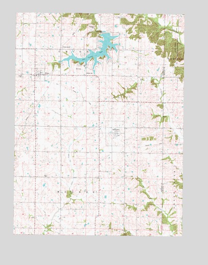
Ellston, IA USGS Topographic Map
Click on map above to begin viewing in our Map Viewer.

This topographic map contains these locations and features:
Feature Name Type Latitude Longitude GNIS ID View Map
BeaconsfieldPopulated PlaceN40.8078°W94.0505°454399View Map
Beaconsfield (historical)LocaleN40.8064°W94.0513°1969450View Map
Beaconsfield Post OfficePost OfficeN40.8078°W94.0505°1969451View Map
Bear CemeteryCemeteryN40.7750°W94.0836°1969452View Map
Blackmore Post Office (historical)Post OfficeN40.7917°W94.1002°1969382View Map
City of BeaconsfieldCivilN40.8076°W94.0507°2394093View Map
City of EllstonCivilN40.8405°W94.1088°2394666View Map
EllstonPopulated PlaceN40.8403°W94.1086°456323View Map
Ellston (historical)LocaleN40.8389°W94.1102°1969448View Map
Ellston CemeteryCemeteryN40.8387°W94.1196°1822894View Map
Ellston Post OfficePost OfficeN40.8403°W94.1086°1969446View Map
First Christian ChurchChurchN40.8400°W94.1069°1969447View Map
Oliver CemeteryCemeteryN40.7830°W94.1003°1822892View Map
Pumptown CemeteryCemeteryN40.8667°W94.0669°1822895View Map
Sand Creek State Wildlife AreaParkN40.8528°W94.0008°1822893View Map
Sun Valley Country ClubLocaleN40.8444°W94.0780°1969449View Map
Sun Valley LakeReservoirN40.8507°W94.0702°1822896View Map
Sun Valley Lake Census Designated PlaceCensusN40.8512°W94.0684°2585488View Map
Township of MonroeCivilN40.7679°W94.0722°468399View Map
Township of UnionCivilN40.8542°W94.0719°468839View Map
Union Hill Post Office (historical)Post OfficeN40.8547°W94.0641°466515View Map
Union Township Fire DepartmentBuildingN40.8403°W94.1077°2577242View Map

Note: Coordinates in the location and feature list above are referenced to NAD83 datum.


Copyright (C) 2008-2025 Ryan Niemi / Sunset Dynamics ... All Rights Reserved