TopoQuest Logo
Do you find TopoQuest useful?
Help keep TopoQuest running and adding new maps/features by donating!
Bitcoin:  19c7KJd3qBynnjoSw5npx9KScwjBe4ifkT
Litecoin:  LXs6TkuXGGXo1vDsWCkWVdjQX94eUKd6ui
Home View Maps Find Maps Find Places Resources & Links


Kellerton, Iowa Topographic Map

USGS Map Title: Kellerton, IA
USGS Map MRC: 40094F1
DRG (GeoTIFF) Download: o40094f1.tif


Neighboring USGS Topographic Map Quads:


  Tingley, IA  
40094G2
 

  Ellston, IA  
40094G1
 

  Grand River, IA  
40093G8
 

  Mount Ayr, IA  
40094F2
 

  Kellerton, IA  
40094F1
 

  Lamoni North, IA  
40093F8
 

  Hatfield, MO  
40094E2
 

  Pawnee, MO  
40094E1
 

  Lamoni South, IA  
40093E8


Map MRC Location:

N41°
W95°
N41°
W94°
H8 H7 H6 H5 H4 H3 H2 H1
G8 G7 G6 G5 G4 G3 G2 G1
F8 F7 F6 F5 F4 F3 F2 F1
E8 E7 E6 E5 E4 E3 E2 E1
D8 D7 D6 D5 D4 D3 D2 D1
C8 C7 C6 C5 C4 C3 C2 C1
B8 B7 B6 B5 B4 B3 B2 B1
A8 A7 A6 A5 A4 A3 A2 A1
N40°
W95°
N40°
W94°

Kellerton, IA USGS 1:24K Topographic Map Preview:
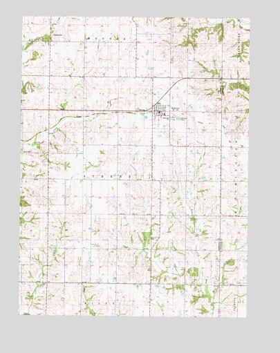
Kellerton, IA USGS Topographic Map
Click on map above to begin viewing in our Map Viewer.

This topographic map contains these locations and features:
Feature Name Type Latitude Longitude GNIS ID View Map
Assembly of God ChurchChurchN40.7108°W94.0500°1969441View Map
Christian ChurchChurchN40.7108°W94.0500°1969440View Map
City of KellertonCivilN40.7103°W94.0502°2395500View Map
Cross Post Office (historical)Post OfficeN40.6958°W94.0527°466518View Map
KellertonPopulated PlaceN40.7108°W94.0500°458029View Map
Kellerton (historical)LocaleN40.7114°W94.0488°1969437View Map
Kellerton First Response TeamBuildingN40.7106°W94.0493°2599934View Map
Kellerton Post OfficePost OfficeN40.7108°W94.0500°1969438View Map
Kuder CreekStreamN40.6333°W94.0186°463406View Map
Lewis CemeteryCemeteryN40.6592°W94.0272°1822809View Map
Maple Row CemeteryCemeteryN40.7078°W94.0425°1822813View Map
Merritt CemeteryCemeteryN40.6928°W94.1192°1822811View Map
Methodist ChurchChurchN40.7108°W94.0500°1969439View Map
Township of AthensCivilN40.6817°W94.0723°467401View Map
WanamakerPopulated PlaceN40.6458°W94.1097°464323View Map
Wanamaker Post Office (historical)Post OfficeN40.6458°W94.1097°1969369View Map
Woodland CemeteryCemeteryN40.7420°W94.1080°1822812View Map

Note: Coordinates in the location and feature list above are referenced to NAD83 datum.


Copyright (C) 2008-2024 Ryan Niemi / Sunset Dynamics ... All Rights Reserved