TopoQuest Logo
Do you find TopoQuest useful?
Help keep TopoQuest running and adding new maps/features by donating!
Bitcoin:  19c7KJd3qBynnjoSw5npx9KScwjBe4ifkT
Litecoin:  LXs6TkuXGGXo1vDsWCkWVdjQX94eUKd6ui
Home View Maps Find Maps Find Places Resources & Links


Claraville, California Topographic Map

USGS Map Title: Claraville, CA
USGS Map MRC: 35118D3
DRG (GeoTIFF) Download: o35118d3.tif


Neighboring USGS Topographic Map Quads:


  Lake Isabella South, CA  
35118E4
 

  Woolstalf Creek, CA  
35118E3
 

  Cane Canyon, CA  
35118E2
 

  Piute Peak, CA  
35118D4
 

  Claraville, CA  
35118D3
 

  Pinyon Mountain, CA  
35118D2
 

  Loraine, CA  
35118C4
 

  Emerald Mountain, CA  
35118C3
 

  Cross Mountain, CA  
35118C2


Map MRC Location:

N36°
W119°
N36°
W118°
H8 H7 H6 H5 H4 H3 H2 H1
G8 G7 G6 G5 G4 G3 G2 G1
F8 F7 F6 F5 F4 F3 F2 F1
E8 E7 E6 E5 E4 E3 E2 E1
D8 D7 D6 D5 D4 D3 D2 D1
C8 C7 C6 C5 C4 C3 C2 C1
B8 B7 B6 B5 B4 B3 B2 B1
A8 A7 A6 A5 A4 A3 A2 A1
N35°
W119°
N35°
W118°

Claraville, CA USGS 1:24K Topographic Map Preview:
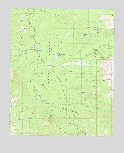
Claraville, CA USGS Topographic Map
Click on map above to begin viewing in our Map Viewer.

This topographic map contains these locations and features:
Feature Name Type Latitude Longitude GNIS ID View Map
Alaska FlatFlatN35.4977°W118.3573°269463View Map
Bryan MineMineN35.4025°W118.2706°270045View Map
Burning Moscow MineMineN35.4808°W118.2701°270089View Map
Burning Moscow SpringSpringN35.4609°W118.2568°270090View Map
Camp Nick WilliamsLocaleN35.4591°W118.3429°270210View Map
ClaravillePopulated PlaceN35.4422°W118.3295°1656461View Map
Claraville FlatFlatN35.4422°W118.3237°1656462View Map
Claraville Post Office (historical)Post OfficeN35.4422°W118.3295°2026853View Map
Dear Born MineMineN35.3775°W118.2784°275845View Map
Don Levy MineMineN35.4141°W118.2934°275850View Map
Esperanza CanyonValleyN35.4194°W118.2509°271078View Map
Evergreen MineMineN35.4736°W118.2631°275828View Map
Four Oaks MineMineN35.3916°W118.3331°275852View Map
French GulchValleyN35.4538°W118.3204°271229View Map
French MeadowFlatN35.4630°W118.3448°271232View Map
Gallup Camp (historical)LocaleN35.4066°W118.3320°1701973View Map
Gallup MineMineN35.4075°W118.3304°275849View Map
Gold Standard MineMineN35.4952°W118.3731°271336View Map
Grouse MeadowFlatN35.4094°W118.3359°271450View Map
Gwynne MineMineN35.3994°W118.3259°271461View Map
Gwynnette MineMineN35.4002°W118.3223°275851View Map
Harris Grade SpringSpringN35.4599°W118.2710°271500View Map
Harris MineMineN35.4686°W118.2598°275829View Map
Inmans (historical)Populated PlaceN35.4283°W118.3517°1701974View Map
Jerry MineMineN35.4369°W118.3273°275826View Map
Landers CreekStreamN35.4538°W118.3204°271974View Map
Landers MeadowFlatN35.4469°W118.2973°271975View Map
Landers Meadow Guard StationLocaleN35.4544°W118.3137°271976View Map
Locarno MineMineN35.3947°W118.3270°272148View Map
Lomar MeadowFlatN35.4450°W118.3284°272168View Map
Mace MeadowFlatN35.4055°W118.3142°272297View Map
Mack MineMineN35.4502°W118.3498°275825View Map
Marino CanyonValleyN35.4338°W118.2509°272352View Map
Marino MineMineN35.4294°W118.2609°272353View Map
Pine CoveValleyN35.4538°W118.3204°272979View Map
Piute LookoutLocaleN35.4800°W118.3592°1670186View Map
Saddie MineMineN35.3758°W118.3420°275853View Map
Saint John RidgeRidgeN35.4511°W118.2590°273398View Map
Shady Rest (historical)Populated PlaceN35.4061°W118.3315°1701976View Map
Simon MineMineN35.3891°W118.3254°273719View Map
Sorrell PeakSummitN35.4175°W118.2892°273806View Map
The George Lodge (historical)LocaleN35.4538°W118.3609°1670190View Map
Thornton MeadowFlatN35.3786°W118.3112°274125View Map
Virginia MineMineN35.4544°W118.3323°275824View Map
Water CanyonValleyN35.4130°W118.2509°274393View Map
Waterhole MineMineN35.4383°W118.3140°275848View Map
Waterhole Mine SpringSpringN35.4384°W118.3120°274397View Map
Weldon MeadowFlatN35.4833°W118.3384°274411View Map

Note: Coordinates in the location and feature list above are referenced to NAD83 datum.


Copyright (C) 2008-2024 Ryan Niemi / Sunset Dynamics ... All Rights Reserved