TopoQuest Logo
Do you find TopoQuest useful?
Help keep TopoQuest running and adding new maps/features by donating!
Bitcoin:  19c7KJd3qBynnjoSw5npx9KScwjBe4ifkT
Litecoin:  LXs6TkuXGGXo1vDsWCkWVdjQX94eUKd6ui
Home View Maps Find Maps Find Places Resources & Links


Emerson, Oregon Topographic Map

USGS Map Title: Emerson, OR
USGS Map MRC: 45120E8
DRG (GeoTIFF) Download: o45120e8.tif


Neighboring USGS Topographic Map Quads:


  Stacker Butte, WA  
45121F1
 

  Wishram, WA  
45120F8
 

  Biggs Junction, OR  
45120F7
 

  Petersburg, OR  
45121E1
 

  Emerson, OR  
45120E8
 

  Locust Grove, OR  
45120E7
 

  Dufur East, OR  
45121D1
 

  Summit Ridge, OR  
45120D8
 

  Erskine, OR  
45120D7


Map MRC Location:

N46°
W121°
N46°
W120°
H8 H7 H6 H5 H4 H3 H2 H1
G8 G7 G6 G5 G4 G3 G2 G1
F8 F7 F6 F5 F4 F3 F2 F1
E8 E7 E6 E5 E4 E3 E2 E1
D8 D7 D6 D5 D4 D3 D2 D1
C8 C7 C6 C5 C4 C3 C2 C1
B8 B7 B6 B5 B4 B3 B2 B1
A8 A7 A6 A5 A4 A3 A2 A1
N45°
W121°
N45°
W120°

Emerson, OR USGS 1:24K Topographic Map Preview:
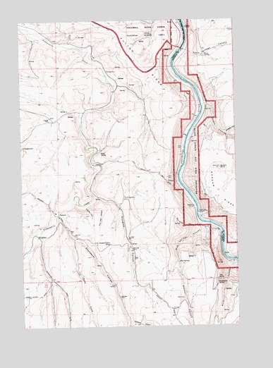
Emerson, OR USGS Topographic Map
Click on map above to begin viewing in our Map Viewer.

This topographic map contains these locations and features:
Feature Name Type Latitude Longitude GNIS ID View Map
Allen CanyonValleyN45.5596°W120.9115°1116875View Map
Blue Sands CanyonValleyN45.5421°W120.8987°1117864View Map
BrookhouseLocaleN45.5887°W120.9595°1129693View Map
Burn CanyonValleyN45.5254°W120.8784°1118334View Map
Columbia HallLocaleN45.5732°W120.9998°1119166View Map
Davis CreekStreamN45.5462°W120.9798°1119710View Map
Deer SpringSpringN45.5193°W120.8877°1119842View Map
Douglas HollowValleyN45.5529°W120.9565°1120048View Map
Douglas Hollow SchoolLocaleN45.5335°W120.9501°1120049View Map
Drill Box CanyonValleyN45.5482°W120.9648°1120088View Map
EmersonPopulated PlaceN45.5457°W120.9803°1136262View Map
Ferry SpringsSpringN45.6101°W120.8940°1120692View Map
Ferry Springs CanyonValleyN45.6126°W120.9053°1120693View Map
Free BridgeLocaleN45.5465°W120.8987°1158245View Map
FreebridgeLocaleN45.5782°W120.9645°1129694View Map
Freebridge Post Office (historical)Post OfficeN45.5782°W120.9645°1165279View Map
Fulton RidgeRidgeN45.6212°W120.9506°1121024View Map
Gordon ButteSummitN45.5647°W120.8859°1121256View Map
Gordon CanyonValleyN45.5904°W120.8937°1121257View Map
Kelly SpringSpringN45.5716°W120.9541°1129943View Map
Kloan (historical)LocaleN45.5490°W120.9017°1122802View Map
Mud SpringsSpringN45.5258°W120.9104°1124498View Map
Mud Springs CanyonValleyN45.5407°W120.8945°1124499View Map
Neabeck (historical)LocaleN45.5573°W120.9606°1699627View Map
Pine Tree CanyonValleyN45.5482°W120.9595°1125414View Map
Rattlesnake SpringSpringN45.5175°W120.8880°1125845View Map
Standard HollowValleyN45.5448°W120.9784°1127523View Map
Stecker CanyonValleyN45.5257°W120.9103°1127566View Map
Windmill CanyonValleyN45.5018°W120.9387°1129218View Map
Wingate CanyonValleyN45.5787°W120.8809°1129231View Map
Wrentham (historical)LocaleN45.5368°W120.9917°1136926View Map
Wrentham Post Office (historical)Post OfficeN45.5368°W120.9917°1166214View Map

Note: Coordinates in the location and feature list above are referenced to NAD83 datum.


Copyright (C) 2008-2025 Ryan Niemi / Sunset Dynamics ... All Rights Reserved