TopoQuest Logo
Do you find TopoQuest useful?
Help keep TopoQuest running and adding new maps/features by donating!
Bitcoin:  19c7KJd3qBynnjoSw5npx9KScwjBe4ifkT
Litecoin:  LXs6TkuXGGXo1vDsWCkWVdjQX94eUKd6ui
Home View Maps Find Maps Find Places Resources & Links


Wishram, Washington Topographic Map

USGS Map Title: Wishram, WA
USGS Map MRC: 45120F8
DRG (GeoTIFF) Download: o45120f8.tif


Neighboring USGS Topographic Map Quads:


  Wahkiacus, WA  
45121G1
 

  Centerville, WA  
45120G8
 

  Goldendale, WA  
45120G7
 

  Stacker Butte, WA  
45121F1
 

  Wishram, WA  
45120F8
 

  Biggs Junction, OR  
45120F7
 

  Petersburg, OR  
45121E1
 

  Emerson, OR  
45120E8
 

  Locust Grove, OR  
45120E7


Map MRC Location:

N46°
W121°
N46°
W120°
H8 H7 H6 H5 H4 H3 H2 H1
G8 G7 G6 G5 G4 G3 G2 G1
F8 F7 F6 F5 F4 F3 F2 F1
E8 E7 E6 E5 E4 E3 E2 E1
D8 D7 D6 D5 D4 D3 D2 D1
C8 C7 C6 C5 C4 C3 C2 C1
B8 B7 B6 B5 B4 B3 B2 B1
A8 A7 A6 A5 A4 A3 A2 A1
N45°
W121°
N45°
W120°

Wishram, WA USGS 1:24K Topographic Map Preview:
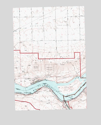
Wishram, WA USGS Topographic Map
Click on map above to begin viewing in our Map Viewer.

This topographic map contains these locations and features:
Feature Name Type Latitude Longitude GNIS ID View Map
Ainsworth (historical)LocaleN45.6493°W120.8784°1167731View Map
Bunnel SpringSpringN45.6768°W120.9954°1517102View Map
Carlisle SpringSpringN45.6362°W120.9372°1129667View Map
Celilo Falls (historical)FallsN45.6498°W120.9790°1161648View Map
Celilo Indian CemeteryCemeteryN45.6501°W120.9467°1158609View Map
Celilo Indian CemeteryCemeteryN45.6486°W120.9456°1158610View Map
Celilo LightBuildingN45.6487°W120.9669°1118769View Map
Celilo ParkParkN45.6501°W120.9620°1118770View Map
Celilo Park Boat RampHarborN45.6489°W120.9636°2699200View Map
Celilo Post Office (historical)Post OfficeN45.6468°W120.9648°1164260View Map
Celilo Treaty Fishing Access SiteReserveN45.6517°W120.9575°2434176View Map
Celilo VillageCivilN45.6446°W120.9663°2419333View Map
Celilo VillagePopulated PlaceN45.6457°W120.9659°1136134View Map
Centerville CemeteryCemeteryN45.7312°W120.9056°1517593View Map
Centerville ValleyValleyN45.7229°W120.9859°1517594View Map
Dechutes Post Office (historical)Post OfficeN45.6337°W120.9095°1164305View Map
Des Chutes (historical)LocaleN45.6351°W120.9153°1167761View Map
Deschutes Bridge Post Office (historical)Post OfficeN45.6337°W120.9095°1164313View Map
Deschutes RiverStreamN45.6354°W120.9145°1140916View Map
Deschutes River Scenic WaterwayParkN45.6262°W120.9067°1966229View Map
Deschutes River State ParkParkN45.6321°W120.9084°1119877View Map
Dillon (historical)LocaleN45.6446°W120.9767°1167726View Map
Dillon Post Office (historical)Post OfficeN45.6446°W120.9767°1165162View Map
Fulton CanyonValleyN45.6468°W120.8815°1121023View Map
Haystack ButteSummitN45.6812°W120.9087°1520626View Map
Hells GateChannelN45.6632°W120.8909°1520698View Map
Hells Gate CanyonValleyN45.6643°W120.8901°1520699View Map
Hells Gate PointCapeN45.6632°W120.8845°1520700View Map
Hells Gate Range BLocaleN45.6590°W120.8798°1529948View Map
Hellsgate Range ALocaleN45.6554°W120.9023°1529947View Map
Heritage LandingLocaleN45.6322°W120.9129°2700113View Map
Horseshoe Falls LightBuildingN45.6456°W120.9723°1122041View Map
Klickitat County Fire District 11BuildingN45.6573°W120.9682°2643332View Map
Miller (historical)LocaleN45.6396°W120.8926°1161441View Map
Miller IslandIslandN45.6501°W120.9028°1523184View Map
Miller Post Office (historical)Post OfficeN45.6396°W120.8926°1165635View Map
MoodyLocaleN45.6262°W120.9123°1161446View Map
Moody IslandIslandN45.6322°W120.9114°2548621View Map
Moody Post Office (historical)Post OfficeN45.6262°W120.9123°1165660View Map
Oregon Trunk JunctionLocaleN45.6448°W120.9856°1637857View Map
Patton SpringSpringN45.6301°W120.9808°1125238View Map
Robertson SpringsSpringN45.6797°W120.9763°1525095View Map
South ChannelChannelN45.6401°W120.9151°1158965View Map
South ChannelChannelN45.6404°W120.9128°1529949View Map
South Channel Range ALocaleN45.6623°W120.9481°1529950View Map
South Channel Range BChannelN45.6443°W120.9206°1158963View Map
South Channel Range CChannelN45.6415°W120.9040°1158966View Map
The SlideCliffN45.6862°W120.8787°1527068View Map
Tumwater (historical)LocaleN45.6476°W120.9642°1167833View Map
WarwickPopulated PlaceN45.7218°W120.9987°1527817View Map
Warwick AirportAirportN45.7184°W120.9841°2443282View Map
WishramPopulated PlaceN45.6573°W120.9667°1528268View Map
Wishram Census Designated PlaceCensusN45.6599°W120.9697°2409618View Map
Wishram HeightsPopulated PlaceN45.6635°W120.9740°1528269View Map
Wishram High and Elementary SchoolSchoolN45.6609°W120.9615°1530699View Map

Note: Coordinates in the location and feature list above are referenced to NAD83 datum.


Copyright (C) 2008-2025 Ryan Niemi / Sunset Dynamics ... All Rights Reserved