TopoQuest Logo
Do you find TopoQuest useful?
Help keep TopoQuest running and adding new maps/features by donating!
Bitcoin:  19c7KJd3qBynnjoSw5npx9KScwjBe4ifkT
Litecoin:  LXs6TkuXGGXo1vDsWCkWVdjQX94eUKd6ui
Home View Maps Find Maps Find Places Resources & Links


Biggs Junction, Oregon Topographic Map

USGS Map Title: Biggs Junction, OR
USGS Map MRC: 45120F7
DRG (GeoTIFF) Download: o45120f7.tif


Neighboring USGS Topographic Map Quads:


  Centerville, WA  
45120G8
 

  Goldendale, WA  
45120G7
 

  Luna Butte, WA  
45120G6
 

  Wishram, WA  
45120F8
 

  Biggs Junction, OR  
45120F7
 

  Rufus, OR  
45120F6
 

  Emerson, OR  
45120E8
 

  Locust Grove, OR  
45120E7
 

  Wasco, OR  
45120E6


Map MRC Location:

N46°
W121°
N46°
W120°
H8 H7 H6 H5 H4 H3 H2 H1
G8 G7 G6 G5 G4 G3 G2 G1
F8 F7 F6 F5 F4 F3 F2 F1
E8 E7 E6 E5 E4 E3 E2 E1
D8 D7 D6 D5 D4 D3 D2 D1
C8 C7 C6 C5 C4 C3 C2 C1
B8 B7 B6 B5 B4 B3 B2 B1
A8 A7 A6 A5 A4 A3 A2 A1
N45°
W121°
N45°
W120°

Biggs Junction, OR USGS 1:24K Topographic Map Preview:
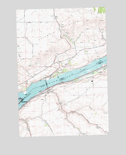
Biggs Junction, OR USGS Topographic Map
Click on map above to begin viewing in our Map Viewer.

This topographic map contains these locations and features:
Feature Name Type Latitude Longitude GNIS ID View Map
BiggsLocaleN45.6679°W120.8384°1167695View Map
Biggs ArchArchN45.6577°W120.8631°2678295View Map
Biggs JunctionPopulated PlaceN45.6698°W120.8328°1117690View Map
Biggs Junction Census Designated PlaceCensusN45.6640°W120.8392°2407848View Map
Biggs Post Office (historical)Post OfficeN45.6679°W120.8384°1164917View Map
Biggs Service District Sewer System FacilityLocaleN45.6711°W120.8315°2697033View Map
Bobs PointCapeN45.6671°W120.8665°1516742View Map
China HollowValleyN45.6487°W120.7956°1118914View Map
China Hollow CreekStreamN45.6482°W120.7956°1132083View Map
Columbia HillsRangeN45.7401°W120.7859°1517976View Map
Davies PassGapN45.7418°W120.8209°1518497View Map
Frank Fulton CanyonValleyN45.6404°W120.8670°1158891View Map
Gerking CanyonValleyN45.6915°W120.7670°1121107View Map
Grant (historical)LocaleN45.6823°W120.7865°1167725View Map
Grant Post Office (historical)Post OfficeN45.6823°W120.7865°1165339View Map
Grebe (historical)LocaleN45.6351°W120.7684°1167735View Map
Gunkel OrchardsLocaleN45.6867°W120.8192°2707222View Map
Hells Gate Channel Range BChannelN45.6623°W120.8665°1156782View Map
Henderson CanyonValleyN45.6776°W120.8540°1520715View Map
Henderson SpringSpringN45.6947°W120.8567°1520717View Map
Mary Hill VineyardsLocaleN45.6850°W120.8244°2707223View Map
MaryhillPopulated PlaceN45.6871°W120.8137°1522785View Map
Maryhill Census Designated PlaceCensusN45.6928°W120.8072°2408188View Map
Maryhill Ferry (historical)LocaleN45.6837°W120.7928°1164030View Map
Maryhill MuseumBuildingN45.6776°W120.8648°1522786View Map
Maryhill Post Office (historical)Post OfficeN45.6871°W120.8137°2027201View Map
Maryhill State ParkParkN45.6829°W120.8270°1522787View Map
Maryhill Treaty Fishing Access SiteReserveN45.6806°W120.8348°2434184View Map
Matties HumpSummitN45.6754°W120.8198°2678296View Map
McCarty PondLakeN45.6852°W120.8538°1522858View Map
Mud HollowValleyN45.6468°W120.8084°1124457View Map
Sam Hill Memorial BridgeBridgeN45.6761°W120.8362°1126538View Map
Spanish HollowValleyN45.6718°W120.8301°1127366View Map
Stonehenge MemorialParkN45.6946°W120.8053°1526585View Map
SugarloafSummitN45.6707°W120.8681°1526667View Map
ThornberryPopulated PlaceN45.6321°W120.7634°1136827View Map
Thornberry Post Office (historical)Post OfficeN45.6321°W120.7634°1166041View Map
Villard Post Office (historical)Post OfficeN45.6854°W120.7809°1164760View Map
Wheelhouse PondLakeN45.6925°W120.8377°1528024View Map

Note: Coordinates in the location and feature list above are referenced to NAD83 datum.


Copyright (C) 2008-2025 Ryan Niemi / Sunset Dynamics ... All Rights Reserved