TopoQuest Logo
Do you find TopoQuest useful?
Help keep TopoQuest running and adding new maps/features by donating!
Bitcoin:  19c7KJd3qBynnjoSw5npx9KScwjBe4ifkT
Litecoin:  LXs6TkuXGGXo1vDsWCkWVdjQX94eUKd6ui
Home View Maps Find Maps Find Places Resources & Links


Emida, Idaho Topographic Map

USGS Map Title: Emida, ID
USGS Map MRC: 47116A5
DRG (GeoTIFF) Download: o47116a5.tif


Neighboring USGS Topographic Map Quads:


  Alder Creek Flats, ID  
47116B6
 

  Lindstrom Peak, ID  
47116B5
 

  Santa, ID  
47116B4
 

  West Dennis, ID  
47116A6
 

  Emida, ID  
47116A5
 

  Fernwood, ID  
47116A4
 

  Harvard, ID  
46116H6
 

  Sand Mountain, ID  
46116H5
 

  Abes Knob, ID  
46116H4


Map MRC Location:

N48°
W117°
N48°
W116°
H8 H7 H6 H5 H4 H3 H2 H1
G8 G7 G6 G5 G4 G3 G2 G1
F8 F7 F6 F5 F4 F3 F2 F1
E8 E7 E6 E5 E4 E3 E2 E1
D8 D7 D6 D5 D4 D3 D2 D1
C8 C7 C6 C5 C4 C3 C2 C1
B8 B7 B6 B5 B4 B3 B2 B1
A8 A7 A6 A5 A4 A3 A2 A1
N47°
W117°
N47°
W116°

Emida, ID USGS 1:24K Topographic Map Preview:
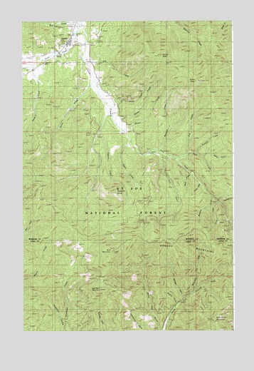
Emida, ID USGS Topographic Map
Click on map above to begin viewing in our Map Viewer.

This topographic map contains these locations and features:
Feature Name Type Latitude Longitude GNIS ID View Map
Baby Grand MountainSummitN47.0038°W116.5124°376797View Map
Bald MountainSummitN47.0316°W116.5718°376888View Map
Bob CreekStreamN47.1221°W116.5910°377974View Map
Brown CreekStreamN47.0807°W116.5649°378263View Map
Charlie CreekStreamN47.1238°W116.5902°379201View Map
Corto CreekStreamN47.0518°W116.5082°379810View Map
Deep CreekStreamN47.1068°W116.6177°380375View Map
East Fork Charlie CreekStreamN47.0866°W116.5716°381066View Map
East Fork Meadow CreekStreamN47.0621°W116.6249°381131View Map
Eena CreekStreamN47.0693°W116.5335°381268View Map
Eldorado GulchValleyN47.0138°W116.5302°381308View Map
Elip CreekStreamN47.0707°W116.5271°381320View Map
Ells CreekStreamN47.1085°W116.5868°381435View Map
EmidaPopulated PlaceN47.1157°W116.5979°381459View Map
Emida PeakSummitN47.1121°W116.5493°396462View Map
Fagan CreekStreamN47.0780°W116.5621°381527View Map
Hume CreekStreamN47.1041°W116.5841°383538View Map
Katsuck CreekStreamN47.0713°W116.5218°384106View Map
Kimta CreekStreamN47.0702°W116.5182°384226View Map
Lacy CreekStreamN47.0713°W116.5499°384328View Map
Lemoosh CreekStreamN47.0516°W116.5068°384577View Map
Little Bald MountainSummitN47.0168°W116.5788°396798View Map
Melakwa CreekStreamN47.0538°W116.5118°386735View Map
Moolock CreekStreamN47.0721°W116.5440°387129View Map
Moscow GulchValleyN47.0118°W116.5346°387249View Map
Mountain GulchValleyN47.0180°W116.5227°387286View Map
Pamas CreekStreamN47.0835°W116.5693°388146View Map
Preston CreekStreamN47.0802°W116.5793°388860View Map
Preston KnobSummitN47.0552°W116.5699°388861View Map
Scurry CreekStreamN47.0571°W116.5163°390061View Map
Short CreekStreamN47.0902°W116.5718°390354View Map
Tyson PeakSummitN47.1007°W116.5199°392586View Map
Wadi CreekStreamN47.0635°W116.5252°392758View Map
White Pine GulchValleyN47.0013°W116.5440°393359View Map

Note: Coordinates in the location and feature list above are referenced to NAD83 datum.


Copyright (C) 2008-2025 Ryan Niemi / Sunset Dynamics ... All Rights Reserved