TopoQuest Logo
Do you find TopoQuest useful?
Help keep TopoQuest running and adding new maps/features by donating!
Bitcoin:  19c7KJd3qBynnjoSw5npx9KScwjBe4ifkT
Litecoin:  LXs6TkuXGGXo1vDsWCkWVdjQX94eUKd6ui
Home View Maps Find Maps Find Places Resources & Links


Sand Mountain, Idaho Topographic Map

USGS Map Title: Sand Mountain, ID
USGS Map MRC: 46116H5
DRG (GeoTIFF) Download: o46116h5.tif


Neighboring USGS Topographic Map Quads:


  West Dennis, ID  
47116A6
 

  Emida, ID  
47116A5
 

  Fernwood, ID  
47116A4
 

  Harvard, ID  
46116H6
 

  Sand Mountain, ID  
46116H5
 

  Abes Knob, ID  
46116H4
 

  Stanford, ID  
46116G6
 

  Deary, ID  
46116G5
 

  Bovill, ID  
46116G4


Map MRC Location:

N47°
W117°
N47°
W116°
H8 H7 H6 H5 H4 H3 H2 H1
G8 G7 G6 G5 G4 G3 G2 G1
F8 F7 F6 F5 F4 F3 F2 F1
E8 E7 E6 E5 E4 E3 E2 E1
D8 D7 D6 D5 D4 D3 D2 D1
C8 C7 C6 C5 C4 C3 C2 C1
B8 B7 B6 B5 B4 B3 B2 B1
A8 A7 A6 A5 A4 A3 A2 A1
N46°
W117°
N46°
W116°

Sand Mountain, ID USGS 1:24K Topographic Map Preview:
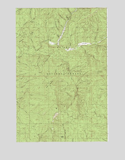
Sand Mountain, ID USGS Topographic Map
Click on map above to begin viewing in our Map Viewer.

This topographic map contains these locations and features:
Feature Name Type Latitude Longitude GNIS ID View Map
Banks GulchValleyN46.9818°W116.5607°376927View Map
Beagle GulchValleyN46.9896°W116.5535°377058View Map
Beals ButteSummitN46.9438°W116.5054°377060View Map
Big Sand CreekStreamN46.9568°W116.6004°377582View Map
Bluejacket CreekStreamN46.9602°W116.5974°377959View Map
Bonami CreekStreamN46.9143°W116.6249°378010View Map
California GulchValleyN46.9949°W116.5502°378723View Map
Cleveland GulchValleyN46.9882°W116.5571°379412View Map
Disalto CreekStreamN46.9577°W116.5774°380603View Map
Doer MineMineN46.8810°W116.5721°380683View Map
Dual CreekStreamN46.9293°W116.5457°380902View Map
Excavation GulchValleyN46.9896°W116.6035°381519View Map
Graves CreekStreamN46.9655°W116.5357°382597View Map
Graves MeadowFlatN46.9660°W116.5296°382600View Map
Greenhorn GulchValleyN46.9757°W116.5627°382659View Map
Headlong CreekStreamN46.9568°W116.5940°383016View Map
Hoodoo GulchValleyN46.9713°W116.5657°383301View Map
Ipsoot CreekStreamN46.9274°W116.5427°383738View Map
Johnson CreekStreamN46.9671°W116.5163°383989View Map
Last Chance MineMineN46.8802°W116.5827°384459View Map
Linn GulchValleyN46.9693°W116.5785°384701View Map
Luella MineMineN46.8810°W116.5940°386280View Map
Mica MountainSummitN46.9066°W116.5671°397905View Map
Mizpah CreekStreamN46.9735°W116.5010°387058View Map
North Fork Palouse RiverStreamN46.9655°W116.5671°387746View Map
Olson MineMineN46.8793°W116.5802°387958View Map
Pardus CreekStreamN46.9157°W116.5454°388196View Map
Piccolo CreekStreamN46.9399°W116.5507°388415View Map
Poorman CreekStreamN46.9696°W116.5835°388740View Map
Sand MountainSummitN46.9260°W116.5796°398091View Map
Sand Mountain Lookout TrailTrailN46.9368°W116.6010°389901View Map
Secunda CreekStreamN46.9491°W116.5546°390093View Map
Slate CreekStreamN46.9963°W116.5443°390558View Map
Stephens CreekStreamN46.9680°W116.5168°391428View Map
Strychnine RidgeRidgeN46.9705°W116.6129°391551View Map
Torpid CreekStreamN46.9416°W116.5515°392247View Map
Triplet CreekStreamN46.9191°W116.5415°392400View Map
Wagner GulchValleyN46.9630°W116.5504°375708View Map
Yakala CreekStreamN46.9285°W116.5438°393730View Map

Note: Coordinates in the location and feature list above are referenced to NAD83 datum.


Copyright (C) 2008-2025 Ryan Niemi / Sunset Dynamics ... All Rights Reserved