TopoQuest Logo
Do you find TopoQuest useful?
Help keep TopoQuest running and adding new maps/features by donating!
Bitcoin:  19c7KJd3qBynnjoSw5npx9KScwjBe4ifkT
Litecoin:  LXs6TkuXGGXo1vDsWCkWVdjQX94eUKd6ui
Home View Maps Find Maps Find Places Resources & Links


West Dennis, Idaho Topographic Map

USGS Map Title: West Dennis, ID
USGS Map MRC: 47116A6
DRG (GeoTIFF) Download: o47116a6.tif


Neighboring USGS Topographic Map Quads:


  Benewah, ID  
47116B7
 

  Alder Creek Flats, ID  
47116B6
 

  Lindstrom Peak, ID  
47116B5
 

  Sanders, ID  
47116A7
 

  West Dennis, ID  
47116A6
 

  Emida, ID  
47116A5
 

  Princeton, ID  
46116H7
 

  Harvard, ID  
46116H6
 

  Sand Mountain, ID  
46116H5


Map MRC Location:

N48°
W117°
N48°
W116°
H8 H7 H6 H5 H4 H3 H2 H1
G8 G7 G6 G5 G4 G3 G2 G1
F8 F7 F6 F5 F4 F3 F2 F1
E8 E7 E6 E5 E4 E3 E2 E1
D8 D7 D6 D5 D4 D3 D2 D1
C8 C7 C6 C5 C4 C3 C2 C1
B8 B7 B6 B5 B4 B3 B2 B1
A8 A7 A6 A5 A4 A3 A2 A1
N47°
W117°
N47°
W116°

West Dennis, ID USGS 1:24K Topographic Map Preview:
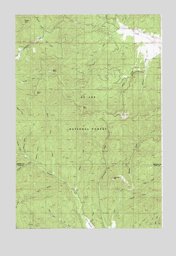
West Dennis, ID USGS Topographic Map
Click on map above to begin viewing in our Map Viewer.

This topographic map contains these locations and features:
Feature Name Type Latitude Longitude GNIS ID View Map
Bedrock GulchValleyN47.0446°W116.7421°399368View Map
Blakes ForkStreamN47.0210°W116.6999°377840View Map
Bunnel CreekStreamN47.1121°W116.7257°378505View Map
Cabin GulchValleyN47.0277°W116.7127°399463View Map
Cedar Grove CampLocaleN47.0230°W116.7002°379103View Map
Charles ButteSummitN47.1213°W116.7429°379199View Map
Chetche'mch'm MeadowFlatN47.1077°W116.6306°2081996View Map
East DennisSummitN47.0707°W116.6929°397668View Map
Fairview KnobSummitN47.0763°W116.7385°397692View Map
Giant White Pine Recreation SiteLocaleN47.0091°W116.6738°393950View Map
Hardpan CreekStreamN47.0430°W116.7460°382902View Map
Hill CreekStreamN47.1110°W116.7291°383198View Map
North South Ski BowlPopulated PlaceN47.1166°W116.6599°399148View Map
North-South Ski BowlBasinN47.0657°W116.6577°393949View Map
Piah CreekStreamN47.0235°W116.6504°388413View Map
Prospect CreekStreamN47.0393°W116.7366°388903View Map
Ramskull CreekStreamN47.1085°W116.6299°389083View Map
South Fork Santa CreekStreamN47.1130°W116.6657°391018View Map
Stewah CreekStreamN47.0382°W116.7329°391445View Map
Stria GulchValleyN47.0032°W116.6857°396003View Map
Three Tree ButteSummitN47.0293°W116.6677°398244View Map
Wepah CreekStreamN47.0138°W116.6621°393004View Map
West DennisSummitN47.0924°W116.7193°398334View Map
White Pine CreekStreamN47.0316°W116.7171°393358View Map
White Pine National Recreation TrailTrailN47.0146°W116.6629°393984View Map
White Pine Scenic DriveTrailN47.0791°W116.6585°393948View Map
Willow CreekStreamN47.0924°W116.6402°393493View Map

Note: Coordinates in the location and feature list above are referenced to NAD83 datum.


Copyright (C) 2008-2025 Ryan Niemi / Sunset Dynamics ... All Rights Reserved