TopoQuest Logo
Do you find TopoQuest useful?
Help keep TopoQuest running and adding new maps/features by donating!
Bitcoin:  19c7KJd3qBynnjoSw5npx9KScwjBe4ifkT
Litecoin:  LXs6TkuXGGXo1vDsWCkWVdjQX94eUKd6ui
Home View Maps Find Maps Find Places Resources & Links


Endeavor, Wisconsin Topographic Map

USGS Map Title: Endeavor, WI
USGS Map MRC: 43089F4
DRG (GeoTIFF) Download: o43089f4.tif


Neighboring USGS Topographic Map Quads:


  Oxford, WI  
43089G5
 

  Packwaukee, WI  
43089G4
 

  Montello, WI  
43089G3
 

  Briggsville, WI  
43089F5
 

  Endeavor, WI  
43089F4
 

  Observatory Hill, WI  
43089F3
 

  Pine Island, WI  
43089E5
 

  Portage, WI  
43089E4
 

  Pardeeville, WI  
43089E3


Map MRC Location:

N44°
W90°
N44°
W89°
H8 H7 H6 H5 H4 H3 H2 H1
G8 G7 G6 G5 G4 G3 G2 G1
F8 F7 F6 F5 F4 F3 F2 F1
E8 E7 E6 E5 E4 E3 E2 E1
D8 D7 D6 D5 D4 D3 D2 D1
C8 C7 C6 C5 C4 C3 C2 C1
B8 B7 B6 B5 B4 B3 B2 B1
A8 A7 A6 A5 A4 A3 A2 A1
N43°
W90°
N43°
W89°

Endeavor, WI USGS 1:24K Topographic Map Preview:
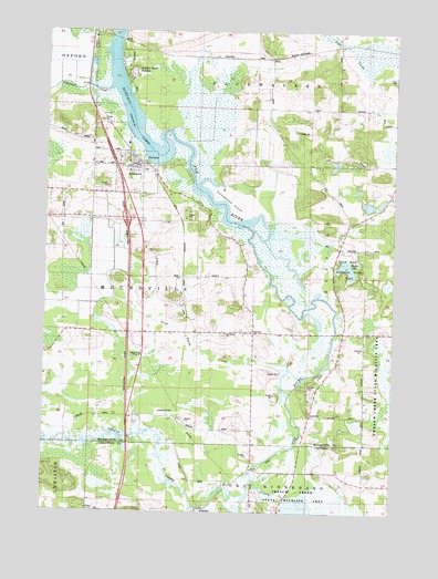
Endeavor, WI USGS Topographic Map
Click on map above to begin viewing in our Map Viewer.

This topographic map contains these locations and features:
Feature Name Type Latitude Longitude GNIS ID View Map
AnackerPopulated PlaceN43.6255°W89.4437°1577491View Map
Buffalo Shore EstatesPopulated PlaceN43.7408°W89.4710°1562372View Map
Chapman CreekStreamN43.7347°W89.4782°1562946View Map
EndeavorPopulated PlaceN43.7158°W89.4662°1564647View Map
Endeavor - Moundville Fire and RescueBuildingN43.7079°W89.4671°2697858View Map
Endeavor Elementary SchoolSchoolN43.7105°W89.4649°1837612View Map
Ennis LakeLakeN43.6885°W89.3914°1564670View Map
Fox River National Wildlife RefugeParkN43.6895°W89.4079°2765305View Map
French CreekStreamN43.6339°W89.4251°1565308View Map
French Creek Wildlife Area Pool Number 2ReservoirN43.6310°W89.4215°2784768View Map
French Creek Wildlife Refuge 2WP1497 DamDamN43.6333°W89.4201°1792876View Map
John Muir Memorial County ParkParkN43.6900°W89.3979°1570013View Map
Moundville ChurchChurchN43.6714°W89.4351°1569801View Map
Muir Park State Natural AreaParkN43.6891°W89.3912°2054859View Map
Neenah CreekStreamN43.6278°W89.4287°1570139View Map
Packwaukee IslandIslandN43.7053°W89.4337°1570987View Map
Rood CemeteryCemeteryN43.6508°W89.4051°1572561View Map
Smith LakeLakeN43.6744°W89.4018°2784550View Map
Town of MoundvilleCivilN43.6788°W89.4605°1583759View Map
Village of EndeavorCivilN43.7163°W89.4695°1583168View Map

Note: Coordinates in the location and feature list above are referenced to NAD83 datum.


Copyright (C) 2008-2025 Ryan Niemi / Sunset Dynamics ... All Rights Reserved