TopoQuest Logo
Do you find TopoQuest useful?
Help keep TopoQuest running and adding new maps/features by donating!
Bitcoin:  19c7KJd3qBynnjoSw5npx9KScwjBe4ifkT
Litecoin:  LXs6TkuXGGXo1vDsWCkWVdjQX94eUKd6ui
Home View Maps Find Maps Find Places Resources & Links


Pardeeville, Wisconsin Topographic Map

USGS Map Title: Pardeeville, WI
USGS Map MRC: 43089E3
DRG (GeoTIFF) Download: o43089e3.tif


Neighboring USGS Topographic Map Quads:


  Endeavor, WI  
43089F4
 

  Observatory Hill, WI  
43089F3
 

  Marquette, WI  
43089F2
 

  Portage, WI  
43089E4
 

  Pardeeville, WI  
43089E3
 

  Sand Spring Creek, WI  
43089E2
 

  Poynette, WI  
43089D4
 

  Wyocena, WI  
43089D3
 

  Rio, WI  
43089D2


Map MRC Location:

N44°
W90°
N44°
W89°
H8 H7 H6 H5 H4 H3 H2 H1
G8 G7 G6 G5 G4 G3 G2 G1
F8 F7 F6 F5 F4 F3 F2 F1
E8 E7 E6 E5 E4 E3 E2 E1
D8 D7 D6 D5 D4 D3 D2 D1
C8 C7 C6 C5 C4 C3 C2 C1
B8 B7 B6 B5 B4 B3 B2 B1
A8 A7 A6 A5 A4 A3 A2 A1
N43°
W90°
N43°
W89°

Pardeeville, WI USGS 1:24K Topographic Map Preview:
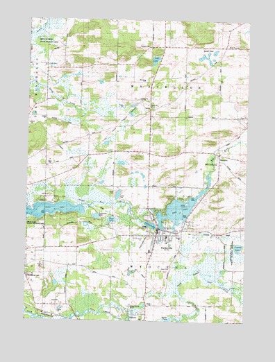
Pardeeville, WI USGS Topographic Map
Click on map above to begin viewing in our Map Viewer.

This topographic map contains these locations and features:
Feature Name Type Latitude Longitude GNIS ID View Map
Angie Williams Cox Public LibraryBuildingN43.5383°W89.3007°1842926View Map
Becker LakeLakeN43.6120°W89.2692°1561484View Map
Belle FountainPopulated PlaceN43.6144°W89.2635°1577512View Map
Breneman LakeLakeN43.5433°W89.3355°1562175View Map
Columbia County Sheriff Office - Pardeeville SubstationBuildingN43.5383°W89.2988°2768286View Map
Comstock CemeteryCemeteryN43.6144°W89.3073°1563305View Map
Crystal LakeLakeN43.5310°W89.2540°1563582View Map
Cuff LakeLakeN43.6085°W89.3032°1563611View Map
First Presbyterian ChurchChurchN43.5353°W89.3012°1842962View Map
Free Methodist Church (historical)SchoolN43.5366°W89.2993°1842966View Map
Fuller CemeteryCemeteryN43.6061°W89.3648°1565362View Map
Henion CemeteryCemeteryN43.5916°W89.3651°1566300View Map
MarcellonPopulated PlaceN43.5686°W89.2657°1569020View Map
Marcellon CemeteryCemeteryN43.5639°W89.2651°1955172View Map
Marcellon Elementary SchoolSchoolN43.5999°W89.3092°1569021View Map
Meadow View SchoolSchoolN43.5830°W89.2542°2716817View Map
PardeevillePopulated PlaceN43.5378°W89.3001°1571029View Map
Pardeeville 2WP832 DamDamN43.5383°W89.3001°1791882View Map
Pardeeville CemeteryCemeteryN43.5432°W89.3065°1955178View Map
Pardeeville District Ambulance ServiceBuildingN43.5278°W89.3092°2698273View Map
Pardeeville Elementary SchoolSchoolN43.5351°W89.2948°1842997View Map
Pardeeville Fire DepartmentBuildingN43.5366°W89.2962°2697776View Map
Pardeeville High SchoolSchoolN43.5339°W89.2924°1842998View Map
Pardeeville Middle SchoolSchoolN43.5342°W89.2916°2716292View Map
Pardeeville Police DepartmentBuildingN43.5383°W89.2987°2759414View Map
Pardeeville Post OfficePost OfficeN43.5383°W89.3004°1842999View Map
Pardeeville Wastewater Treatment FacilityLocaleN43.5383°W89.3058°2723965View Map
Park LakeLakeN43.5469°W89.2875°1571040View Map
Park Lake 56ReservoirN43.5383°W89.3001°1791883View Map
Reuhl Landing Strip (historical)AirportN43.5325°W89.3079°1843016View Map
Rohdes Airport (historical)AirportN43.5664°W89.2671°1582141View Map
Saint John's Lutheran SchoolSchoolN43.5325°W89.2947°2716546View Map
Saint Johns Evangelical Lutheran ChurchChurchN43.5344°W89.2957°1843022View Map
Saint Johns Lutheran ChurchChurchN43.5328°W89.2948°1843023View Map
Saint Marys Roman Catholic ChurchChurchN43.5300°W89.3021°1843027View Map
Sheep IslandIslandN43.5486°W89.2840°1573999View Map
Spring LakeLakeN43.5400°W89.3045°1574659View Map
Swan LakeLakeN43.5450°W89.3649°1575164View Map
Town of MarcellonCivilN43.5994°W89.3054°1583650View Map
Town of WyocenaCivilN43.5046°W89.3053°1584489View Map
Valley View FarmLocaleN43.6164°W89.2731°2611490View Map
Village of PardeevilleCivilN43.5359°W89.3012°1583892View Map
Wesleyan Bible ChurchChurchN43.5366°W89.2993°1843050View Map
West LakeLakeN43.5420°W89.3264°1576522View Map
Wildia Landing Strip (historical)AirportN43.5019°W89.3615°1843052View Map
Williams CampLocaleN43.5508°W89.2840°1576763View Map
Wyocena Wastewater Treatment FacilityLocaleN43.5058°W89.3158°2723967View Map

Note: Coordinates in the location and feature list above are referenced to NAD83 datum.


Copyright (C) 2008-2024 Ryan Niemi / Sunset Dynamics ... All Rights Reserved