TopoQuest Logo
Do you find TopoQuest useful?
Help keep TopoQuest running and adding new maps/features by donating!
Bitcoin:  19c7KJd3qBynnjoSw5npx9KScwjBe4ifkT
Litecoin:  LXs6TkuXGGXo1vDsWCkWVdjQX94eUKd6ui
Home View Maps Find Maps Find Places Resources & Links


Briggsville, Wisconsin Topographic Map

USGS Map Title: Briggsville, WI
USGS Map MRC: 43089F5
DRG (GeoTIFF) Download: o43089f5.tif


Neighboring USGS Topographic Map Quads:


  Brooks, WI  
43089G6
 

  Oxford, WI  
43089G5
 

  Packwaukee, WI  
43089G4
 

  Big Spring, WI  
43089F6
 

  Briggsville, WI  
43089F5
 

  Endeavor, WI  
43089F4
 

  Lewiston, WI  
43089E6
 

  Pine Island, WI  
43089E5
 

  Portage, WI  
43089E4


Map MRC Location:

N44°
W90°
N44°
W89°
H8 H7 H6 H5 H4 H3 H2 H1
G8 G7 G6 G5 G4 G3 G2 G1
F8 F7 F6 F5 F4 F3 F2 F1
E8 E7 E6 E5 E4 E3 E2 E1
D8 D7 D6 D5 D4 D3 D2 D1
C8 C7 C6 C5 C4 C3 C2 C1
B8 B7 B6 B5 B4 B3 B2 B1
A8 A7 A6 A5 A4 A3 A2 A1
N43°
W90°
N43°
W89°

Briggsville, WI USGS 1:24K Topographic Map Preview:
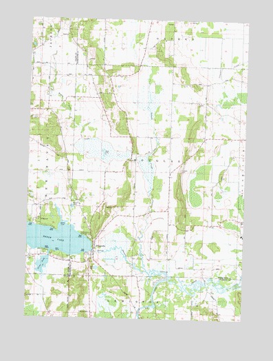
Briggsville, WI USGS Topographic Map
Click on map above to begin viewing in our Map Viewer.

This topographic map contains these locations and features:
Feature Name Type Latitude Longitude GNIS ID View Map
Amey PondLakeN43.6472°W89.6157°1560830View Map
Big SloughStreamN43.6414°W89.5432°1561771View Map
BriggsvillePopulated PlaceN43.6550°W89.5854°1562201View Map
Briggsville 1869C221 DamDamN43.6516°W89.5918°1791964View Map
Briggsville Volunteer Fire CompanyBuildingN43.6552°W89.5860°2697754View Map
Douglas CenterPopulated PlaceN43.7008°W89.5554°1837611View Map
Douglas ChurchChurchN43.7158°W89.5276°1564080View Map
Greenwood CemeteryCemeteryN43.6272°W89.5873°1565863View Map
Little LakeLakeN43.6460°W89.5847°1568296View Map
Mason LakeReservoirN43.6578°W89.6079°1569118View Map
Mason Lake 37ReservoirN43.6516°W89.5918°1791965View Map
McCall LakeLakeN43.6716°W89.5992°1569168View Map
Morris CoveBayN43.6630°W89.6043°1569749View Map
Mud LakeLakeN43.6942°W89.5817°1569915View Map
Neenah Creek Elementary SchoolSchoolN43.6622°W89.6089°2715865View Map
Norlings Landing Field (historical)AirportN43.6469°W89.6104°1837595View Map
O'Keefe CreekStreamN43.6819°W89.5546°1576716View Map
South Branch Neenah CreekStreamN43.6450°W89.5560°1574408View Map
Stafford School (historical)SchoolN43.7044°W89.6079°1837605View Map
Summerton Bog State Natural AreaParkN43.7497°W89.5246°2054862View Map
Town of DouglasCivilN43.6866°W89.5515°1583091View Map

Note: Coordinates in the location and feature list above are referenced to NAD83 datum.


Copyright (C) 2008-2025 Ryan Niemi / Sunset Dynamics ... All Rights Reserved