TopoQuest Logo
Do you find TopoQuest useful?
Help keep TopoQuest running and adding new maps/features by donating!
Bitcoin:  19c7KJd3qBynnjoSw5npx9KScwjBe4ifkT
Litecoin:  LXs6TkuXGGXo1vDsWCkWVdjQX94eUKd6ui
Home View Maps Find Maps Find Places Resources & Links


Esko, Minnesota Topographic Map

USGS Map Title: Esko, MN
USGS Map MRC: 46092F3
DRG (GeoTIFF) Download: o46092f3.tif


Neighboring USGS Topographic Map Quads:


  Saginaw, MN  
46092G4
 

  Adolph, MN  
46092G3
 

  Duluth Heights, MN  
46092G2
 

  Cloquet, MN  
46092F4
 

  Esko, MN  
46092F3
 

  West Duluth, MN  
46092F2
 

  Wrenshall, MN  
46092E4
 

  Frogner, MN  
46092E3
 

  Borea, WI  
46092E2


Map MRC Location:

N47°
W93°
N47°
W92°
H8 H7 H6 H5 H4 H3 H2 H1
G8 G7 G6 G5 G4 G3 G2 G1
F8 F7 F6 F5 F4 F3 F2 F1
E8 E7 E6 E5 E4 E3 E2 E1
D8 D7 D6 D5 D4 D3 D2 D1
C8 C7 C6 C5 C4 C3 C2 C1
B8 B7 B6 B5 B4 B3 B2 B1
A8 A7 A6 A5 A4 A3 A2 A1
N46°
W93°
N46°
W92°

Esko, MN USGS 1:24K Topographic Map Preview:
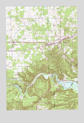
Esko, MN USGS Topographic Map
Click on map above to begin viewing in our Map Viewer.

This topographic map contains these locations and features:
Feature Name Type Latitude Longitude GNIS ID View Map
Amik IslandIslandN46.6561°W92.2788°1560834View Map
Augustana CemeteryCemeteryN46.7464°W92.2805°2117591View Map
Augustana ChurchChurchN46.7458°W92.2807°660699View Map
Breath of Life Christian ChurchChurchN46.7067°W92.3575°2073848View Map
BrownellPopulated PlaceN46.6772°W92.3382°654616View Map
Carson ParkParkN46.6674°W92.2688°660964View Map
Eldes CornerPopulated PlaceN46.7099°W92.2799°661198View Map
Elys PeakSummitN46.6816°W92.2538°661210View Map
EskoPopulated PlaceN46.7058°W92.3632°643411View Map
Esko - Thomson Township Volunteer Fire DepartmentBuildingN46.7057°W92.3636°2073844View Map
Esko Census Designated PlaceCensusN46.7100°W92.3721°2628675View Map
Esko Post OfficePost OfficeN46.7067°W92.3647°2073845View Map
Esko SchoolsSchoolN46.7064°W92.3611°2073846View Map
Evergreen Memorial Drive Historical MarkerParkN46.6383°W92.3147°2074311View Map
Finnish Apostolic CemeteryCemeteryN46.7097°W92.3450°2074211View Map
Finnish ChurchChurchN46.7099°W92.3452°643630View Map
Fond du LacPopulated PlaceN46.6597°W92.2732°661294View Map
Fond du Lac Community ChurchChurchN46.6622°W92.2758°2117541View Map
Fond du Lac DamDamN46.6649°W92.2935°1776839View Map
Fond du Lac Historical MarkerParkN46.6611°W92.2750°2117542View Map
Fond du Lac ParkParkN46.6705°W92.2816°661295View Map
Fond du Lac Post Office (historical)Post OfficeN46.6597°W92.2731°2123645View Map
Forbay LakeReservoirN46.6619°W92.3575°643792View Map
Geology of the Saint Louis River Geological MarkerParkN46.6383°W92.3147°2074300View Map
Gill CreekStreamN46.6630°W92.3252°644142View Map
HarneyLocaleN46.7217°W92.3333°2074111View Map
HarneyPopulated PlaceN46.7216°W92.3335°644679View Map
Harney Post OfficePost OfficeN46.7217°W92.3333°2074112View Map
Hay CreekStreamN46.7277°W92.3485°661441View Map
Henry C Hornby Historical MarkerParkN46.6547°W92.3519°2074307View Map
Henry Oldenburg Historical MarkerParkN46.6547°W92.3519°2074308View Map
Interchange 242CrossingN46.6964°W92.3650°2074256View Map
J Rodney Paine Historical MarkerParkN46.6547°W92.3519°2074309View Map
Jay Cooke State ParkParkN46.6497°W92.3307°645588View Map
Jay Cooke State Park Geological MarkerParkN46.6547°W92.3519°2074305View Map
Joshiah B Scovell Historical MarkerParkN46.6547°W92.3519°2074310View Map
Little RiverStreamN46.6688°W92.3096°646908View Map
Lost LakeLakeN46.6405°W92.3340°647204View Map
Magney ParkParkN46.6955°W92.2507°661844View Map
Merritt ParkParkN46.6677°W92.2563°661908View Map
Mission CreekStreamN46.6588°W92.2760°661935View Map
Nekuk IslandIslandN46.6569°W92.2760°1570149View Map
Nopeming Care CenterHospitalN46.7056°W92.2717°2117549View Map
Nopeming Post Office (historical)Post OfficeN46.7056°W92.2722°2117823View Map
Northwood United Methodist ChurchChurchN46.7067°W92.3556°2073849View Map
Oldenburg PointCliffN46.6538°W92.3521°648941View Map
Ondaig IslandIslandN46.6527°W92.2741°1570821View Map
Pine Hill Lutheran ChurchChurchN46.7089°W92.2808°2117527View Map
Saint Matthew's Lutheran ChurchChurchN46.7078°W92.3572°2073847View Map
Short Line ParkLocaleN46.6763°W92.2580°662439View Map
Short Line Park Post Office (historical)Post OfficeN46.6764°W92.2578°2117782View Map
Silver CreekStreamN46.6452°W92.3507°652039View Map
Thomson Township - Esko Police DepartmentBuildingN46.7220°W92.3616°2758690View Map
Township of MidwayCivilN46.7297°W92.2716°664968View Map
Township of ThomsonCivilN46.7152°W92.3604°665784View Map
Wahbegon IslandIslandN46.6519°W92.2746°1576144View Map
Washington SchoolSchoolN46.7361°W92.3671°653819View Map
Wrenshall Scenic OverlookParkN46.6383°W92.3147°2074299View Map

Note: Coordinates in the location and feature list above are referenced to NAD83 datum.


Copyright (C) 2008-2024 Ryan Niemi / Sunset Dynamics ... All Rights Reserved