TopoQuest Logo
Do you find TopoQuest useful?
Help keep TopoQuest running and adding new maps/features by donating!
Bitcoin:  19c7KJd3qBynnjoSw5npx9KScwjBe4ifkT
Litecoin:  LXs6TkuXGGXo1vDsWCkWVdjQX94eUKd6ui
Home View Maps Find Maps Find Places Resources & Links


Saginaw, Minnesota Topographic Map

USGS Map Title: Saginaw, MN
USGS Map MRC: 46092G4
DRG (GeoTIFF) Download: o46092g4.tif


Neighboring USGS Topographic Map Quads:


  Alborn, MN  
46092H5
 

  Independence, MN  
46092H4
 

  Twig, MN  
46092H3
 

  Brookston, MN  
46092G5
 

  Saginaw, MN  
46092G4
 

  Adolph, MN  
46092G3
 

  Iverson, MN  
46092F5
 

  Cloquet, MN  
46092F4
 

  Esko, MN  
46092F3


Map MRC Location:

N47°
W93°
N47°
W92°
H8 H7 H6 H5 H4 H3 H2 H1
G8 G7 G6 G5 G4 G3 G2 G1
F8 F7 F6 F5 F4 F3 F2 F1
E8 E7 E6 E5 E4 E3 E2 E1
D8 D7 D6 D5 D4 D3 D2 D1
C8 C7 C6 C5 C4 C3 C2 C1
B8 B7 B6 B5 B4 B3 B2 B1
A8 A7 A6 A5 A4 A3 A2 A1
N46°
W93°
N46°
W92°

Saginaw, MN USGS 1:24K Topographic Map Preview:
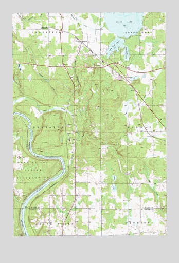
Saginaw, MN USGS Topographic Map
Click on map above to begin viewing in our Map Viewer.

This topographic map contains these locations and features:
Feature Name Type Latitude Longitude GNIS ID View Map
Albrook SchoolSchoolN46.8522°W92.4617°2123667View Map
Andy LakeLakeN46.8447°W92.4943°660657View Map
Baby Grand LakeLakeN46.8516°W92.4069°660702View Map
Brevator CemeteryCemeteryN46.8022°W92.4499°660875View Map
Country Haven AirportAirportN46.7525°W92.4190°660113View Map
Duluth Apostolic Lutheran ChurchChurchN46.7508°W92.3814°2073850View Map
Dutch SloughStreamN46.8036°W92.4485°661156View Map
East Brevator Fire DepartmentBuildingN46.7795°W92.4447°2666507View Map
Fond du Lac CreekStreamN46.7519°W92.4919°652521View Map
Grand LakePopulated PlaceN46.8666°W92.4680°661376View Map
Holy Family CemeteriesCemeteryN46.7513°W92.4943°645119View Map
Industrial Volunteer Fire DepartmentBuildingN46.8661°W92.4724°2123666View Map
Johnson CreekStreamN46.8213°W92.4657°661588View Map
Little Grand LakeLakeN46.8564°W92.4160°661742View Map
Pine IslandIslandN46.7663°W92.4913°662197View Map
Pine RiverStreamN46.7866°W92.4574°662203View Map
SaginawPopulated PlaceN46.8591°W92.4444°662318View Map
Saginaw Post OfficePost OfficeN46.8477°W92.4181°2123663View Map
Saginaw StationLocaleN46.8583°W92.4422°2123662View Map
Saint Peter's Lutheran ChurchChurchN46.8556°W92.4703°2123665View Map
Saint Philip Neri Catholic ChurchChurchN46.8528°W92.4703°2123664View Map
Swan FieldAirportN46.8722°W92.4575°2676853View Map
Township of BrevatorCivilN46.8087°W92.4918°663662View Map
Twin LakesLakeN46.7764°W92.4179°662689View Map

Note: Coordinates in the location and feature list above are referenced to NAD83 datum.


Copyright (C) 2008-2025 Ryan Niemi / Sunset Dynamics ... All Rights Reserved