TopoQuest Logo
Do you find TopoQuest useful?
Help keep TopoQuest running and adding new maps/features by donating!
Bitcoin:  19c7KJd3qBynnjoSw5npx9KScwjBe4ifkT
Litecoin:  LXs6TkuXGGXo1vDsWCkWVdjQX94eUKd6ui
Home View Maps Find Maps Find Places Resources & Links


Essex Center, Vermont Topographic Map

USGS Map Title: Essex Center, VT
USGS Map MRC: 44073E1
DRG (GeoTIFF) Download: o44073e1.tif


Neighboring USGS Topographic Map Quads:


  Georgia Plains, VT  
44073F2
 

  Milton, VT  
44073F1
 

  Gilson Mountain, VT  
44072F8
 

  Colchester, VT  
44073E2
 

  Essex Center, VT  
44073E1
 

  Underhill, VT  
44072E8
 

  Burlington, VT  
44073D2
 

  Essex Junction, VT  
44073D1
 

  Richmond, VT  
44072D8


Map MRC Location:

N45°
W74°
N45°
W73°
H8 H7 H6 H5 H4 H3 H2 H1
G8 G7 G6 G5 G4 G3 G2 G1
F8 F7 F6 F5 F4 F3 F2 F1
E8 E7 E6 E5 E4 E3 E2 E1
D8 D7 D6 D5 D4 D3 D2 D1
C8 C7 C6 C5 C4 C3 C2 C1
B8 B7 B6 B5 B4 B3 B2 B1
A8 A7 A6 A5 A4 A3 A2 A1
N44°
W74°
N44°
W73°

Essex Center, VT USGS 1:24K Topographic Map Preview:
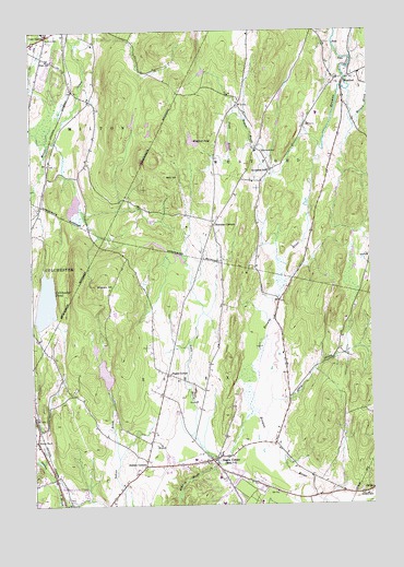
Essex Center, VT USGS Topographic Map
Click on map above to begin viewing in our Map Viewer.

This topographic map contains these locations and features:
Feature Name Type Latitude Longitude GNIS ID View Map
Abbey BrookStreamN44.5281°W73.0374°1456103View Map
Bald HillSummitN44.5873°W73.0718°1456221View Map
Bowman CornersPopulated PlaceN44.5737°W73.0571°1456532View Map
Brigham HillSummitN44.5581°W73.1010°1456568View Map
BrooksidePopulated PlaceN44.5937°W73.0421°1918568View Map
Brookside CemeteryCemeteryN44.5929°W73.0391°1456588View Map
Brookside SchoolSchoolN44.5878°W73.0368°1456591View Map
Butlers CornersPopulated PlaceN44.5103°W73.0840°1456701View Map
Colchester PondLakeN44.5535°W73.1197°1456962View Map
Colchester Pond DamDamN44.5484°W73.1246°1766391View Map
Cornerstone Assembly of God ChurchChurchN44.6192°W73.1212°1918630View Map
Covenant Community ChurchChurchN44.5020°W73.0204°1918632View Map
Cozy CornerPopulated PlaceN44.6237°W73.1179°1457040View Map
Essex Alliance ChurchChurchN44.5150°W73.0815°1918647View Map
Essex CenterPopulated PlaceN44.5120°W73.0596°1457376View Map
Essex Elementary SchoolSchoolN44.5129°W73.0557°1918650View Map
Essex Fire DepartmentBuildingN44.5048°W73.0527°2121389View Map
Essex Free LibraryBuildingN44.5209°W73.0601°1918651View Map
Essex Junction Post OfficePost OfficeN44.5081°W73.0784°1918580View Map
Essex Junction Village CemeteryCemeteryN44.5112°W73.0600°1918648View Map
Essex Junction Village ForestForestN44.5014°W73.0371°1918654View Map
Essex Junction Village Municipal ForestForestN44.5345°W73.0982°1918655View Map
Essex Town School DistrictSchoolN44.5005°W73.0532°2427450View Map
Fairview CemeteryCemeteryN44.5019°W73.1116°1918661View Map
Federated ChurchChurchN44.5112°W73.0610°1918668View Map
Founders Memorial SchoolSchoolN44.5005°W73.0552°1918684View Map
Indian Brook DamDamN44.5300°W73.0979°1766389View Map
Indian Brook ReservoirReservoirN44.5350°W73.0985°1766390View Map
Milton Fire DepartmentBuildingN44.6186°W73.1231°2121399View Map
Milton Police DepartmentBuildingN44.6190°W73.1240°2752781View Map
Milton Post OfficePost OfficeN44.6242°W73.1191°1918771View Map
Milton Public LibraryBuildingN44.6187°W73.1215°1918772View Map
Milton Rescue SquadBuildingN44.6188°W73.1228°2578075View Map
Morgan BrookStreamN44.6089°W73.0074°1458533View Map
Mountain View CemeteryCemeteryN44.5058°W73.0558°1918779View Map
New England Culinary Institute - Essex CampusSchoolN44.5018°W73.0785°2427501View Map
Pages CornerPopulated PlaceN44.5348°W73.0749°1458882View Map
Plain SchoolSchoolN44.6175°W73.1182°1458993View Map
Pond BrookStreamN44.6031°W73.0487°1459032View Map
Rogers BrookStreamN44.5945°W73.0179°1459241View Map
Saint Anns CemeteryCemeteryN44.6225°W73.1174°1459318View Map
Saint Pius X ChurchChurchN44.5098°W73.0557°1918857View Map
School Number 2SchoolN44.5170°W73.1240°1459409View Map
Town of EssexCivilN44.5196°W73.0654°1462091View Map
Town of WestfordCivilN44.6010°W73.0048°1462251View Map
United Church of WestfordChurchN44.6114°W73.0135°1918928View Map
WestfordPopulated PlaceN44.6120°W73.0087°1460179View Map
Westford Elementary SchoolSchoolN44.6028°W73.0189°1918949View Map
Westford PondLakeN44.5957°W73.0646°1460181View Map
Westford Post OfficePost OfficeN44.6151°W73.0152°1918950View Map
Westford Volunteer Fire DepartmentBuildingN44.6121°W73.0058°2121490View Map

Note: Coordinates in the location and feature list above are referenced to NAD83 datum.


Copyright (C) 2008-2024 Ryan Niemi / Sunset Dynamics ... All Rights Reserved