TopoQuest Logo
Do you find TopoQuest useful?
Help keep TopoQuest running and adding new maps/features by donating!
Bitcoin:  19c7KJd3qBynnjoSw5npx9KScwjBe4ifkT
Litecoin:  LXs6TkuXGGXo1vDsWCkWVdjQX94eUKd6ui
Home View Maps Find Maps Find Places Resources & Links


Milton, Vermont Topographic Map

USGS Map Title: Milton, VT
USGS Map MRC: 44073F1
DRG (GeoTIFF) Download: o44073f1.tif


Neighboring USGS Topographic Map Quads:


  Saint Albans Bay, VT  
44073G2
 

  Saint Albans, VT  
44073G1
 

  Fairfield, VT  
44072G8
 

  Georgia Plains, VT  
44073F2
 

  Milton, VT  
44073F1
 

  Gilson Mountain, VT  
44072F8
 

  Colchester, VT  
44073E2
 

  Essex Center, VT  
44073E1
 

  Underhill, VT  
44072E8


Map MRC Location:

N45°
W74°
N45°
W73°
H8 H7 H6 H5 H4 H3 H2 H1
G8 G7 G6 G5 G4 G3 G2 G1
F8 F7 F6 F5 F4 F3 F2 F1
E8 E7 E6 E5 E4 E3 E2 E1
D8 D7 D6 D5 D4 D3 D2 D1
C8 C7 C6 C5 C4 C3 C2 C1
B8 B7 B6 B5 B4 B3 B2 B1
A8 A7 A6 A5 A4 A3 A2 A1
N44°
W74°
N44°
W73°

Milton, VT USGS 1:24K Topographic Map Preview:
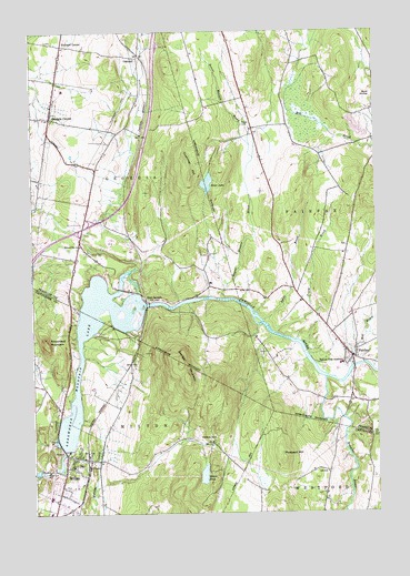
Milton, VT USGS Topographic Map
Click on map above to begin viewing in our Map Viewer.

This topographic map contains these locations and features:
Feature Name Type Latitude Longitude GNIS ID View Map
Arrowhead MountainSummitN44.6706°W73.1201°1456176View Map
Arrowhead Mountain LakeReservoirN44.6743°W73.0916°1456177View Map
Beaver CemeteryCemeteryN44.7257°W73.0478°1456342View Map
Beaver Meadow BrookStreamN44.6809°W73.0546°1456353View Map
Bellows Free AcademySchoolN44.6636°W73.0133°1456383View Map
Browns RiverStreamN44.6600°W73.0187°1456612View Map
Clarks Falls DamDamN44.6417°W73.1129°1766358View Map
Cushman HillSummitN44.7128°W73.0662°1457078View Map
Davis CemeteryCemeteryN44.7366°W73.1145°1920565View Map
East GeorgiaPopulated PlaceN44.6800°W73.0832°1460412View Map
Fairchild CemeteryCemeteryN44.7449°W73.0859°1920601View Map
FairfaxPopulated PlaceN44.6653°W73.0087°1457391View Map
Fairfax Census Designated PlaceCensusN44.6695°W73.0107°2586630View Map
Fairfax Community LibraryBuildingN44.6678°W73.0110°1920602View Map
Fairfax Fire DepartmentBuildingN44.6697°W73.0165°2121453View Map
Fairfax Plains CemeteryCemeteryN44.6547°W73.0159°1920603View Map
Fairfax Post OfficePost OfficeN44.6566°W73.0085°1920600View Map
Fairfax Rescue SquadBuildingN44.6698°W73.0166°2578066View Map
Georgia CenterPopulated PlaceN44.7275°W73.1176°1461772View Map
Georgia Elementary SchoolSchoolN44.7358°W73.1149°1920622View Map
Georgia Middle SchoolSchoolN44.7353°W73.1142°1920623View Map
Georgia MountainSummitN44.6639°W73.0707°1457533View Map
Georgia Volunteer Fire DepartmentBuildingN44.7310°W73.1163°2121445View Map
Goodrich CemeteryCemeteryN44.7284°W73.1230°1920627View Map
Homestead CampgroundsLocaleN44.6909°W73.1065°1920655View Map
Hope CemeteryCemeteryN44.6928°W73.1040°1457885View Map
Hubbard CemeteryCemeteryN44.7475°W73.1190°1920657View Map
Hubbard CornerPopulated PlaceN44.7464°W73.1129°1457923View Map
Hyde CemeteryCemeteryN44.6813°W73.0941°1920662View Map
Interchange 18CrossingN44.6992°W73.1224°1920663View Map
Keezer CemeteryCemeteryN44.6959°W73.0554°1920671View Map
Loomis CemeteryCemeteryN44.7243°W73.0911°1920676View Map
Lower Covered BridgeBridgeN44.6684°W73.0076°1920678View Map
Maple Grove CampgroundLocaleN44.7075°W73.0368°1920680View Map
Mill BrookStreamN44.6625°W73.0093°1458466View Map
MiltonPopulated PlaceN44.6398°W73.1104°1458483View Map
Milton Census Designated PlaceCensusN44.6352°W73.1155°2378131View Map
Milton DamDamN44.6367°W73.1179°1766357View Map
Milton Elementary SchoolSchoolN44.6324°W73.1100°1918702View Map
Milton Middle / High SchoolSchoolN44.6290°W73.1190°1918769View Map
Milton MuseumBuildingN44.6403°W73.1135°1918770View Map
Milton PondLakeN44.6348°W73.0632°1458484View Map
Milton School DistrictSchoolN44.6324°W73.1100°2427451View Map
Milton Square Shopping CenterLocaleN44.6256°W73.1190°1918773View Map
OaklandPopulated PlaceN44.7431°W73.0849°1458815View Map
Old Milton CemeteryCemeteryN44.6378°W73.1077°1918804View Map
Old Plains CemeteryCemeteryN44.6255°W73.1148°1918806View Map
Pleasant View CemeteryCemeteryN44.6288°W73.0183°1918820View Map
Prospect HillSummitN44.6387°W73.0343°1459086View Map
Safford CemeteryCemeteryN44.6942°W73.0102°1920737View Map
Saint Ann ChurchChurchN44.6387°W73.1110°1918841View Map
Saint Lukes Catholic ChurchChurchN44.6564°W73.0099°1920759View Map
School Number 14SchoolN44.6945°W73.1074°1459407View Map
School Number 6SchoolN44.6448°W73.0637°1459419View Map
School Street SchoolSchoolN44.6373°W73.1104°1918868View Map
Silver LakeReservoirN44.7107°W73.0607°1459509View Map
Silver Lake DamDamN44.7103°W73.0599°1766559View Map
Swift BrookStreamN44.6750°W73.0410°1459806View Map
Town of FairfaxCivilN44.6998°W73.0075°1462092View Map
Tracy BrookStreamN44.6714°W73.0362°1459945View Map
United Church of MiltonChurchN44.6395°W73.1076°1918926View Map
Village of Milton (historical)CivilN44.6398°W73.1099°2057742View Map

Note: Coordinates in the location and feature list above are referenced to NAD83 datum.


Copyright (C) 2008-2024 Ryan Niemi / Sunset Dynamics ... All Rights Reserved