TopoQuest Logo
Do you find TopoQuest useful?
Help keep TopoQuest running and adding new maps/features by donating!
Bitcoin:  19c7KJd3qBynnjoSw5npx9KScwjBe4ifkT
Litecoin:  LXs6TkuXGGXo1vDsWCkWVdjQX94eUKd6ui
Home View Maps Find Maps Find Places Resources & Links


Richmond, Vermont Topographic Map

USGS Map Title: Richmond, VT
USGS Map MRC: 44072D8
DRG (GeoTIFF) Download: o44072d8.tif


Neighboring USGS Topographic Map Quads:


  Essex Center, VT  
44073E1
 

  Underhill, VT  
44072E8
 

  Mount Mansfield, VT  
44072E7
 

  Essex Junction, VT  
44073D1
 

  Richmond, VT  
44072D8
 

  Bolton Mountain, VT  
44072D7
 

  Hinesburg, VT  
44073C1
 

  Huntington, VT  
44072C8
 

  Waterbury, VT  
44072C7


Map MRC Location:

N45°
W73°
N45°
W72°
H8 H7 H6 H5 H4 H3 H2 H1
G8 G7 G6 G5 G4 G3 G2 G1
F8 F7 F6 F5 F4 F3 F2 F1
E8 E7 E6 E5 E4 E3 E2 E1
D8 D7 D6 D5 D4 D3 D2 D1
C8 C7 C6 C5 C4 C3 C2 C1
B8 B7 B6 B5 B4 B3 B2 B1
A8 A7 A6 A5 A4 A3 A2 A1
N44°
W73°
N44°
W72°

Richmond, VT USGS 1:24K Topographic Map Preview:
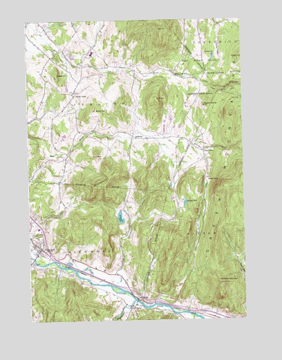
Richmond, VT USGS Topographic Map
Click on map above to begin viewing in our Map Viewer.

This topographic map contains these locations and features:
Feature Name Type Latitude Longitude GNIS ID View Map
Bald HillSummitN44.4973°W72.9198°1456220View Map
Birch HillSummitN44.4626°W72.9598°1456428View Map
Birnies NoseCliffN44.4735°W72.8786°1456432View Map
Bolton NotchLocaleN44.4328°W72.8962°1456516View Map
Camels Hump Middle SchoolSchoolN44.4137°W72.9940°1918581View Map
Camp UnderhillLocaleN44.4942°W72.9071°1456756View Map
Champlain Council Campfire Girls CampLocaleN44.4195°W72.9385°1918598View Map
Cochran Ski CenterLocaleN44.3959°W72.9821°1918621View Map
Cushing HillSummitN44.4859°W72.8962°1457076View Map
Duck BrookStreamN44.3820°W72.9276°1457200View Map
Edmond BridgeBridgeN44.3809°W72.9418°1457342View Map
Huckleberry HillSummitN44.4314°W72.9568°1457929View Map
Huntington RiverStreamN44.3837°W72.9393°1461015View Map
Jericho CenterPopulated PlaceN44.4689°W72.9723°1458003View Map
Jericho Center Post OfficePost OfficeN44.4699°W72.9732°1918732View Map
JonesvillePopulated PlaceN44.3839°W72.9376°1458039View Map
Jonesville AcademySchoolN44.3814°W72.9387°1918739View Map
Jonesville Post OfficePost OfficeN44.3838°W72.9373°1918740View Map
Laisdell HillSummitN44.4773°W72.9821°1458132View Map
Machine Gun School (historical)SchoolN44.4937°W72.8982°1918751View Map
Marr FlatFlatN44.4670°W72.8785°1458359View Map
Mayers DomeSummitN44.4642°W72.8968°1458385View Map
Meadow AirportAirportN44.4466°W72.9139°2442721View Map
Mount Mansfield Union High SchoolSchoolN44.4862°W72.9619°1918782View Map
NashvillePopulated PlaceN44.4520°W72.9385°1458649View Map
O P HillSummitN44.4664°W72.9240°1458802View Map
Old Round ChurchChurchN44.3992°W72.9990°1458835View Map
Preston BrookStreamN44.3770°W72.9054°1459070View Map
Preston PondLakeN44.4238°W72.9088°1459072View Map
RichmondPopulated PlaceN44.4053°W72.9929°1459179View Map
Richmond Census Designated PlaceCensusN44.4076°W72.9965°2586651View Map
Richmond Congregational ChurchChurchN44.4028°W72.9951°1918832View Map
Richmond Elementary SchoolSchoolN44.4125°W72.9938°1918833View Map
Richmond Fire DepartmentBuildingN44.4021°W72.9873°2121385View Map
Richmond Police DepartmentBuildingN44.4026°W72.9953°2752763View Map
Richmond PondLakeN44.4174°W72.9466°1459182View Map
Richmond Post OfficePost OfficeN44.4025°W72.9951°1918834View Map
Richmond Rescue SquadBuildingN44.4059°W72.9975°2578110View Map
Richmond Village CemeteryCemeteryN44.4034°W72.9944°1918808View Map
River View CemeteryCemeteryN44.4115°W72.9992°1459195View Map
Saint Marys CemeteryCemeteryN44.3973°W72.9908°1918855View Map
Snipe Island BrookStreamN44.3903°W72.9548°1459553View Map
Starbird RidgeRidgeN44.4792°W72.8793°1459678View Map
Stimson MountainSummitN44.3914°W72.8898°1459723View Map
Talbot HollowValleyN44.4764°W72.9032°1459817View Map
The CobbleSummitN44.4428°W72.9596°1459849View Map
Town of BoltonCivilN44.3990°W72.8773°1462045View Map
Town of JerichoCivilN44.4765°W72.9628°1462128View Map
Town of RichmondCivilN44.3952°W72.9940°1462186View Map
Training Site Ethan Allen RangeMilitaryN44.4726°W72.8982°2512358View Map
Underhill - Jericho Fire DepartmentBuildingN44.4758°W72.9688°2121386View Map
Vermont Research Forest Agriculture Experiment StatiONParkN44.4478°W72.9987°1460022View Map
West BoltonPopulated PlaceN44.4456°W72.8979°1460113View Map
West Bolton CemeteryCemeteryN44.4498°W72.8982°1918945View Map
West Bolton Golf CourseLocaleN44.4437°W72.9007°1918946View Map

Note: Coordinates in the location and feature list above are referenced to NAD83 datum.


Copyright (C) 2008-2025 Ryan Niemi / Sunset Dynamics ... All Rights Reserved