TopoQuest Logo
Do you find TopoQuest useful?
Help keep TopoQuest running and adding new maps/features by donating!
Bitcoin:  19c7KJd3qBynnjoSw5npx9KScwjBe4ifkT
Litecoin:  LXs6TkuXGGXo1vDsWCkWVdjQX94eUKd6ui
Home View Maps Find Maps Find Places Resources & Links


Tonganoxie, Kansas Topographic Map

USGS Map Title: Tonganoxie, KS
USGS Map MRC: 39095A1
DRG (GeoTIFF) Download: o39095a1.tif


Neighboring USGS Topographic Map Quads:


  McLouth, KS  
39095B2
 

  Jarbalo, KS  
39095B1
 

  Basehor, KS  
39094B8
 

  Midland, KS  
39095A2
 

  Tonganoxie, KS  
39095A1
 

  Bonner Springs, KS  
39094A8
 

  Lawrence East, KS  
38095H2
 

  Eudora, KS  
38095H1
 

  De Soto, KS  
38094H8


Map MRC Location:

N40°
W96°
N40°
W95°
H8 H7 H6 H5 H4 H3 H2 H1
G8 G7 G6 G5 G4 G3 G2 G1
F8 F7 F6 F5 F4 F3 F2 F1
E8 E7 E6 E5 E4 E3 E2 E1
D8 D7 D6 D5 D4 D3 D2 D1
C8 C7 C6 C5 C4 C3 C2 C1
B8 B7 B6 B5 B4 B3 B2 B1
A8 A7 A6 A5 A4 A3 A2 A1
N39°
W96°
N39°
W95°

Tonganoxie, KS USGS 1:24K Topographic Map Preview:
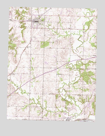
Tonganoxie, KS USGS Topographic Map
Click on map above to begin viewing in our Map Viewer.

This topographic map contains these locations and features:
Feature Name Type Latitude Longitude GNIS ID View Map
Chance CemeteryCemeteryN39.0019°W95.0158°478839View Map
City of LinwoodCivilN39.0022°W95.0361°2395727View Map
City of TonganoxieCivilN39.1084°W95.0826°2397035View Map
Congregational CemeteryCemeteryN39.0013°W95.0368°2509865View Map
Country Hills Manufactured Home CommunityPopulated PlaceN39.1147°W95.0960°2694069View Map
Cow CreekStreamN39.0292°W95.0966°478845View Map
Dafer (historical)LocaleN39.0731°W95.0014°481860View Map
Daffer School (historical)SchoolN39.0731°W95.0011°478848View Map
Defries - Brotherson Industrial ParkLocaleN39.1194°W95.0719°2509580View Map
First Baptist Church of LinwoodChurchN39.0011°W95.0407°2510357View Map
Hawk Hollow SchoolSchoolN39.0867°W95.0611°478847View Map
Highland Ridge Business CenterLocaleN39.1170°W95.0709°2509583View Map
Hillsdale Shopping CenterLocaleN39.0367°W95.0002°481674View Map
Honey Valley SchoolSchoolN39.0800°W95.0983°478846View Map
Impel CemeteryCemeteryN39.0981°W95.0194°478850View Map
Leavenworth County FairgroundsLocaleN39.1109°W95.1010°2695106View Map
LinwoodPopulated PlaceN39.0014°W95.0391°478854View Map
Linwood Church of ChristChurchN39.0025°W95.0381°2509966View Map
Linwood City HallBuildingN39.0011°W95.0387°2511040View Map
Linwood Community LibraryBuildingN39.0012°W95.0393°2510931View Map
Linwood Elementary SchoolSchoolN39.0020°W95.0406°480891View Map
Linwood Post OfficePost OfficeN39.0002°W95.0384°2510404View Map
Linwood United Methodist ChurchChurchN39.0029°W95.0370°2511092View Map
Maple Grove CemeteryCemeteryN39.0917°W95.0898°478849View Map
Mount Sidney CemeteryCemeteryN39.0019°W95.0240°478838View Map
Ninemile CreekStreamN39.0067°W95.0294°478529View Map
Paradise Mobile Home ParkPopulated PlaceN39.0892°W95.0912°2509997View Map
Pickens SchoolSchoolN39.0297°W95.0650°478841View Map
Pleasant Prairie SchoolSchoolN39.1097°W95.1211°478851View Map
Pleasant Valley SchoolSchoolN39.0514°W95.0561°478844View Map
RenoPopulated PlaceN39.0511°W95.1200°478843View Map
Reno CemeteryCemeteryN39.0504°W95.1164°2673299View Map
Sarcoxie CemeteryCemeteryN39.0409°W95.0186°478842View Map
Sarcoxie SchoolSchoolN39.0292°W95.0233°478840View Map
Sherman Township Fire Department LinwoodBuildingN39.0002°W95.0388°2111884View Map
Sherman Township Fire Department Storage BarnBuildingN39.0001°W95.0388°2111888View Map
Stranger Township Volunteer Fire DepartmentBuildingN39.1144°W95.0311°2111911View Map
TonganoxiePopulated PlaceN39.1097°W95.0877°478853View Map
Tonganoxie CemeteryCemeteryN39.1091°W95.1087°2509644View Map
Tonganoxie CemeteryCemeteryN39.1092°W95.1091°478852View Map
Tonganoxie City HallBuildingN39.1095°W95.0866°2511083View Map
Tonganoxie CreekStreamN39.0961°W95.0244°478549View Map
Tonganoxie Elementary SchoolSchoolN39.1099°W95.0905°2506374View Map
Tonganoxie Fire DepartmentBuildingN39.1095°W95.0826°2111926View Map
Tonganoxie High SchoolSchoolN39.1152°W95.0881°2506508View Map
Tonganoxie Historical MuseumBuildingN39.1053°W95.0963°2509920View Map
Tonganoxie Middle SchoolSchoolN39.1003°W95.0831°2506395View Map
Tonganoxie Nursing CenterBuildingN39.1034°W95.0805°2510288View Map
Tonganoxie Police DepartmentBuildingN39.1094°W95.0861°2503793View Map
Tonganoxie Post OfficePost OfficeN39.1095°W95.0874°2509631View Map
Tonganoxie Public LibraryBuildingN39.1095°W95.0879°2511034View Map
Tonganoxie Township Rural Fire DepartmentBuildingN39.1200°W95.1221°2111927View Map
Tonganoxie Unified School District OfficesSchoolN39.1153°W95.0904°2506428View Map
Villa Eden SchoolSchoolN39.0008°W95.1025°478837View Map
Walnut SchoolSchoolN39.1022°W95.0383°478856View Map

Note: Coordinates in the location and feature list above are referenced to NAD83 datum.


Copyright (C) 2008-2025 Ryan Niemi / Sunset Dynamics ... All Rights Reserved