TopoQuest Logo
Do you find TopoQuest useful?
Help keep TopoQuest running and adding new maps/features by donating!
Bitcoin:  19c7KJd3qBynnjoSw5npx9KScwjBe4ifkT
Litecoin:  LXs6TkuXGGXo1vDsWCkWVdjQX94eUKd6ui
Home View Maps Find Maps Find Places Resources & Links


Evansport, Ohio Topographic Map

USGS Map Title: Evansport, OH
USGS Map MRC: 41084D4
DRG (GeoTIFF) Download: o41084d4.tif


Neighboring USGS Topographic Map Quads:


  Montpelier, OH  
41084E5
 

  West Unity, OH  
41084E4
 

  Archbold, OH  
41084E3
 

  Bryan, OH  
41084D5
 

  Evansport, OH  
41084D4
 

  Ridgeville Corners, OH  
41084D3
 

  Sherwood, OH  
41084C5
 

  Defiance West, OH  
41084C4
 

  Defiance East, OH  
41084C3


Map MRC Location:

N42°
W85°
N42°
W84°
H8 H7 H6 H5 H4 H3 H2 H1
G8 G7 G6 G5 G4 G3 G2 G1
F8 F7 F6 F5 F4 F3 F2 F1
E8 E7 E6 E5 E4 E3 E2 E1
D8 D7 D6 D5 D4 D3 D2 D1
C8 C7 C6 C5 C4 C3 C2 C1
B8 B7 B6 B5 B4 B3 B2 B1
A8 A7 A6 A5 A4 A3 A2 A1
N41°
W85°
N41°
W84°

Evansport, OH USGS 1:24K Topographic Map Preview:
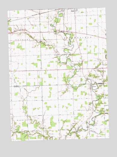
Evansport, OH USGS Topographic Map
Click on map above to begin viewing in our Map Viewer.

This topographic map contains these locations and features:
Feature Name Type Latitude Longitude GNIS ID View Map
Beaver CreekStreamN41.4545°W84.4358°1037752View Map
Beaver Creek CemeteryCemeteryN41.4809°W84.4858°1037755View Map
Boynton CemeteryCemeteryN41.4786°W84.4372°1038243View Map
Brush CreekStreamN41.4314°W84.4011°1038411View Map
Buck CemeteryCemeteryN41.4273°W84.4249°1038451View Map
Coon CreekStreamN41.4242°W84.3874°1039343View Map
Coy FarmsLocaleN41.4411°W84.4183°2702823View Map
Coys SubdivisionPopulated PlaceN41.4764°W84.4144°1055280View Map
Doll CemeteryCemeteryN41.3806°W84.4958°1039742View Map
Doty RunStreamN41.3806°W84.4244°1039757View Map
EvansportPopulated PlaceN41.4262°W84.3963°1056280View Map
Evansport CemeteryCemeteryN41.4076°W84.3963°1040263View Map
Evansport Post OfficePost OfficeN41.4264°W84.3958°1983548View Map
First Lutheran ChurchChurchN41.4989°W84.4136°1700883View Map
Glenburg (historical)Populated PlaceN41.4251°W84.4591°1055122View Map
Glenburg Post Office (historical)Post OfficeN41.4251°W84.4597°1983563View Map
Lakeland Woods EstatesPopulated PlaceN41.4814°W84.4888°1055255View Map
New Saint Johns Methodist CemeteryCemeteryN41.3873°W84.3930°1806052View Map
Oak Grove ChurchChurchN41.4559°W84.4394°1044037View Map
Oakwood CemeteryCemeteryN41.4984°W84.4297°1044047View Map
Old Evansport CemeteryCemeteryN41.4076°W84.3947°1806054View Map
Old Saint Johns Methodist CemeteryCemeteryN41.3881°W84.3941°1806055View Map
Pine Grove Mennonite ChurchChurchN41.4784°W84.4283°1071987View Map
Prairie CreekStreamN41.3767°W84.4541°1044744View Map
Promised Land SubdivisionPopulated PlaceN41.4987°W84.4258°1061239View Map
Riggs SubdivisionPopulated PlaceN41.4773°W84.4261°1055267View Map
Riverside Golf CourseLocaleN41.4948°W84.4433°1055268View Map
Rupp LandingLocaleN41.4998°W84.4299°1806091View Map
Saint Johns ChurchChurchN41.3870°W84.3938°1045538View Map
Shaffers AcresPopulated PlaceN41.4792°W84.4922°1055269View Map
Sloan FarmsLocaleN41.4608°W84.4083°2677549View Map
Stryker United Methodist ChurchChurchN41.4975°W84.4103°2677564View Map
Tiffin Elementary SchoolSchoolN41.3862°W84.4005°1055133View Map
Tiffin Township Fire DepartmentBuildingN41.3846°W84.3993°2550475View Map
Township High SchoolSchoolN41.3864°W84.4005°1047119View Map
Township of SpringfieldCivilN41.4707°W84.4005°1087176View Map
Township of TiffinCivilN41.3840°W84.4001°1086039View Map
Union Chapel Church of GodChurchN41.4273°W84.4791°1065404View Map
United Methodist Church of EvansportChurchN41.4242°W84.3980°1079646View Map
WilnaPopulated PlaceN41.4562°W84.4536°1055278View Map

Note: Coordinates in the location and feature list above are referenced to NAD83 datum.


Copyright (C) 2008-2024 Ryan Niemi / Sunset Dynamics ... All Rights Reserved