TopoQuest Logo
Do you find TopoQuest useful?
Help keep TopoQuest running and adding new maps/features by donating!
Bitcoin:  19c7KJd3qBynnjoSw5npx9KScwjBe4ifkT
Litecoin:  LXs6TkuXGGXo1vDsWCkWVdjQX94eUKd6ui
Home View Maps Find Maps Find Places Resources & Links


Sherwood, Ohio Topographic Map

USGS Map Title: Sherwood, OH
USGS Map MRC: 41084C5
DRG (GeoTIFF) Download: o41084c5.tif


Neighboring USGS Topographic Map Quads:


  Edgerton, OH  
41084D6
 

  Bryan, OH  
41084D5
 

  Evansport, OH  
41084D4
 

  Mark Center, OH  
41084C6
 

  Sherwood, OH  
41084C5
 

  Defiance West, OH  
41084C4
 

  Antwerp, OH  
41084B6
 

  Paulding, OH  
41084B5
 

  Junction, OH  
41084B4


Map MRC Location:

N42°
W85°
N42°
W84°
H8 H7 H6 H5 H4 H3 H2 H1
G8 G7 G6 G5 G4 G3 G2 G1
F8 F7 F6 F5 F4 F3 F2 F1
E8 E7 E6 E5 E4 E3 E2 E1
D8 D7 D6 D5 D4 D3 D2 D1
C8 C7 C6 C5 C4 C3 C2 C1
B8 B7 B6 B5 B4 B3 B2 B1
A8 A7 A6 A5 A4 A3 A2 A1
N41°
W85°
N41°
W84°

Sherwood, OH USGS 1:24K Topographic Map Preview:
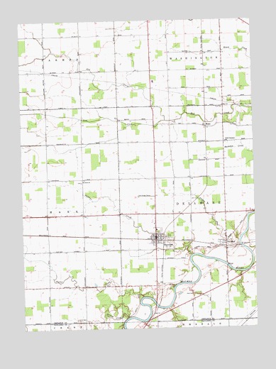
Sherwood, OH USGS Topographic Map
Click on map above to begin viewing in our Map Viewer.

This topographic map contains these locations and features:
Feature Name Type Latitude Longitude GNIS ID View Map
Blair CemeteryCemeteryN41.2678°W84.5436°1038097View Map
Case School (historical)SchoolN41.3542°W84.5919°1080722View Map
Coffin School (historical)SchoolN41.2676°W84.5541°1080721View Map
Colby CemeteryCemeteryN41.2534°W84.5952°1039236View Map
Colby School (historical)SchoolN41.2526°W84.6016°1053285View Map
Delaware Township Fire DepartmentBuildingN41.2961°W84.5154°2549339View Map
Dickey School (historical)SchoolN41.2964°W84.5919°1069567View Map
Dry CreekStreamN41.3342°W84.5480°1039800View Map
Dry Creek United Brethren Church (historical)ChurchN41.3617°W84.6113°1079631View Map
Fairview High SchoolSchoolN41.3503°W84.5530°1055121View Map
Fairview Junior High SchoolSchoolN41.3501°W84.5530°1079632View Map
Funk CemeteryCemeteryN41.3398°W84.5163°1040730View Map
Glore CemeteryCemeteryN41.2639°W84.5341°1040927View Map
Gordon CreekStreamN41.2545°W84.5686°1066019View Map
Lost CreekStreamN41.3342°W84.5480°1042787View Map
Mason School (historical)SchoolN41.3251°W84.5527°1080719View Map
MoatsPopulated PlaceN41.3317°W84.5258°1065041View Map
Moats CemeteryCemeteryN41.3325°W84.5194°1961349View Map
Moats Post Office (historical)Post OfficeN41.3320°W84.5263°1983569View Map
Mock School (historical)SchoolN41.3256°W84.5155°1080716View Map
New Saint Stephens Catholic CemeteryCemeteryN41.2823°W84.5152°1961350View Map
North Delaware ChurchChurchN41.3256°W84.5155°1043935View Map
Platter CreekStreamN41.2631°W84.5605°1066143View Map
Platter Creek School (historical)SchoolN41.2667°W84.5916°1080726View Map
Pleasant Point School (historical)SchoolN41.3548°W84.5541°1080718View Map
Rogers Private AirportAirportN41.3269°W84.5578°1083013View Map
Saint John's Lutheran ChurchChurchN41.3095°W84.5933°1045536View Map
Saint Johns Lutheran CemeteryCemeteryN41.3099°W84.5932°1961354View Map
Saint Johns School (historical)SchoolN41.3092°W84.5925°1080724View Map
School Number 1 (historical)SchoolN41.3251°W84.5919°1080723View Map
School Number 5 (historical)SchoolN41.2967°W84.5155°1080717View Map
School Number 8 (historical)SchoolN41.3551°W84.5158°1069569View Map
Shady Corner School (historical)SchoolN41.2820°W84.6113°1080725View Map
SherwoodPopulated PlaceN41.2873°W84.5536°1046206View Map
Sherwood CemeteryCemeteryN41.2901°W84.5508°1079667View Map
Sherwood Elementary SchoolSchoolN41.2901°W84.5530°1055131View Map
Sherwood Post OfficePost OfficeN41.2876°W84.5541°1983554View Map
Shoestring School (historical)SchoolN41.3034°W84.5530°1080720View Map
Snooks RunStreamN41.2848°W84.5088°1046403View Map
Sulphur CreekStreamN41.2795°W84.5344°1046849View Map
The BendPopulated PlaceN41.2839°W84.5155°1061681View Map
The Bend Post Office (historical)Post OfficeN41.2834°W84.5152°1983560View Map
Township of DelawareCivilN41.2965°W84.5152°1086031View Map
Village of SherwoodCivilN41.2890°W84.5530°2399805View Map
Village of Sherwood Volunteer Fire DepartmentBuildingN41.2872°W84.5538°2549728View Map
WDFM-FM (Defiance)TowerN41.2912°W84.5380°1083824View Map

Note: Coordinates in the location and feature list above are referenced to NAD83 datum.


Copyright (C) 2008-2025 Ryan Niemi / Sunset Dynamics ... All Rights Reserved