TopoQuest Logo
Do you find TopoQuest useful?
Help keep TopoQuest running and adding new maps/features by donating!
Bitcoin:  19c7KJd3qBynnjoSw5npx9KScwjBe4ifkT
Litecoin:  LXs6TkuXGGXo1vDsWCkWVdjQX94eUKd6ui
Home View Maps Find Maps Find Places Resources & Links


Evaro, Montana Topographic Map

USGS Map Title: Evaro, MT
USGS Map MRC: 47114A1
DRG (GeoTIFF) Download: o47114a1.tif


Neighboring USGS Topographic Map Quads:


  Saddle Mountain, MT  
47114B2
 

  Arlee, MT  
47114B1
 

  Gold Creek, MT  
47113B8
 

  Frenchtown, MT  
47114A2
 

  Evaro, MT  
47114A1
 

  Stuart Peak, MT  
47113A8
 

  Primrose, MT  
46114H2
 

  Northwest Missoula, MT  
46114H1
 

  Northeast Missoula, MT  
46113H8


Map MRC Location:

N48°
W115°
N48°
W114°
H8 H7 H6 H5 H4 H3 H2 H1
G8 G7 G6 G5 G4 G3 G2 G1
F8 F7 F6 F5 F4 F3 F2 F1
E8 E7 E6 E5 E4 E3 E2 E1
D8 D7 D6 D5 D4 D3 D2 D1
C8 C7 C6 C5 C4 C3 C2 C1
B8 B7 B6 B5 B4 B3 B2 B1
A8 A7 A6 A5 A4 A3 A2 A1
N47°
W115°
N47°
W114°

Evaro, MT USGS 1:24K Topographic Map Preview:
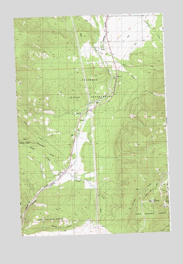
Evaro, MT USGS Topographic Map
Click on map above to begin viewing in our Map Viewer.

This topographic map contains these locations and features:
Feature Name Type Latitude Longitude GNIS ID View Map
14N20W03AA__01 WellWellN47.0063°W114.1051°820104View Map
15N19W05BBCC01 WellWellN47.0913°W114.0390°820687View Map
15N19W05BCCC01 WellWellN47.0877°W114.0376°820660View Map
15N19W07BCCC01 WellWellN47.0735°W114.0598°820573View Map
15N20W12CAAC01 WellWellN47.0716°W114.0732°820550View Map
15N20W12CAD_01 WellWellN47.0705°W114.0723°820546View Map
15N20W13BABB01 WellWellN47.0652°W114.0746°820522View Map
15N20W13BCCC01 WellWellN47.0560°W114.0737°820456View Map
15N20W13CADA01 WellWellN47.0566°W114.0726°820461View Map
15N20W13CADA02 WellWellN47.0566°W114.0726°820462View Map
15N20W13CADA03 WellWellN47.0566°W114.0726°820463View Map
15N20W13DCAA01 WellWellN47.0727°W114.0601°820564View Map
15N20W23DCAA01 WellWellN47.0405°W114.0865°820361View Map
15N20W24BCCB01 WellWellN47.0652°W114.0807°820523View Map
15N20W26ABC_01 WellWellN47.0344°W114.0909°820317View Map
16N19W30BCCD01 WellWellN47.1171°W114.0579°820850View Map
16N19W30CDBC01 WellWellN47.1116°W114.0551°820812View Map
16N19W30DBA_01 WellWellN47.1155°W114.0459°820838View Map
16N19W31BBBB01 WellWellN47.1088°W114.0582°820799View Map
16N19W31CBA_01 WellWellN47.1010°W114.0565°820741View Map
16N19W31DABB01 WellWellN47.1016°W114.0432°820742View Map
16N19W31DDAB01 WellWellN47.0983°W114.0401°820726View Map
Coriacan DefileGapN47.0744°W114.0657°1852101View Map
East Fork Finley CreekStreamN47.0980°W114.0521°782844View Map
EvaroLocaleN47.0321°W114.0915°1781325View Map
EvaroPopulated PlaceN47.0321°W114.0915°783256View Map
Evaro Census Designated PlaceCensusN47.0737°W114.0206°2408095View Map
Evaro Post Office (historical)Post OfficeN47.0321°W114.0915°1781323View Map
Evaro School (historical)SchoolN47.0321°W114.0915°1781324View Map
Frenchtown Rural Fire District Station 2BuildingN47.0341°W114.0909°2546485View Map
Frog CreekStreamN47.0471°W114.0757°783761View Map
KECI-TV (Missoula)TowerN47.0177°W114.0140°806738View Map
KPAX-TV (Missoula)TowerN47.0183°W114.0123°806739View Map
KTMF-TV (Missoula)TowerN47.0194°W114.0137°806740View Map
Landon (historical)LocaleN47.0333°W114.0926°1781268View Map
Marent GulchValleyN47.0033°W114.1243°786837View Map
Marent TrestleBridgeN47.0033°W114.1243°799336View Map
N CanalCanalN47.1035°W114.0279°787902View Map
SchleyPopulated PlaceN47.1033°W114.0540°790120View Map
Schley CreekStreamN47.0924°W114.0465°790121View Map
Sim-heh CreekStreamN47.0711°W114.0661°2723431View Map
Snow Park Ski AreaParkN47.0144°W114.0296°790780View Map
Spruce (historical)LocaleN47.0374°W114.0843°1781234View Map
TV MountainSummitN47.0174°W114.0140°791842View Map

Note: Coordinates in the location and feature list above are referenced to NAD83 datum.


Copyright (C) 2008-2024 Ryan Niemi / Sunset Dynamics ... All Rights Reserved