TopoQuest Logo
Do you find TopoQuest useful?
Help keep TopoQuest running and adding new maps/features by donating!
Bitcoin:  19c7KJd3qBynnjoSw5npx9KScwjBe4ifkT
Litecoin:  LXs6TkuXGGXo1vDsWCkWVdjQX94eUKd6ui
Home View Maps Find Maps Find Places Resources & Links


Northwest Missoula, Montana Topographic Map

USGS Map Title: Northwest Missoula, MT
USGS Map MRC: 46114H1
DRG (GeoTIFF) Download: o46114h1.tif


Neighboring USGS Topographic Map Quads:


  Frenchtown, MT  
47114A2
 

  Evaro, MT  
47114A1
 

  Stuart Peak, MT  
47113A8
 

  Primrose, MT  
46114H2
 

  Northwest Missoula, MT  
46114H1
 

  Northeast Missoula, MT  
46113H8
 

  Blue Mountain, MT  
46114G2
 

  Southwest Missoula, MT  
46114G1
 

  Southeast Missoula, MT  
46113G8


Map MRC Location:

N47°
W115°
N47°
W114°
H8 H7 H6 H5 H4 H3 H2 H1
G8 G7 G6 G5 G4 G3 G2 G1
F8 F7 F6 F5 F4 F3 F2 F1
E8 E7 E6 E5 E4 E3 E2 E1
D8 D7 D6 D5 D4 D3 D2 D1
C8 C7 C6 C5 C4 C3 C2 C1
B8 B7 B6 B5 B4 B3 B2 B1
A8 A7 A6 A5 A4 A3 A2 A1
N46°
W115°
N46°
W114°

Northwest Missoula, MT USGS 1:24K Topographic Map Preview:
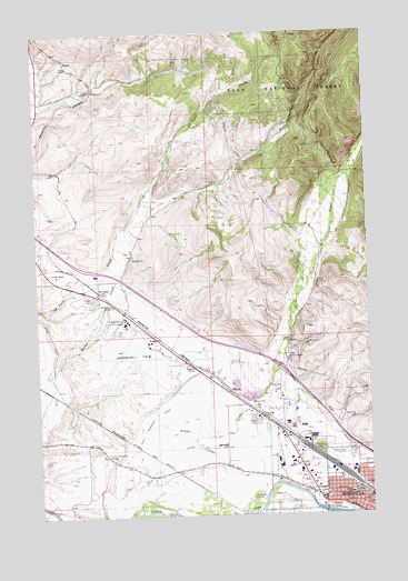
Northwest Missoula, MT USGS Topographic Map
Click on map above to begin viewing in our Map Viewer.

This topographic map contains these locations and features:
Feature Name Type Latitude Longitude GNIS ID View Map
13N19W04BA__01 WellWellN46.9196°W114.0098°819377View Map
13N19W05AD__01 WellWellN46.9160°W114.0204°819355View Map
13N19W05BA__01 WellWellN46.9196°W114.0309°819378View Map
13N19W05BA__02 WellWellN46.9196°W114.0309°819379View Map
13N19W05BC__01 WellWellN46.9160°W114.0362°819356View Map
13N19W06AA__01 WellWellN46.9196°W114.0415°819380View Map
13N19W06AA__02 WellWellN46.9196°W114.0415°819381View Map
13N19W06AD__01 WellWellN46.9160°W114.0415°819357View Map
13N19W06BA__01 WellWellN46.9196°W114.0521°819382View Map
13N19W06BB__01 WellWellN46.9196°W114.0573°819383View Map
13N19W06BB__02 WellWellN46.9196°W114.0573°819384View Map
13N19W07AC__01 WellWellN46.9016°W114.0468°819277View Map
13N19W07AD__01 WellWellN46.9016°W114.0415°819275View Map
13N19W07AD__02 WellWellN46.9016°W114.0415°819276View Map
13N19W07BC__01 WellWellN46.9016°W114.0573°819278View Map
13N19W07CC__01 WellWellN46.8944°W114.0573°819220View Map
13N19W07DA__01 WellWellN46.8980°W114.0415°819254View Map
13N19W07DA__02 WellWellN46.8980°W114.0415°819255View Map
13N19W07DD__01 WellWellN46.8944°W114.0415°819219View Map
13N19W08AA__01 WellWellN46.9052°W114.0204°819305View Map
13N19W08AB__01 WellWellN46.9052°W114.0257°819306View Map
13N19W08CB__01 WellWellN46.8980°W114.0362°819253View Map
13N19W08CC__01 WellWellN46.8944°W114.0362°819218View Map
13N19W08CD__01 WellWellN46.8944°W114.0309°819217View Map
13N19W08DC__01 WellWellN46.8944°W114.0257°819216View Map
13N19W08DD__01 WellWellN46.8944°W114.0204°819215View Map
13N19W09AB__01 WellWellN46.9052°W114.0046°819302View Map
13N19W09BA__02 WellWellN46.9052°W114.0098°819303View Map
13N19W09BB__01 WellWellN46.9052°W114.0151°819304View Map
13N19W09BD__01 WellWellN46.9016°W114.0098°819274View Map
13N19W16BA__01 WellWellN46.8908°W114.0098°819166View Map
13N19W16BB__01 WellWellN46.8908°W114.0151°819167View Map
13N19W16CBBC01 WellWellN46.8835°W114.0176°819082View Map
13N19W17AA__01 WellWellN46.8908°W114.0204°819168View Map
13N19W17AC__01 WellWellN46.8871°W114.0257°819116View Map
13N19W17AC__02 WellWellN46.8871°W114.0257°819117View Map
13N19W17BC__01 WellWellN46.8871°W114.0362°819118View Map
13N19W17DB__01 WellWellN46.8835°W114.0257°819083View Map
13N19W17DC__01 WellWellN46.8799°W114.0257°819037View Map
13N19W17DD__01 WellWellN46.8799°W114.0204°819036View Map
13N19W18AA__01 WellWellN46.8908°W114.0415°819169View Map
13N19W18AA__02 WellWellN46.8908°W114.0415°819170View Map
13N19W18AD__01 WellWellN46.8871°W114.0415°819119View Map
13N19W18AD__02 WellWellN46.8871°W114.0415°819120View Map
13N19W18BA__01 WellWellN46.8908°W114.0521°819171View Map
13N19W18BA__02 WellWellN46.8908°W114.0521°819172View Map
13N19W18BC__01 WellWellN46.8871°W114.0573°819121View Map
13N19W18CD__01 WellWellN46.8799°W114.0521°819039View Map
13N19W18DA__01 WellWellN46.8835°W114.0415°819084View Map
13N19W18DD__01 WellWellN46.8799°W114.0415°819038View Map
13N19W20BB__01 WellWellN46.8760°W114.0362°819013View Map
13N19W20CABD01 WellWellN46.8808°W114.0326°819056View Map
13N19W21AB__01 WellWellN46.8760°W114.0046°819012View Map
13N20W01BB__01 WellWellN46.9199°W114.0784°819385View Map
13N20W12DC__01 WellWellN46.8944°W114.0679°819221View Map
13N20W13AC__01 WellWellN46.8871°W114.0679°819125View Map
13N20W13AD__03 WellWellN46.8871°W114.0626°819122View Map
13N20W13AD__04 WellWellN46.8871°W114.0626°819123View Map
13N20W13AD__05 WellWellN46.8871°W114.0626°819124View Map
13N20W13BC__01 WellWellN46.8871°W114.0784°819128View Map
13N20W13BD__01 WellWellN46.8871°W114.0732°819126View Map
13N20W13BD__02 WellWellN46.8871°W114.0732°819127View Map
13N20W13DC__01 WellWellN46.8799°W114.0679°819040View Map
13N20W14AC__01 WellWellN46.8871°W114.0890°819130View Map
13N20W14ACCA01 WellWellN46.8866°W114.0898°819113View Map
13N20W14AD__01 WellWellN46.8871°W114.0837°819129View Map
13N20W14BA__01 WellWellN46.8908°W114.0943°819173View Map
13N20W14BB__01 WellWellN46.8908°W114.0996°819174View Map
13N20W14BB__02 WellWellN46.8908°W114.0996°819175View Map
13N20W14BD__02 WellWellN46.8871°W114.0943°819131View Map
13N20W23AB__01 WellWellN46.8760°W114.0890°819014View Map
13N20W25BCBB01 WellWellN46.8810°W114.0809°819058View Map
14N20W10CC__01 WellWellN46.9810°W114.1209°819919View Map
14N20W12BB__01 WellWellN46.9919°W114.0787°819990View Map
14N20W24ADBC01 WellWellN46.9594°W114.0657°819705View Map
14N20W24ADBD01 WellWellN46.9599°W114.0640°819713View Map
14N20W24ADBD02 WellWellN46.9594°W114.0637°819704View Map
14N20W24ADCB01 WellWellN46.9591°W114.0651°819697View Map
14N20W25AB__02 WellWellN46.9488°W114.0682°819573View Map
14N20W26AB__01 WellWellN46.9488°W114.0893°819574View Map
14N20W26CC__02 WellWellN46.9380°W114.0998°819506View Map
14N20W34AA__01 WellWellN46.9344°W114.1051°819476View Map
14N20W34AB__01 WellWellN46.9344°W114.1104°819477View Map
14N20W34AD__01 WellWellN46.9308°W114.1051°819453View Map
14N20W35AC__01 WellWellN46.9308°W114.0893°819451View Map
14N20W35AD__01 WellWellN46.9308°W114.0840°819450View Map
14N20W35BACB01 WellWellN46.9333°W114.0968°819470View Map
14N20W35BB__01 WellWellN46.9344°W114.0998°819474View Map
14N20W35BB__02 WellWellN46.9344°W114.0998°819475View Map
14N20W35BC__01 WellWellN46.9308°W114.0998°819452View Map
14N20W35DC__01 WellWellN46.9235°W114.0893°819410View Map
Advanced Air NetworkBuildingN46.9202°W114.0811°2637838View Map
Butler CreekStreamN46.9121°W114.1209°780682View Map
California Street Bridge (historical)BridgeN46.8755°W114.0121°1781346View Map
Countryside Court Mobile Home ParkPopulated PlaceN46.8883°W114.0707°1781508View Map
De SmetPopulated PlaceN46.9333°W114.1032°782132View Map
DeSmetLocaleN46.9333°W114.1032°1781298View Map
Desmet Post Office (historical)Post OfficeN46.9333°W114.1032°1781299View Map
DeSmet SchoolSchoolN46.9294°W114.0973°782134View Map
Downtown Lions ParkParkN46.8763°W114.0107°1781184View Map
Family Practice MissoulaHospitalN46.8763°W114.0015°1781168View Map
Field Doughery DitchCanalN46.9035°W114.0740°783370View Map
Flynn Lowney DitchCanalN46.8891°W114.0596°783573View Map
Fords South Airport (historical)AirportN46.9233°W114.0884°806474View Map
Grant CreekStreamN46.8930°W114.0896°784183View Map
Grant Creek (historical)Populated PlaceN46.9583°W114.0093°1781285View Map
Green Field Mobile Home ParkPopulated PlaceN46.8841°W114.0843°1781512View Map
Hell Gate (historical)Populated PlaceN46.8833°W114.0871°1781279View Map
Hell Gate Post Office (historical)Post OfficeN46.8833°W114.0871°1781280View Map
Hellgate SchoolSchoolN46.8927°W114.0557°772335View Map
Hollywood Trailer CourtPopulated PlaceN46.8846°W114.0182°1781490View Map
Interchange 101CrossingN46.9127°W114.0343°1781563View Map
Internal Revenue Service Criminal Investigation Division Missoula OfficeBuildingN46.8850°W114.0310°2548972View Map
KGRZ-AM (Missoula)TowerN46.8766°W114.0140°806632View Map
Kilo (historical)LocaleN46.9044°W114.0482°1781270View Map
KOA El-Mar KampgroundLocaleN46.8930°W114.0404°1781529View Map
Kona Ranch DamDamN46.8933°W114.1243°796265View Map
Lehsou DitchCanalN46.9046°W114.0234°786037View Map
Little McCormick ParkParkN46.8780°W114.0012°1781185View Map
Lowell SchoolSchoolN46.8804°W114.0085°786656View Map
McLeod (historical)LocaleN46.9069°W114.0537°1781257View Map
Missoula CemeteryCemeteryN46.8930°W114.0209°787505View Map
Missoula Chiropractic CenterHospitalN46.8777°W114.0093°1781150View Map
Missoula County Detention FacilityBuildingN46.8829°W114.0273°2548942View Map
Missoula Emergency Services Station 2BuildingN46.9012°W114.0356°2637881View Map
Missoula Fire Department Station 4BuildingN46.8915°W114.0326°1781340View Map
Missoula International AirportAirportN46.9163°W114.0906°806484View Map
Missoula International Airport PoliceBuildingN46.9189°W114.0841°2548920View Map
Missoula Rural Fire District Station 2BuildingN46.9340°W114.1091°2546467View Map
Missoula Rural Fire District Station 6BuildingN46.8940°W114.1145°2546466View Map
Mobile City Trailer ParkPopulated PlaceN46.8758°W114.0215°1781506View Map
Montana Highway Patrol District I OfficeBuildingN46.8848°W114.0306°2548933View Map
Mountain View Baptist ChurchChurchN46.8944°W114.1176°1781091View Map
Mullan Post OfficePost OfficeN46.8936°W114.0349°2738317View Map
NagosPopulated PlaceN46.9916°W114.1129°806307View Map
North HillsRangeN46.9138°W114.0065°1781198View Map
Northgate PlazaLocaleN46.8860°W114.0384°1781207View Map
O'Keefe School (historical)SchoolN46.9796°W114.1243°1781364View Map
Old Hellgate Village Trailer ParkPopulated PlaceN46.8841°W114.0815°1781509View Map
Out Post CampgroundLocaleN46.9796°W114.1232°1781528View Map
Reid (historical)LocaleN46.9769°W114.1232°1781243View Map
Reserve Street BridgeBridgeN46.8819°W114.0384°1781347View Map
Riddle (historical)LocaleN46.9166°W114.0676°1781242View Map
Riverside Health Care CenterHospitalN46.8766°W114.0101°1781151View Map
Rocky Mountain Elk Foundation Wildlife Visitor CenterBuildingN46.8866°W114.0273°1781209View Map
Russell Street BridgeBridgeN46.8760°W114.0187°1781348View Map
Saint Patrick Hosptal Emergency ServicesBuildingN46.8759°W114.0001°2637923View Map
Smokejumper Center and Aerial Fire DepotBuildingN46.9257°W114.0919°1781212View Map
Sunset Memorial GardensCemeteryN46.8905°W114.1015°791718View Map
Thomas Post Office (historical)Post OfficeN46.9769°W114.1226°1781244View Map
Travois VillagePopulated PlaceN46.8871°W114.0209°1781491View Map
United States Forest Service Aerial Fire DepotLocaleN46.9249°W114.0929°799359View Map
West Side ParkParkN46.8802°W114.0068°793131View Map
Westview ParkPopulated PlaceN46.9119°W114.0426°1781507View Map
WyePopulated PlaceN46.9530°W114.1215°1853193View Map

Note: Coordinates in the location and feature list above are referenced to NAD83 datum.


Copyright (C) 2008-2025 Ryan Niemi / Sunset Dynamics ... All Rights Reserved