TopoQuest Logo
Do you find TopoQuest useful?
Help keep TopoQuest running and adding new maps/features by donating!
Bitcoin:  19c7KJd3qBynnjoSw5npx9KScwjBe4ifkT
Litecoin:  LXs6TkuXGGXo1vDsWCkWVdjQX94eUKd6ui
Home View Maps Find Maps Find Places Resources & Links


Primrose, Montana Topographic Map

USGS Map Title: Primrose, MT
USGS Map MRC: 46114H2
DRG (GeoTIFF) Download: o46114h2.tif


Neighboring USGS Topographic Map Quads:


  Huson, MT  
47114A3
 

  Frenchtown, MT  
47114A2
 

  Evaro, MT  
47114A1
 

  Diamond Point, MT  
46114H3
 

  Primrose, MT  
46114H2
 

  Northwest Missoula, MT  
46114H1
 

  Camp Creek, MT  
46114G3
 

  Blue Mountain, MT  
46114G2
 

  Southwest Missoula, MT  
46114G1


Map MRC Location:

N47°
W115°
N47°
W114°
H8 H7 H6 H5 H4 H3 H2 H1
G8 G7 G6 G5 G4 G3 G2 G1
F8 F7 F6 F5 F4 F3 F2 F1
E8 E7 E6 E5 E4 E3 E2 E1
D8 D7 D6 D5 D4 D3 D2 D1
C8 C7 C6 C5 C4 C3 C2 C1
B8 B7 B6 B5 B4 B3 B2 B1
A8 A7 A6 A5 A4 A3 A2 A1
N46°
W115°
N46°
W114°

Primrose, MT USGS 1:24K Topographic Map Preview:
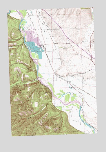
Primrose, MT USGS Topographic Map
Click on map above to begin viewing in our Map Viewer.

This topographic map contains these locations and features:
Feature Name Type Latitude Longitude GNIS ID View Map
13N20W04BC__01 WellWellN46.9163°W114.1415°819359View Map
13N20W04CB__01 WellWellN46.9127°W114.1415°819344View Map
13N20W06AA__03 WellWellN46.9199°W114.1679°819386View Map
13N20W08CBB_01 WellWellN46.8988°W114.1637°819258View Map
13N20W08DA__01 WellWellN46.8980°W114.1468°819256View Map
13N20W09BA__01 WellWellN46.9052°W114.1362°819307View Map
13N20W17BB__01 WellWellN46.8908°W114.1626°819176View Map
13N20W21BB__01 WellWellN46.8760°W114.1415°819015View Map
13N21W01DCAD01 WellWellN46.9091°W114.1932°819321View Map
13N21W11AADC01 WellWellN46.9033°W114.2107°819285View Map
14N20W07DB__01 WellWellN46.9846°W114.1740°819939View Map
14N20W07DD__01 WellWellN46.9810°W114.1687°819921View Map
14N20W08DDCC01 WellWellN46.9802°W114.1496°819908View Map
14N20W09DD__01 WellWellN46.9810°W114.1265°819920View Map
14N20W19BD__01 WellWellN46.9596°W114.1793°819710View Map
14N20W19CB__01 WellWellN46.9560°W114.1846°819677View Map
14N20W20BB__01 WellWellN46.9633°W114.1634°819754View Map
14N20W21BB__01 WellWellN46.9633°W114.1423°819753View Map
14N20W21BD__01 WellWellN46.9596°W114.1371°819709View Map
14N20W28AB__01 WellWellN46.9488°W114.1318°819575View Map
14N20W28DA__01 WellWellN46.9416°W114.1265°819529View Map
14N20W28DBDD01 WellWellN46.9396°W114.1315°819519View Map
14N20W28DCCC01 WellWellN46.9360°W114.1351°819489View Map
14N20W29DCCA01 WellWellN46.9377°W114.1540°819505View Map
14N20W30CC__01 WellWellN46.9380°W114.1846°819507View Map
14N20W31AA__01 WellWellN46.9344°W114.1687°819479View Map
14N20W31BB__01 WellWellN46.9344°W114.1846°819480View Map
14N20W31BD__01 WellWellN46.9308°W114.1793°819454View Map
14N20W31DA__01 WellWellN46.9271°W114.1687°819438View Map
14N20W31DB__01 WellWellN46.9271°W114.1740°819439View Map
14N20W31DD__01 WellWellN46.9235°W114.1687°819413View Map
14N20W32BB__01 WellWellN46.9344°W114.1634°819478View Map
14N20W32CB__01 WellWellN46.9271°W114.1634°819436View Map
14N20W32CB__02 WellWellN46.9271°W114.1634°819437View Map
14N20W32DC__01 WellWellN46.9235°W114.1529°819412View Map
14N20W32DCCA01 WellWellN46.9227°W114.1540°819404View Map
14N20W33CC__01 WellWellN46.9235°W114.1423°819411View Map
14N21W01DDBB01 WellWellN46.9974°W114.1918°820034View Map
14N21W02DC__01 WellWellN46.9955°W114.2157°820023View Map
14N21W11ABAB01 WellWellN46.9938°W114.2160°820003View Map
14N21W11BA__01 WellWellN46.9919°W114.2210°819991View Map
14N21W11CA__01 WellWellN46.9846°W114.2210°819941View Map
14N21W12DB__01 WellWellN46.9846°W114.1946°819940View Map
14N21W13AB__01 WellWellN46.9774°W114.1946°819882View Map
14N21W13BB__01 WellWellN46.9774°W114.2051°819883View Map
14N21W13BB__02 WellWellN46.9774°W114.2051°819884View Map
14N21W13BBAA01 WellWellN46.9791°W114.2034°819899View Map
14N21W13CACC01 WellWellN46.9688°W114.2018°819827View Map
14N21W13CD__01 WellWellN46.9666°W114.1998°819810View Map
14N21W13DB__01 WellWellN46.9702°W114.1946°819838View Map
14N21W13DC__02 WellWellN46.9666°W114.1946°819809View Map
14N21W13DCDA01 WellWellN46.9666°W114.1929°819808View Map
14N21W13DDCA01 WellWellN46.9666°W114.1923°819807View Map
14N21W13DDCC01 WellWellN46.9652°W114.1923°819783View Map
14N21W14DA__01 WellWellN46.9702°W114.2104°819839View Map
14N21W14DB__01 WellWellN46.9702°W114.2157°819840View Map
14N21W23AA__01 WellWellN46.9633°W114.2104°819761View Map
14N21W24AC__01 WellWellN46.9596°W114.1946°819711View Map
14N21W24AC__02 WellWellN46.9596°W114.1946°819712View Map
14N21W24BA__01 WellWellN46.9633°W114.1998°819755View Map
14N21W24BA__03 WellWellN46.9633°W114.1998°819757View Map
14N21W24BA__04 WellWellN46.9633°W114.1998°819758View Map
14N21W24BA__05 WellWellN46.9633°W114.1998°819759View Map
14N21W24BA__06 WellWellN46.9633°W114.1998°819760View Map
14N21W24BAAC01 WellWellN46.9635°W114.2001°819762View Map
14N21W24BAAC02 WellWellN46.9633°W114.1998°819756View Map
14N21W24DA__01 WellWellN46.9560°W114.1893°819678View Map
14N21W24DB__01 WellWellN46.9560°W114.1946°819679View Map
14N21W24DBA_01 WellWellN46.9574°W114.1929°819691View Map
14N21W25AB__01 WellWellN46.9488°W114.1946°819576View Map
14N21W25ABCC01 WellWellN46.9469°W114.1979°819566View Map
14N21W25AC__01 WellWellN46.9452°W114.1946°819554View Map
14N21W25BCAA01 WellWellN46.9458°W114.2040°819557View Map
14N21W25BCAC01 WellWellN46.9449°W114.2048°819553View Map
14N21W25CADD01 WellWellN46.9399°W114.1982°819520View Map
14N21W25CADD02 WellWellN46.9399°W114.1982°819521View Map
14N21W25CBA_01 WellWellN46.9427°W114.2040°819535View Map
14N21W25CBA_02 WellWellN46.9424°W114.2040°819534View Map
14N21W25CCDA01 WellWellN46.9371°W114.2037°819492View Map
14N21W25CCDA02 WellWellN46.9371°W114.2037°819493View Map
14N21W25DA__01 WellWellN46.9416°W114.1893°819530View Map
14N21W25DD__01 WellWellN46.9380°W114.1893°819508View Map
14N21W36BD__01 WellWellN46.9308°W114.1998°819455View Map
14N21W36DD__01 WellWellN46.9235°W114.1893°819414View Map
Albert CreekStreamN46.9735°W114.2298°778906View Map
Ardrum (historical)LocaleN46.9949°W114.1254°1781330View Map
Ardrum (historical)Populated PlaceN46.9949°W114.1254°1781331View Map
Ardrum Post Office (historical)Post OfficeN46.9949°W114.1254°1781332View Map
Big FlatFlatN46.8935°W114.1598°779805View Map
Council GroveLocaleN46.9094°W114.1534°794298View Map
Council Grove State ParkParkN46.9124°W114.1509°1781523View Map
Cyr GulchValleyN46.9424°W114.2126°782026View Map
Deep CreekStreamN46.9310°W114.2109°782200View Map
Deep Creek Fishing Access SiteLocaleN46.9294°W114.2101°1744264View Map
Dog GulchValleyN46.9621°W114.2485°782442View Map
Dry GulchValleyN46.9263°W114.2057°782621View Map
Frenchtown Rural Fire District Station 6BuildingN46.9618°W114.1982°2738264View Map
Frenchtown Rural Fire District Station 7BuildingN46.9645°W114.1276°2546482View Map
Gaspard (historical)LocaleN46.9527°W114.1815°1781286View Map
Grass ValleyPopulated PlaceN46.9358°W114.1404°784201View Map
Grass Valley (historical)LocaleN46.9358°W114.1404°1781284View Map
Grass Valley French DitchCanalN46.9324°W114.1543°784202View Map
Grass Valley Post Office (historical)Post OfficeN46.9358°W114.1404°1781283View Map
Grass Valley School (historical)SchoolN46.9213°W114.1579°784203View Map
Harper BridgeBridgeN46.9313°W114.2096°784558View Map
Interchange 96CrossingN46.9519°W114.1315°1781564View Map
Jellystone RV ParkLocaleN46.9438°W114.1273°1781531View Map
Jim and Marys RV ParkLocaleN46.9652°W114.1315°1781530View Map
La Valle CreekStreamN46.9316°W114.1748°785879View Map
Little Martin GulchValleyN46.8955°W114.1790°786324View Map
Martin GulchValleyN46.8991°W114.1793°786888View Map
Mellady (historical)LocaleN46.9638°W114.1843°1781287View Map
O'Keefe CreekStreamN46.9505°W114.2101°788371View Map
PrimrosePopulated PlaceN46.9271°W114.1668°789188View Map
Rock CreekStreamN46.9674°W114.2279°789675View Map
SchillingPopulated PlaceN46.9641°W114.2018°790117View Map
Schilling SidingLocaleN46.9652°W114.1846°790118View Map
Sherman GulchValleyN46.9083°W114.1898°790410View Map
Sherman Gulch BeaconLocaleN46.9171°W114.1987°799349View Map
Skyline Trailer CourtPopulated PlaceN46.9305°W114.1315°1781510View Map
Wagon Wheel Trailer CourtPopulated PlaceN46.9049°W114.1837°1781511View Map
Warm SloughLakeN46.9147°W114.1728°792825View Map
Wye Census Designated PlaceCensusN46.9523°W114.1331°2409631View Map

Note: Coordinates in the location and feature list above are referenced to NAD83 datum.


Copyright (C) 2008-2024 Ryan Niemi / Sunset Dynamics ... All Rights Reserved