TopoQuest Logo
Do you find TopoQuest useful?
Help keep TopoQuest running and adding new maps/features by donating!
Bitcoin:  19c7KJd3qBynnjoSw5npx9KScwjBe4ifkT
Litecoin:  LXs6TkuXGGXo1vDsWCkWVdjQX94eUKd6ui
Home View Maps Find Maps Find Places Resources & Links


Fallon SW, Montana Topographic Map

USGS Map Title: Fallon SW, MT
USGS Map MRC: 46105G2
DRG (GeoTIFF) Download: o46105g2.tif


Neighboring USGS Topographic Map Quads:


  Diamond G Creek, MT  
46105H3
 

  Hendrickson Coulee, MT  
46105H2
 

  Fallon NE, MT  
46105H1
 

  Terry, MT  
46105G3
 

  Fallon SW, MT  
46105G2
 

  Fallon, MT  
46105G1
 

  Zero NE, MT  
46105F3
 

  Flat Top Butte, MT  
46105F2
 

  Flat Top Butte NE, MT  
46105F1


Map MRC Location:

N47°
W106°
N47°
W105°
H8 H7 H6 H5 H4 H3 H2 H1
G8 G7 G6 G5 G4 G3 G2 G1
F8 F7 F6 F5 F4 F3 F2 F1
E8 E7 E6 E5 E4 E3 E2 E1
D8 D7 D6 D5 D4 D3 D2 D1
C8 C7 C6 C5 C4 C3 C2 C1
B8 B7 B6 B5 B4 B3 B2 B1
A8 A7 A6 A5 A4 A3 A2 A1
N46°
W106°
N46°
W105°

Fallon SW, MT USGS 1:24K Topographic Map Preview:
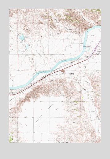
Fallon SW, MT USGS Topographic Map
Click on map above to begin viewing in our Map Viewer.

This topographic map contains these locations and features:
Feature Name Type Latitude Longitude GNIS ID View Map
12N51E12CDAD01 WellWellN46.8047°W105.2494°818412View Map
12N51E13DB__01 WellWellN46.7936°W105.2467°818361View Map
12N52E04BBBB01 WellWellN46.8322°W105.1953°818662View Map
12N52E06BAAA01 WellWellN46.8314°W105.2286°818655View Map
12N52E18CB__01 WellWellN46.7933°W105.2355°818360View Map
12N52E23DBAD01 WellWellN46.7797°W105.1386°818256View Map
12N52E26BB__01 WellWellN46.7714°W105.1514°818201View Map
12N52E26BCAB01 WellWellN46.7695°W105.1500°818181View Map
13N51E34AADA01 WellWellN46.8447°W105.2394°818728View Map
13N52E29BDBC01 WellWellN46.8561°W105.1705°818834View Map
13N52E29CADB01 WellWellN46.8517°W105.1672°818789View Map
13N52E30CBCA01 WellWellN46.8517°W105.1953°818790View Map
13N52E32ADAA01 WellWellN46.8428°W105.1550°818715View Map
13N52E33AC__01 WellWellN46.8414°W105.1416°818711View Map
13N52E34CDBB01 WellWellN46.8361°W105.1278°818687View Map
BluffportPopulated PlaceN46.8145°W105.1661°769055View Map
Brights Valley CreekStreamN46.7681°W105.1439°1715811View Map
Broadview BenchBenchN46.7795°W105.2008°769232View Map
Broadview School (historical)SchoolN46.7736°W105.2175°1715676View Map
Cameron CreekStreamN46.8467°W105.1828°1715805View Map
Cato (historical)LocaleN46.7964°W105.2453°1715666View Map
Cherry CreekStreamN46.8025°W105.2450°769788View Map
Coal CreekStreamN46.8161°W105.2116°769980View Map
Coal Creek DamDamN46.8467°W105.2339°795732View Map
Coal Creek Drop DamDamN46.8383°W105.2289°795731View Map
Coal Creek ReservoirReservoirN46.8481°W105.2328°769985View Map
Cottonwood CreekStreamN46.8586°W105.1361°770181View Map
Deer CreekStreamN46.8189°W105.1928°770568View Map
Fallon CemeteryCemeteryN46.8169°W105.1333°771301View Map
Fallon Census Designated PlaceCensusN46.8373°W105.1270°2408114View Map
Haley School (historical)SchoolN46.8250°W105.1878°1715700View Map
Interchange 185CrossingN46.8375°W105.1339°1715792View Map
Johnson CreekStreamN46.7908°W105.1400°1715813View Map
Mamies CouleeValleyN46.7803°W105.1458°1715812View Map
Newman Hollow CreekStreamN46.7736°W105.1314°1715810View Map
O'Fallon CreekStreamN46.8364°W105.1472°774899View Map
Pine CreekStreamN46.8536°W105.1461°775240View Map
Resettlement FSA Number 4 DamDamN46.8217°W105.2239°795519View Map
Skunk ArroyoValleyN46.8220°W105.1955°776621View Map
White Island RapidsRapidsN46.8542°W105.1450°1715846View Map

Note: Coordinates in the location and feature list above are referenced to NAD83 datum.


Copyright (C) 2008-2025 Ryan Niemi / Sunset Dynamics ... All Rights Reserved