TopoQuest Logo
Do you find TopoQuest useful?
Help keep TopoQuest running and adding new maps/features by donating!
Bitcoin:  19c7KJd3qBynnjoSw5npx9KScwjBe4ifkT
Litecoin:  LXs6TkuXGGXo1vDsWCkWVdjQX94eUKd6ui
Home View Maps Find Maps Find Places Resources & Links


Fallon NE, Montana Topographic Map

USGS Map Title: Fallon NE, MT
USGS Map MRC: 46105H1
DRG (GeoTIFF) Download: o46105h1.tif


Neighboring USGS Topographic Map Quads:


  Lindsay SW, MT  
47105A2
 

  Upper Cracker Box School, MT  
47105A1
 

  Pleasant View, MT  
47104A8
 

  Hendrickson Coulee, MT  
46105H2
 

  Fallon NE, MT  
46105H1
 

  Marsh, MT  
46104H8
 

  Fallon SW, MT  
46105G2
 

  Fallon, MT  
46105G1
 

  Marsh SW, MT  
46104G8


Map MRC Location:

N47°
W106°
N47°
W105°
H8 H7 H6 H5 H4 H3 H2 H1
G8 G7 G6 G5 G4 G3 G2 G1
F8 F7 F6 F5 F4 F3 F2 F1
E8 E7 E6 E5 E4 E3 E2 E1
D8 D7 D6 D5 D4 D3 D2 D1
C8 C7 C6 C5 C4 C3 C2 C1
B8 B7 B6 B5 B4 B3 B2 B1
A8 A7 A6 A5 A4 A3 A2 A1
N46°
W106°
N46°
W105°

Fallon NE, MT USGS 1:24K Topographic Map Preview:
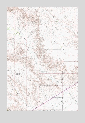
Fallon NE, MT USGS Topographic Map
Click on map above to begin viewing in our Map Viewer.

This topographic map contains these locations and features:
Feature Name Type Latitude Longitude GNIS ID View Map
13N53E04CABA01 WellWellN46.9125°W105.0194°819340View Map
13N53E07BDDD01 WellWellN46.8983°W105.0597°819257View Map
13N53E09DAD_01 WellWellN46.8953°W105.0091°819225View Map
13N53E09DDCD01 WellWellN46.8914°W105.0097°819177View Map
13N53E10CBB_01 WellWellN46.8917°W105.0064°819184View Map
13N53E10CCC_01 WellWellN46.8936°W105.0011°819205View Map
13N53E15BAA_01 WellWellN46.8900°W105.0039°819159View Map
13N53E15BBA_01 WellWellN46.8864°W105.0039°819110View Map
13N53E15BCA_01 WellWellN46.8845°W105.0011°819091View Map
13N53E15BDC_01 WellWellN46.8828°W105.0011°819075View Map
13N53E15CAB_02 WellWellN46.8828°W105.0011°819076View Map
13N53E15CAB_03 WellWellN46.8828°W105.0011°819077View Map
13N53E15CCB_01 WellWellN46.8792°W105.0064°819033View Map
13N53E16BAA_01 WellWellN46.8900°W105.0197°819160View Map
13N53E16BDB_01 WellWellN46.8864°W105.0225°819111View Map
13N53E16CDBC01 WellWellN46.8783°W105.0219°819022View Map
13N53E16DDB_01 WellWellN46.8792°W105.0116°819034View Map
13N53E17AAA_01 WellWellN46.8900°W105.0305°819161View Map
13N53E17ADB_01 WellWellN46.8864°W105.0330°819112View Map
13N53E17CCD_01 WellWellN46.8772°W105.0464°819018View Map
13N53E17DCBC01 WellWellN46.8786°W105.0369°819023View Map
13N53E18ABAA01 WellWellN46.8906°W105.0553°819163View Map
14N52E24CBCA01 WellWellN46.9533°W105.0894°819632View Map
14N52E34DBCD01 WellWellN46.9236°W105.1211°819407View Map
14N52E34DBCD02 WellWellN46.9236°W105.1211°819408View Map
14N53E04CACC01 WellWellN46.9967°W105.0211°820025View Map
14N53E04CBDD01 WellWellN46.9964°W105.0225°820024View Map
14N53E20DDA_01 WellWellN46.9522°W105.0286°819608View Map
Amo School (historical)SchoolN46.9492°W105.0269°1715493View Map
Denbys PeakSummitN46.8831°W105.0728°2035480View Map
Glendive West Rest AreaLocaleN46.8983°W105.0194°1715630View Map
Hatchet Creek School (historical)SchoolN46.8767°W105.0903°1715701View Map
Interchange 192CrossingN46.9008°W105.0200°1715625View Map
Morris Post Office (historical)Post OfficeN46.9347°W105.0233°1715357View Map
Yellowstone River Historical MarkerParkN46.8983°W105.0194°1715629View Map

Note: Coordinates in the location and feature list above are referenced to NAD83 datum.


Copyright (C) 2008-2025 Ryan Niemi / Sunset Dynamics ... All Rights Reserved