TopoQuest Logo
Do you find TopoQuest useful?
Help keep TopoQuest running and adding new maps/features by donating!
Bitcoin:  19c7KJd3qBynnjoSw5npx9KScwjBe4ifkT
Litecoin:  LXs6TkuXGGXo1vDsWCkWVdjQX94eUKd6ui
Home View Maps Find Maps Find Places Resources & Links


Farragut, Iowa Topographic Map

USGS Map Title: Farragut, IA
USGS Map MRC: 40095F4
DRG (GeoTIFF) Download: o40095f4.tif


Neighboring USGS Topographic Map Quads:


  Randolph, IA  
40095G5
 

  Shenandoah West, IA  
40095G4
 

  Shenandoah East, IA  
40095G3
 

  Riverton, IA  
40095F5
 

  Farragut, IA  
40095F4
 

  Bingham, IA  
40095F3
 

  McElroy Creek, MO  
40095E5
 

  Farmers City, MO  
40095E4
 

  Westboro, MO  
40095E3


Map MRC Location:

N41°
W96°
N41°
W95°
H8 H7 H6 H5 H4 H3 H2 H1
G8 G7 G6 G5 G4 G3 G2 G1
F8 F7 F6 F5 F4 F3 F2 F1
E8 E7 E6 E5 E4 E3 E2 E1
D8 D7 D6 D5 D4 D3 D2 D1
C8 C7 C6 C5 C4 C3 C2 C1
B8 B7 B6 B5 B4 B3 B2 B1
A8 A7 A6 A5 A4 A3 A2 A1
N40°
W96°
N40°
W95°

Farragut, IA USGS 1:24K Topographic Map Preview:
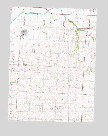
Farragut, IA USGS Topographic Map
Click on map above to begin viewing in our Map Viewer.

This topographic map contains these locations and features:
Feature Name Type Latitude Longitude GNIS ID View Map
American Legion Country ClubLocaleN40.7486°W95.3758°1968541View Map
City of FarragutCivilN40.7200°W95.4807°2394751View Map
Congregational United ChurchChurchN40.7231°W95.4792°1949923View Map
Crestland Co-op ElevatorLocaleN40.7208°W95.4805°1949921View Map
FarragutPopulated PlaceN40.7219°W95.4808°456556View Map
FarragutLocaleN40.7203°W95.4819°1949918View Map
Farragut CemeteryCemeteryN40.7353°W95.4783°456557View Map
Farragut City HallBuildingN40.7189°W95.4808°1949920View Map
Farragut Elementary SchoolSchoolN40.7233°W95.4814°2719960View Map
Farragut Fire and RescueBuildingN40.7189°W95.4815°2577435View Map
Farragut Post OfficePost OfficeN40.7200°W95.4805°1949919View Map
MantiLocaleN40.7283°W95.4092°466335View Map
Manti CemeteryCemeteryN40.7232°W95.3993°458767View Map
Manti Cemetery - Off the Mormon Trail Historical MarkerParkN40.7231°W95.3992°1949962View Map
Manti Memorial ParkParkN40.7264°W95.4008°1949819View Map
Manti Post Office (historical)Post OfficeN40.7283°W95.4030°1949834View Map
Nishnabotna High SchoolSchoolN40.7228°W95.4816°1949924View Map
Summit ChurchChurchN40.6694°W95.3933°462080View Map
Township of FisherCivilN40.7060°W95.4285°467834View Map
United Methodist ChurchChurchN40.7192°W95.4819°1949922View Map

Note: Coordinates in the location and feature list above are referenced to NAD83 datum.


Copyright (C) 2008-2025 Ryan Niemi / Sunset Dynamics ... All Rights Reserved