TopoQuest Logo
Do you find TopoQuest useful?
Help keep TopoQuest running and adding new maps/features by donating!
Bitcoin:  19c7KJd3qBynnjoSw5npx9KScwjBe4ifkT
Litecoin:  LXs6TkuXGGXo1vDsWCkWVdjQX94eUKd6ui
Home View Maps Find Maps Find Places Resources & Links


Randolph, Iowa Topographic Map

USGS Map Title: Randolph, IA
USGS Map MRC: 40095G5
DRG (GeoTIFF) Download: o40095g5.tif


Neighboring USGS Topographic Map Quads:


  Tabor, IA  
40095H6
 

  Tabor NE, IA  
40095H5
 

  Imogene, IA  
40095H4
 

  Tabor SW, IA  
40095G6
 

  Randolph, IA  
40095G5
 

  Shenandoah West, IA  
40095G4
 

  Sidney, IA  
40095F6
 

  Riverton, IA  
40095F5
 

  Farragut, IA  
40095F4


Map MRC Location:

N41°
W96°
N41°
W95°
H8 H7 H6 H5 H4 H3 H2 H1
G8 G7 G6 G5 G4 G3 G2 G1
F8 F7 F6 F5 F4 F3 F2 F1
E8 E7 E6 E5 E4 E3 E2 E1
D8 D7 D6 D5 D4 D3 D2 D1
C8 C7 C6 C5 C4 C3 C2 C1
B8 B7 B6 B5 B4 B3 B2 B1
A8 A7 A6 A5 A4 A3 A2 A1
N40°
W96°
N40°
W95°

Randolph, IA USGS 1:24K Topographic Map Preview:
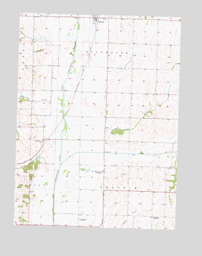
Randolph, IA USGS Topographic Map
Click on map above to begin viewing in our Map Viewer.

This topographic map contains these locations and features:
Feature Name Type Latitude Longitude GNIS ID View Map
AndersonPopulated PlaceN40.8014°W95.6042°454177View Map
Anderson (historical)LocaleN40.7972°W95.6031°1949850View Map
Anderson Census Designated PlaceCensusN40.7983°W95.6085°2583477View Map
Anderson Post Office (historical)Post OfficeN40.8014°W95.6042°1949849View Map
Camp CreekStreamN40.8222°W95.5897°455109View Map
Canyon CreekStreamN40.7831°W95.5917°455156View Map
Center SchoolLocaleN40.7572°W95.5183°455306View Map
Chamber CemeteryCemeteryN40.7862°W95.5088°455337View Map
City of RandolphCivilN40.8734°W95.5647°2396317View Map
Deer Creek Post Office (historical)Post OfficeN40.8658°W95.5547°466505View Map
Duff CemeteryCemeteryN40.8222°W95.6003°1949926View Map
Hilltop AirportAirportN40.7524°W95.6229°2717067View Map
Honey CreekStreamN40.8081°W95.5856°457606View Map
Lake Shawtee Wildlife Management AreaParkN40.8500°W95.5086°1949818View Map
Mayflower SchoolLocaleN40.7828°W95.5569°458869View Map
RandolphPopulated PlaceN40.8731°W95.5664°460522View Map
Randolph (historical)LocaleN40.8731°W95.5642°1949832View Map
Randolph Post OfficePost OfficeN40.8731°W95.5664°1949833View Map
Randolph Volunteer Fire and RescueBuildingN40.8722°W95.5657°2577420View Map
Riverside SchoolLocaleN40.7544°W95.5744°460678View Map
Township of PrairieCivilN40.7718°W95.5469°468570View Map
Township of RiversideCivilN40.8584°W95.5567°468621View Map
VaughanLocaleN40.7864°W95.5092°466333View Map
Wagner CemeteryCemeteryN40.8061°W95.5418°1949925View Map
Walnut CreekStreamN40.7867°W95.5900°465610View Map

Note: Coordinates in the location and feature list above are referenced to NAD83 datum.


Copyright (C) 2008-2024 Ryan Niemi / Sunset Dynamics ... All Rights Reserved