TopoQuest Logo
Do you find TopoQuest useful?
Help keep TopoQuest running and adding new maps/features by donating!
Bitcoin:  19c7KJd3qBynnjoSw5npx9KScwjBe4ifkT
Litecoin:  LXs6TkuXGGXo1vDsWCkWVdjQX94eUKd6ui
Home View Maps Find Maps Find Places Resources & Links


Farrar, Georgia Topographic Map

USGS Map Title: Farrar, GA
USGS Map MRC: 33083D6
DRG (GeoTIFF) Download: o33083d6.tif


Neighboring USGS Topographic Map Quads:


  Covington, GA  
33083E7
 

  Mansfield, GA  
33083E6
 

  Rutledge South, GA  
33083E5
 

  Stewart, GA  
33083D7
 

  Farrar, GA  
33083D6
 

  Shady Dale, GA  
33083D5
 

  Lloyd Shoals Dam, GA  
33083C7
 

  Monticello, GA  
33083C6
 

  Smithboro, GA  
33083C5


Map MRC Location:

N34°
W84°
N34°
W83°
H8 H7 H6 H5 H4 H3 H2 H1
G8 G7 G6 G5 G4 G3 G2 G1
F8 F7 F6 F5 F4 F3 F2 F1
E8 E7 E6 E5 E4 E3 E2 E1
D8 D7 D6 D5 D4 D3 D2 D1
C8 C7 C6 C5 C4 C3 C2 C1
B8 B7 B6 B5 B4 B3 B2 B1
A8 A7 A6 A5 A4 A3 A2 A1
N33°
W84°
N33°
W83°

Farrar, GA USGS 1:24K Topographic Map Preview:
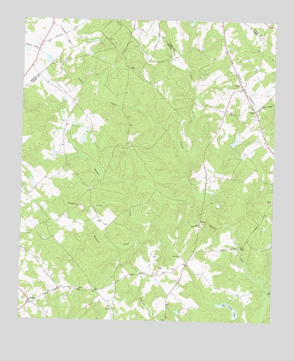
Farrar, GA USGS Topographic Map
Click on map above to begin viewing in our Map Viewer.

This topographic map contains these locations and features:
Feature Name Type Latitude Longitude GNIS ID View Map
Barr BridgeBridgeN33.4065°W83.6407°310821View Map
Boyle Lake Dam Number FiveDamN33.4435°W83.7332°336602View Map
Boyle Lake Dam Number OneDamN33.4668°W83.7282°336600View Map
Boyle Lake Dam Number ThreeDamN33.4551°W83.7249°336598View Map
Boyle Lake Dam Number TwoDamN33.4585°W83.7299°336604View Map
Boyle Lake NortheastReservoirN33.4539°W83.7171°340046View Map
Boyle Lake Northeast DamDamN33.4535°W83.7166°340045View Map
Boyle Lake Number FiveReservoirN33.4420°W83.7340°336603View Map
Boyle Lake Number FourReservoirN33.4504°W83.7189°336607View Map
Boyle Lake Number Four DamDamN33.4485°W83.7199°336606View Map
Boyle Lake Number OneReservoirN33.4668°W83.7290°336601View Map
Boyle Lake Number ThreeReservoirN33.4569°W83.7236°336599View Map
Boyle Lake Number TwoReservoirN33.4594°W83.7300°336605View Map
Boyle Murder LakeReservoirN33.4554°W83.7320°340050View Map
Boyle Murder Lake DamDamN33.4535°W83.7299°340049View Map
CalvinPopulated PlaceN33.3798°W83.7041°331310View Map
Eudora DivisionCivilN33.4108°W83.7331°1936253View Map
FarrarPopulated PlaceN33.4629°W83.6341°331702View Map
Hopewell Baptist ChurchChurchN33.3754°W83.6777°346141View Map
Hopewell CemeteryCemeteryN33.3757°W83.6774°349364View Map
Jasper County Emergency Services Station 7 FarrarBuildingN33.4667°W83.6368°2604095View Map
Lake CelesteReservoirN33.4998°W83.6662°340048View Map
Lake Celeste DamDamN33.4985°W83.6666°340047View Map
Liberty ChurchChurchN33.3879°W83.7202°316812View Map
Loyd CemeteryCemeteryN33.4771°W83.7141°346156View Map
MaxwellPopulated PlaceN33.4168°W83.6610°332336View Map
Murder Creek CemeteryCemeteryN33.4397°W83.7271°349369View Map
Murder Creek Church (historical)ChurchN33.4393°W83.7277°346168View Map
Murder Creek LakeReservoirN33.4489°W83.7247°336597View Map
Murder Creek Lake DamDamN33.4451°W83.7216°336596View Map
Palalto Airport (historical)AirportN33.3760°W83.7463°351854View Map
PalatoPopulated PlaceN33.3829°W83.7443°326447View Map
Pittman BranchStreamN33.4371°W83.6666°320759View Map
Pittman CreekStreamN33.4154°W83.6482°320764View Map
Pitts ChapelChurchN33.4801°W83.6971°320773View Map
Quailwood LakeReservoirN33.4503°W83.6440°336583View Map
Quailwood Lake DamDamN33.4485°W83.6466°336582View Map
Rex Haven Lake Number OneReservoirN33.3823°W83.6494°336593View Map
Rex Haven Lake Number One DamDamN33.3835°W83.6466°336592View Map
Rex Haven Lake Number TwoReservoirN33.3794°W83.6433°336585View Map
Rex Haven Lake Number Two DamDamN33.3768°W83.6432°336584View Map
Rex Haven LakesReservoirN33.3794°W83.6433°321533View Map
Robinson CreekStreamN33.4157°W83.6857°321694View Map
Rock Hill School (historical)SchoolN33.4598°W83.7268°346180View Map
Shady Grove ChurchChurchN33.4021°W83.6702°322760View Map
Sheppard CreekStreamN33.4243°W83.6963°322838View Map
Sheppard LakeReservoirN33.4320°W83.7443°336595View Map
Sheppard Lake DamDamN33.4318°W83.7432°336594View Map
Shiloh CemeteryCemeteryN33.4743°W83.6429°349372View Map
Shiloh ChurchChurchN33.4618°W83.6455°322884View Map
Shiloh ChurchChurchN33.4737°W83.6427°322885View Map

Note: Coordinates in the location and feature list above are referenced to NAD83 datum.


Copyright (C) 2008-2025 Ryan Niemi / Sunset Dynamics ... All Rights Reserved