TopoQuest Logo
Do you find TopoQuest useful?
Help keep TopoQuest running and adding new maps/features by donating!
Bitcoin:  19c7KJd3qBynnjoSw5npx9KScwjBe4ifkT
Litecoin:  LXs6TkuXGGXo1vDsWCkWVdjQX94eUKd6ui
Home View Maps Find Maps Find Places Resources & Links


Fayette, Ohio Topographic Map

USGS Map Title: Fayette, OH
USGS Map MRC: 41084F3
DRG (GeoTIFF) Download: o41084f3.tif


Neighboring USGS Topographic Map Quads:


  Pittsford, MI  
41084G4
 

  Hudson, MI  
41084G3
 

  Clayton, MI  
41084G2
 

  Alvordton, OH  
41084F4
 

  Fayette, OH  
41084F3
 

  Morenci, MI  
41084F2
 

  West Unity, OH  
41084E4
 

  Archbold, OH  
41084E3
 

  Wauseon, OH  
41084E2


Map MRC Location:

N42°
W85°
N42°
W84°
H8 H7 H6 H5 H4 H3 H2 H1
G8 G7 G6 G5 G4 G3 G2 G1
F8 F7 F6 F5 F4 F3 F2 F1
E8 E7 E6 E5 E4 E3 E2 E1
D8 D7 D6 D5 D4 D3 D2 D1
C8 C7 C6 C5 C4 C3 C2 C1
B8 B7 B6 B5 B4 B3 B2 B1
A8 A7 A6 A5 A4 A3 A2 A1
N41°
W85°
N41°
W84°

Fayette, OH USGS 1:24K Topographic Map Preview:
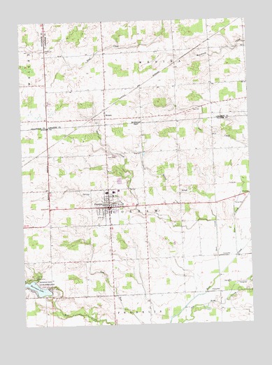
Fayette, OH USGS Topographic Map
Click on map above to begin viewing in our Map Viewer.

This topographic map contains these locations and features:
Feature Name Type Latitude Longitude GNIS ID View Map
Ackmer School (historical)SchoolN41.6803°W84.3697°1080967View Map
Blanchard DrainStreamN41.7328°W84.3474°621566View Map
Camp PalmerLocaleN41.6451°W84.3688°1038734View Map
County Line CemeteryCemeteryN41.7381°W84.3605°623883View Map
Deer CreekStreamN41.6445°W84.2683°624453View Map
FayettePopulated PlaceN41.6734°W84.3269°1064644View Map
Fayette Bible ChurchChurchN41.6709°W84.3308°1071876View Map
Fayette Christian ChurchChurchN41.6734°W84.3291°1063679View Map
Fayette Church of the NazareneChurchN41.6689°W84.3277°1063680View Map
Fayette Post OfficePost OfficeN41.6737°W84.3263°1987648View Map
Fayette United Methodist ChurchChurchN41.6739°W84.3241°1063681View Map
Fayette Village Police DepartmentBuildingN41.6732°W84.3284°2732538View Map
Gorham Fayette Fire and Rescue DepartmentBuildingN41.6733°W84.3264°2549607View Map
Gorham Fayette High SchoolSchoolN41.6781°W84.3252°1055291View Map
Goss CemeteryCemeteryN41.7133°W84.2794°2465711View Map
Harrison LakeReservoirN41.6405°W84.3692°1041365View Map
Harrison Lake DamDamN41.6396°W84.3607°1078354View Map
Harrison Lake State ReservationParkN41.6437°W84.3722°1056315View Map
Hoffman School (historical)SchoolN41.6512°W84.3074°1080964View Map
Iron CreekStreamN41.6520°W84.2583°629072View Map
Jehovah's WitnessesCemeteryN41.7155°W84.2704°2436168View Map
Lester School (historical)SchoolN41.6951°W84.3649°1080966View Map
Mundron FieldAirportN41.7043°W84.3701°2442567View Map
MunsonPopulated PlaceN41.7114°W84.3291°633128View Map
Munson Post Office (historical)Post OfficeN41.7114°W84.3292°2435671View Map
Munson StationLocaleN41.7133°W84.3292°2435558View Map
Munson United Brethren ChurchChurchN41.7122°W84.3289°2463796View Map
Ontario Post Office (historical)Post OfficeN41.7319°W84.2892°2435607View Map
Ontario StationLocaleN41.7319°W84.2894°2435555View Map
Our Lady of Mercy Catholic ChurchChurchN41.6742°W84.3227°1063682View Map
Parkview Mobile Home CourtPopulated PlaceN41.6767°W84.3217°2678152View Map
Pleasant View CemeteryCemeteryN41.6698°W84.3324°1960508View Map
Ritters (historical)Populated PlaceN41.7028°W84.2699°1080962View Map
Ritters Post Office (historical)Post OfficeN41.7028°W84.2694°1083292View Map
School Number 2 (historical)SchoolN41.6964°W84.2699°1080963View Map
School Number 7 (historical)SchoolN41.6745°W84.2872°1084100View Map
Snow CemeteryCemeteryN41.6956°W84.3085°1046404View Map
Snow School (historical)SchoolN41.6953°W84.3088°1080965View Map
Spring BrookStreamN41.6781°W84.2744°1046546View Map
Spring CreekStreamN41.6670°W84.2688°1046548View Map
Sugar Grove School (historical)SchoolN41.6470°W84.3416°1080968View Map
Township of GorhamCivilN41.6732°W84.3120°1086127View Map
Village of FayetteCivilN41.6729°W84.3283°2398867View Map
Woodworth CemeteryCemeteryN41.7133°W84.2783°2465712View Map

Note: Coordinates in the location and feature list above are referenced to NAD83 datum.


Copyright (C) 2008-2025 Ryan Niemi / Sunset Dynamics ... All Rights Reserved