TopoQuest Logo
Do you find TopoQuest useful?
Help keep TopoQuest running and adding new maps/features by donating!
Bitcoin:  19c7KJd3qBynnjoSw5npx9KScwjBe4ifkT
Litecoin:  LXs6TkuXGGXo1vDsWCkWVdjQX94eUKd6ui
Home View Maps Find Maps Find Places Resources & Links


Pittsford, Michigan Topographic Map

USGS Map Title: Pittsford, MI
USGS Map MRC: 41084G4
DRG (GeoTIFF) Download: o41084g4.tif


Neighboring USGS Topographic Map Quads:


  North Adams, MI  
41084H5
 

  Wheatland, MI  
41084H4
 

  Addison, MI  
41084H3
 

  Frontier, MI  
41084G5
 

  Pittsford, MI  
41084G4
 

  Hudson, MI  
41084G3
 

  Pioneer, OH  
41084F5
 

  Alvordton, OH  
41084F4
 

  Fayette, OH  
41084F3


Map MRC Location:

N42°
W85°
N42°
W84°
H8 H7 H6 H5 H4 H3 H2 H1
G8 G7 G6 G5 G4 G3 G2 G1
F8 F7 F6 F5 F4 F3 F2 F1
E8 E7 E6 E5 E4 E3 E2 E1
D8 D7 D6 D5 D4 D3 D2 D1
C8 C7 C6 C5 C4 C3 C2 C1
B8 B7 B6 B5 B4 B3 B2 B1
A8 A7 A6 A5 A4 A3 A2 A1
N41°
W85°
N41°
W84°

Pittsford, MI USGS 1:24K Topographic Map Preview:
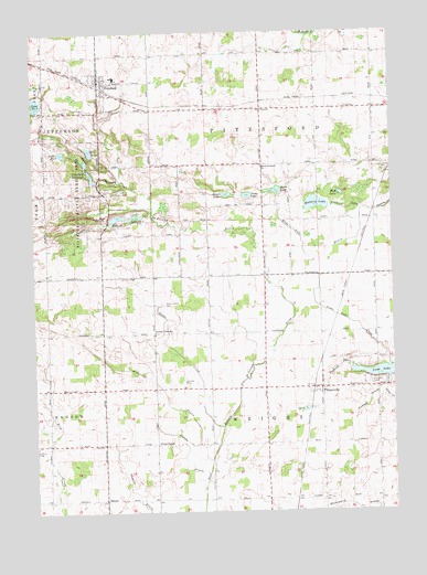
Pittsford, MI USGS Topographic Map
Click on map above to begin viewing in our Map Viewer.

This topographic map contains these locations and features:
Feature Name Type Latitude Longitude GNIS ID View Map
Anderson DrainStreamN41.7634°W84.4388°620095View Map
Bacon Farm GraveCemeteryN41.8405°W84.4594°2419747View Map
Bell LakeLakeN41.8442°W84.4801°621034View Map
BetzerPopulated PlaceN41.7531°W84.4758°1617442View Map
Betzer Community ChurchChurchN41.7533°W84.4764°2418440View Map
Betzer Post Office (historical)Post OfficeN41.7531°W84.4758°2418321View Map
Cambria Township HallBuildingN41.8194°W84.4983°2418361View Map
Devoe LakeLakeN41.8324°W84.4251°624613View Map
Dillon DrainStreamN41.7603°W84.4394°624680View Map
Goodrich CemeteryCemeteryN41.8552°W84.3906°630124View Map
Goose CreekStreamN41.7720°W84.4347°626958View Map
Greenwood CemeteryCemeteryN41.8542°W84.4811°2419726View Map
Lake Number EightLakeN41.8436°W84.4896°629987View Map
Lake Number FiveLakeN41.8567°W84.4988°633437View Map
Lake Number OneLakeN41.8270°W84.4640°629985View Map
Lake Number TwoLakeN41.8265°W84.4707°629986View Map
Leonardson CemeteryCemeteryN41.8548°W84.4802°630319View Map
Liberty Bible ChurchChurchN41.8622°W84.4750°2418428View Map
Lickleys Corners Post Office (historical)Post OfficeN41.7964°W84.4583°2418313View Map
Lickly CornersPopulated PlaceN41.7964°W84.4583°630370View Map
Lickly Corners CemeteryCemeteryN41.8042°W84.4547°630371View Map
Lime LakeReservoirN41.7838°W84.3771°630431View Map
Lime Lake InletStreamN41.7870°W84.3761°630432View Map
Mallory LakeLakeN41.8300°W84.4012°631359View Map
Mallory Post Office (historical)Post OfficeN41.8292°W84.4100°2418310View Map
Moon LakeLakeN41.8336°W84.4149°632620View Map
Moon Lake DrainStreamN41.8287°W84.3858°632631View Map
Mud LakeLakeN41.8328°W84.3924°632889View Map
PittsfordPopulated PlaceN41.8623°W84.4769°635063View Map
Pittsford - Jefferson Fire and Rescue Station 10BuildingN41.8621°W84.4767°2636153View Map
Pittsford Area SchoolSchoolN41.8633°W84.4711°2418431View Map
Pittsford First Congregational ChurchChurchN41.8636°W84.4767°2418427View Map
Pittsford MillpondReservoirN41.8387°W84.4801°635064View Map
Pittsford Post OfficePost OfficeN41.8622°W84.4769°2418432View Map
Pittsford Public LibraryBuildingN41.8581°W84.4708°2418430View Map
Pittsford State Game AreaParkN41.8309°W84.4827°635065View Map
Pittsford Station (historical)LocaleN41.8617°W84.4764°2418433View Map
Pittsford Wesleyan ChurchChurchN41.8589°W84.4694°2418429View Map
PrattvillePopulated PlaceN41.7823°W84.3997°635408View Map
Prattville CemeteryCemeteryN41.7831°W84.3824°635409View Map
Prattville Community ChurchChurchN41.7808°W84.3997°2418438View Map
Prattville DrainStreamN41.7873°W84.3894°635410View Map
Prattville Post OfficePost OfficeN41.7822°W84.3997°2418305View Map
Prattville SchoolSchoolN41.7678°W84.4572°635411View Map
Prattville Seventh Day Adventist ChurchChurchN41.8542°W84.4194°2418439View Map
Prattville Station (historical)LocaleN41.7819°W84.4028°2418306View Map
Reece LakeLakeN41.8327°W84.4321°635749View Map
South Pittsford ChurchChurchN41.8403°W84.4202°638398View Map
Timma DrainStreamN41.7806°W84.3783°1614872View Map
Township of PittsfordCivilN41.8550°W84.4190°1626910View Map
Township of WrightCivilN41.7583°W84.4187°1627292View Map

Note: Coordinates in the location and feature list above are referenced to NAD83 datum.


Copyright (C) 2008-2025 Ryan Niemi / Sunset Dynamics ... All Rights Reserved