TopoQuest Logo
Do you find TopoQuest useful?
Help keep TopoQuest running and adding new maps/features by donating!
Bitcoin:  19c7KJd3qBynnjoSw5npx9KScwjBe4ifkT
Litecoin:  LXs6TkuXGGXo1vDsWCkWVdjQX94eUKd6ui
Home View Maps Find Maps Find Places Resources & Links


Fenton, Iowa Topographic Map

USGS Map Title: Fenton, IA
USGS Map MRC: 43094B4
DRG (GeoTIFF) Download: o43094b4.tif


Neighboring USGS Topographic Map Quads:


  Ringsted, IA  
43094C5
 

  Seneca, IA  
43094C4
 

  Armstrong SE, IA  
43094C3
 

  Depew, IA  
43094B5
 

  Fenton, IA  
43094B4
 

  Lone Rock, IA  
43094B3
 

  Cylinder, IA  
43094A5
 

  Whittemore, IA  
43094A4
 

  Hobarton, IA  
43094A3


Map MRC Location:

N44°
W95°
N44°
W94°
H8 H7 H6 H5 H4 H3 H2 H1
G8 G7 G6 G5 G4 G3 G2 G1
F8 F7 F6 F5 F4 F3 F2 F1
E8 E7 E6 E5 E4 E3 E2 E1
D8 D7 D6 D5 D4 D3 D2 D1
C8 C7 C6 C5 C4 C3 C2 C1
B8 B7 B6 B5 B4 B3 B2 B1
A8 A7 A6 A5 A4 A3 A2 A1
N43°
W95°
N43°
W94°

Fenton, IA USGS 1:24K Topographic Map Preview:
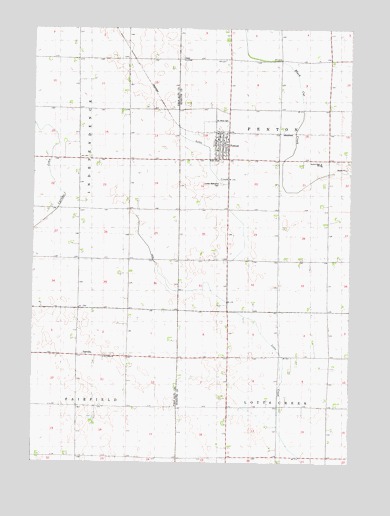
Fenton, IA USGS Topographic Map
Click on map above to begin viewing in our Map Viewer.

This topographic map contains these locations and features:
Feature Name Type Latitude Longitude GNIS ID View Map
City of FentonCivilN43.2182°W94.4280°2394756View Map
Ditch Number 1CanalN43.1744°W94.4403°1822730View Map
FairvillePopulated PlaceN43.1561°W94.4633°456526View Map
Fairville Post Office (historical)Post OfficeN43.1561°W94.4633°1925485View Map
FentonPopulated PlaceN43.2197°W94.4305°456571View Map
Fenton (historical)LocaleN43.2197°W94.4280°1925210View Map
Fenton City HallBuildingN43.2197°W94.4280°1925209View Map
Fenton Post OfficePost OfficeN43.2197°W94.4280°1925207View Map
Fenton Public LibraryBuildingN43.2197°W94.4280°1925204View Map
Fenton Volunteer Fire DepartmentBuildingN43.2199°W94.4262°2577288View Map
North Sentral Kossuth Middle SchoolSchoolN43.2110°W94.3870°1822732View Map
Saint John's Lutheran ChurchChurchN43.2197°W94.4280°1925205View Map
Saint Johns CemeteryCemeteryN43.2239°W94.4290°1822734View Map
Saint Lukes CemeteryCemeteryN43.1546°W94.4723°1925486View Map
Saint Lukes ChurchChurchN43.1552°W94.4719°1822731View Map
Sentral Area AmbulanceBuildingN43.2199°W94.4262°2599794View Map
Sentral Elementary SchoolSchoolN43.2111°W94.3871°2719832View Map
State Line Co-op ElevatorLocaleN43.2197°W94.4280°1925206View Map
Township of FentonCivilN43.2119°W94.3837°467830View Map
Township of Lotts CreekCivilN43.1259°W94.3836°468306View Map
United Methodist CemeteryCemeteryN43.2052°W94.4266°1822733View Map
United Methodist ChurchChurchN43.2197°W94.4280°1925208View Map

Note: Coordinates in the location and feature list above are referenced to NAD83 datum.


Copyright (C) 2008-2025 Ryan Niemi / Sunset Dynamics ... All Rights Reserved