TopoQuest Logo
Do you find TopoQuest useful?
Help keep TopoQuest running and adding new maps/features by donating!
Bitcoin:  19c7KJd3qBynnjoSw5npx9KScwjBe4ifkT
Litecoin:  LXs6TkuXGGXo1vDsWCkWVdjQX94eUKd6ui
Home View Maps Find Maps Find Places Resources & Links


Ringsted, Iowa Topographic Map

USGS Map Title: Ringsted, IA
USGS Map MRC: 43094C5
DRG (GeoTIFF) Download: o43094c5.tif


Neighboring USGS Topographic Map Quads:


  Gruver, IA  
43094D6
 

  Dolliver, IA  
43094D5
 

  Armstrong, IA  
43094D4
 

  Ingham Lake, IA  
43094C6
 

  Ringsted, IA  
43094C5
 

  Seneca, IA  
43094C4
 

  Graettinger East, IA  
43094B6
 

  Depew, IA  
43094B5
 

  Fenton, IA  
43094B4


Map MRC Location:

N44°
W95°
N44°
W94°
H8 H7 H6 H5 H4 H3 H2 H1
G8 G7 G6 G5 G4 G3 G2 G1
F8 F7 F6 F5 F4 F3 F2 F1
E8 E7 E6 E5 E4 E3 E2 E1
D8 D7 D6 D5 D4 D3 D2 D1
C8 C7 C6 C5 C4 C3 C2 C1
B8 B7 B6 B5 B4 B3 B2 B1
A8 A7 A6 A5 A4 A3 A2 A1
N43°
W95°
N43°
W94°

Ringsted, IA USGS 1:24K Topographic Map Preview:
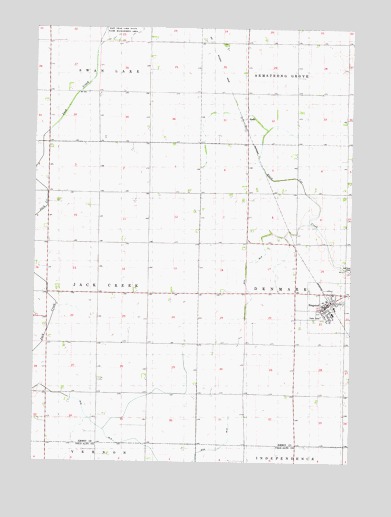
Ringsted, IA USGS Topographic Map
Click on map above to begin viewing in our Map Viewer.

This topographic map contains these locations and features:
Feature Name Type Latitude Longitude GNIS ID View Map
Armstrong - Ringsted Elementary SchoolSchoolN43.2928°W94.5073°1907478View Map
City of RingstedCivilN43.2949°W94.5067°2396378View Map
Co-op Grain and Product Company ElevatorLocaleN43.2947°W94.5116°1907477View Map
Ditch Number 21CanalN43.2597°W94.5983°1823085View Map
Ditch Number 37CanalN43.3080°W94.5378°1823031View Map
HalfaPopulated PlaceN43.3519°W94.5419°457204View Map
Halfa (historical)LocaleN43.3519°W94.5419°1907419View Map
Halfa Post Office (historical)Post OfficeN43.3519°W94.5419°1907420View Map
HoprigPopulated PlaceN43.2700°W94.6194°464041View Map
Hoprig Post Office (historical)Post OfficeN43.2700°W94.6194°1907415View Map
J and N FarmLocaleN43.2635°W94.5815°2729166View Map
Luke FarmLocaleN43.2742°W94.5812°2729164View Map
M and R FarmsLocaleN43.2559°W94.6186°2729165View Map
Presbyterian ChurchChurchN43.2947°W94.5116°1907476View Map
RingstedPopulated PlaceN43.2947°W94.5116°460640View Map
Ringsted (historical)LocaleN43.2963°W94.5083°1907474View Map
Ringsted City HallBuildingN43.2947°W94.5116°1907472View Map
Ringsted Fire DepartmentBuildingN43.2958°W94.5100°1907473View Map
Ringsted Post OfficePost OfficeN43.2949°W94.5099°1907471View Map
Ringsted Public LibraryBuildingN43.2947°W94.5116°1907469View Map
Saint Pauls Lutheran ChurchChurchN43.2941°W94.5114°1907475View Map
State Line Co-op ElevatorLocaleN43.3519°W94.5419°1907510View Map
State Line Cooperative ElevatorLocaleN43.2947°W94.5116°1907470View Map
Township of DenmarkCivilN43.2985°W94.5015°467703View Map
Township of Jack CreekCivilN43.2986°W94.6194°468089View Map

Note: Coordinates in the location and feature list above are referenced to NAD83 datum.


Copyright (C) 2008-2024 Ryan Niemi / Sunset Dynamics ... All Rights Reserved