TopoQuest Logo
Do you find TopoQuest useful?
Help keep TopoQuest running and adding new maps/features by donating!
Bitcoin:  19c7KJd3qBynnjoSw5npx9KScwjBe4ifkT
Litecoin:  LXs6TkuXGGXo1vDsWCkWVdjQX94eUKd6ui
Home View Maps Find Maps Find Places Resources & Links


Ferriday South, Louisiana Topographic Map

USGS Map Title: Ferriday South, LA
USGS Map MRC: 31091E5
DRG (GeoTIFF) Download: o31091e5.tif


Neighboring USGS Topographic Map Quads:


  Dunbarton, LA  
31091F6
 

  Ferriday North, LA  
31091F5
 

  Spokane, LA  
31091F4
 

  Frogmore, LA  
31091E6
 

  Ferriday South, LA  
31091E5
 

  Natchez, MS  
31091E4
 

  Monterey, LA  
31091D6
 

  Deer Park, LA  
31091D5
 

  Sibley, MS  
31091D4


Map MRC Location:

N32°
W92°
N32°
W91°
H8 H7 H6 H5 H4 H3 H2 H1
G8 G7 G6 G5 G4 G3 G2 G1
F8 F7 F6 F5 F4 F3 F2 F1
E8 E7 E6 E5 E4 E3 E2 E1
D8 D7 D6 D5 D4 D3 D2 D1
C8 C7 C6 C5 C4 C3 C2 C1
B8 B7 B6 B5 B4 B3 B2 B1
A8 A7 A6 A5 A4 A3 A2 A1
N31°
W92°
N31°
W91°

Ferriday South, LA USGS 1:24K Topographic Map Preview:
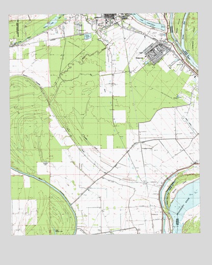
Ferriday South, LA USGS Topographic Map
Click on map above to begin viewing in our Map Viewer.

This topographic map contains these locations and features:
Feature Name Type Latitude Longitude GNIS ID View Map
Bayou Cocodrie National Wildlife RefugeParkN31.5531°W91.6208°2765191View Map
Bethel Missionary SchoolSchoolN31.5848°W91.5001°2462941View Map
Campfire SloughGutN31.5535°W91.5746°533670View Map
Concordia Education Center SchoolSchoolN31.6191°W91.5654°544634View Map
Concordia Fire District 2BuildingN31.5801°W91.5047°2672896View Map
Concordia Parish AirportAirportN31.5664°W91.5086°1632996View Map
Delta Ultralight AirportAirportN31.6035°W91.6140°1632703View Map
Dobbins LakeLakeN31.5416°W91.6021°554247View Map
Evangel TempleChurchN31.6029°W91.5368°541583View Map
Ferriday CemeteryCemeteryN31.6249°W91.5462°544629View Map
Ferriday Junior High SchoolSchoolN31.6200°W91.5603°544633View Map
Ferriday Upper Elementary SchoolSchoolN31.6216°W91.5606°544637View Map
Fort Bowie ParkParkN31.6185°W91.5618°556627View Map
Hoover SloughStreamN31.5754°W91.5985°535778View Map
Jeffries LandingLocaleN31.5091°W91.5187°548809View Map
KFNV-AM (Ferriday)TowerN31.5846°W91.5376°1632524View Map
KFNV-FM (Ferriday)TowerN31.6024°W91.5410°1632443View Map
Lambert CemeteryCemeteryN31.5296°W91.5276°536316View Map
Little Wallace LakeLakeN31.5008°W91.5959°555106View Map
Lucerna (historical)Populated PlaceN31.5285°W91.5354°544649View Map
Marengo Bend RevetmentLeveeN31.5952°W91.5040°548812View Map
Mercy Seat Baptist ChurchChurchN31.6246°W91.5565°556626View Map
MorvillePopulated PlaceN31.5082°W91.5251°544652View Map
Mount Beulah Baptist ChurchChurchN31.6249°W91.5498°557940View Map
Mount Olive Baptist ChurchChurchN31.6249°W91.5576°557941View Map
Mount Pleasant ChurchChurchN31.5391°W91.5062°537391View Map
Natchez IslandIslandN31.5274°W91.5118°674514View Map
New Morning Star Baptist ChurchChurchN31.6246°W91.5529°557942View Map
Old Saint Reed ChurchChurchN31.6091°W91.5226°541581View Map
Parish Governing Authority District 4CivilN31.5786°W91.5719°1930007View Map
Red BayouStreamN31.5877°W91.5896°555763View Map
RidgecrestPopulated PlaceN31.6029°W91.5279°541582View Map
Ridgecrest Baptist ChurchChurchN31.6043°W91.5293°557944View Map
Ridgecrest SchoolSchoolN31.6007°W91.5349°544663View Map
Ridgecrest Volunteer Fire DepartmentBuildingN31.6063°W91.5238°2672927View Map
Rosenwald School (historical)SchoolN31.5271°W91.5257°557085View Map
Rufus Baptist ChurchChurchN31.6229°W91.5562°557945View Map
Saint Catherine BendBendN31.6002°W91.5085°540700View Map
Saint GenevievePopulated PlaceN31.5266°W91.5257°538848View Map
Saint James CemeteryCemeteryN31.5116°W91.5321°538854View Map
Saint James ChurchChurchN31.6227°W91.5487°541584View Map
Saint James Church (historical)ChurchN31.5116°W91.5321°548823View Map
Saint Thomas ChurchChurchN31.6071°W91.5218°541580View Map
Saughy (historical)Populated PlaceN31.5196°W91.5273°544667View Map
Sawyer CemeteryCemeteryN31.5229°W91.5307°539202View Map
Sevier High SchoolSchoolN31.6213°W91.5593°539263View Map
Shady Acres ChurchChurchN31.6157°W91.5787°556628View Map
SycamorePopulated PlaceN31.6127°W91.5343°544681View Map
Sycamore Baptist ChurchChurchN31.5957°W91.5104°556625View Map
Sycamore LandingLocaleN31.6141°W91.5182°548835View Map
Town of RidgecrestCivilN31.6018°W91.5304°2407213View Map
Turner Acres CemeteryCemeteryN31.6218°W91.5737°541585View Map
Turtle LakeSwampN31.6197°W91.5997°556285View Map
Turtle Lake (historical)Populated PlaceN31.6079°W91.6201°544684View Map
Union Baptist ChurchChurchN31.5274°W91.5257°557087View Map
Ward FourCivilN31.5741°W91.5060°544993View Map
West Ferriday Census Designated PlaceCensusN31.6216°W91.5880°2403003View Map
WillettsPopulated PlaceN31.5085°W91.5273°543785View Map

Note: Coordinates in the location and feature list above are referenced to NAD83 datum.


Copyright (C) 2008-2024 Ryan Niemi / Sunset Dynamics ... All Rights Reserved