TopoQuest Logo
Do you find TopoQuest useful?
Help keep TopoQuest running and adding new maps/features by donating!
Bitcoin:  19c7KJd3qBynnjoSw5npx9KScwjBe4ifkT
Litecoin:  LXs6TkuXGGXo1vDsWCkWVdjQX94eUKd6ui
Home View Maps Find Maps Find Places Resources & Links


Ferriday North, Louisiana Topographic Map

USGS Map Title: Ferriday North, LA
USGS Map MRC: 31091F5
DRG (GeoTIFF) Download: o31091f5.tif


Neighboring USGS Topographic Map Quads:


  Sicily Island, LA  
31091G6
 

  Foules, LA  
31091G5
 

  Waterproof, LA  
31091G4
 

  Dunbarton, LA  
31091F6
 

  Ferriday North, LA  
31091F5
 

  Spokane, LA  
31091F4
 

  Frogmore, LA  
31091E6
 

  Ferriday South, LA  
31091E5
 

  Natchez, MS  
31091E4


Map MRC Location:

N32°
W92°
N32°
W91°
H8 H7 H6 H5 H4 H3 H2 H1
G8 G7 G6 G5 G4 G3 G2 G1
F8 F7 F6 F5 F4 F3 F2 F1
E8 E7 E6 E5 E4 E3 E2 E1
D8 D7 D6 D5 D4 D3 D2 D1
C8 C7 C6 C5 C4 C3 C2 C1
B8 B7 B6 B5 B4 B3 B2 B1
A8 A7 A6 A5 A4 A3 A2 A1
N31°
W92°
N31°
W91°

Ferriday North, LA USGS 1:24K Topographic Map Preview:
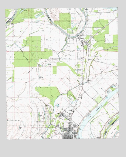
Ferriday North, LA USGS Topographic Map
Click on map above to begin viewing in our Map Viewer.

This topographic map contains these locations and features:
Feature Name Type Latitude Longitude GNIS ID View Map
Black BayouLakeN31.6681°W91.5628°533157View Map
Blue LakeLakeN31.7482°W91.6056°533239View Map
Calhoun CemeteryCemeteryN31.7449°W91.5196°533626View Map
Camp LakeLakeN31.6359°W91.6113°541572View Map
Carroll LakeGutN31.6829°W91.5337°533784View Map
Church of ChristChurchN31.6404°W91.5540°557934View Map
ClaytonPopulated PlaceN31.7227°W91.5432°558195View Map
Clayton JunctionLocaleN31.7071°W91.5354°544618View Map
Clayton Post OfficePost OfficeN31.7201°W91.5408°1632219View Map
Clayton Volunteer Fire DepartmentBuildingN31.7235°W91.5408°2673159View Map
Concordia Parish LibraryBuildingN31.6368°W91.5535°544621View Map
Dicen BayouLakeN31.6770°W91.5774°534523View Map
Evening Star Church (historical)ChurchN31.6454°W91.5396°548797View Map
FerridayPopulated PlaceN31.6302°W91.5546°534940View Map
Ferriday City HallBuildingN31.6318°W91.5529°544630View Map
Ferriday Country ClubLocaleN31.6635°W91.5529°544631View Map
Ferriday Fire DepartmentBuildingN31.6338°W91.5518°2672767View Map
Ferriday High SchoolSchoolN31.6378°W91.5539°544632View Map
Ferriday Lower Elementary SchoolSchoolN31.6393°W91.5482°544635View Map
Ferriday Plaza Shopping CenterLocaleN31.6452°W91.5557°544636View Map
Ferriday Police DepartmentBuildingN31.6414°W91.5552°2755322View Map
Ferriday Post OfficePost OfficeN31.6296°W91.5537°1632227View Map
First Assembly of God ChurchChurchN31.6313°W91.5596°557935View Map
First Baptist ChurchChurchN31.6327°W91.5551°557936View Map
First Church of GodChurchN31.6368°W91.5537°557938View Map
Flat LakeLakeN31.6964°W91.5788°554432View Map
Greater Saint Reed Baptist ChurchChurchN31.6263°W91.5596°557939View Map
Hill Memorial Baptist ChurchChurchN31.6571°W91.5810°554714View Map
Huntington SchoolSchoolN31.6503°W91.5651°544643View Map
Jenkins LakeLakeN31.6478°W91.5823°554868View Map
Kimball BayouGutN31.7127°W91.5607°554928View Map
Lake ConcordiaLakeN31.6667°W91.5098°554067View Map
Learned ParkParkN31.6377°W91.5523°544645View Map
Little Tensas RiverStreamN31.7463°W91.5379°555102View Map
Louisiana Technical College Shelby M Jackson CampusSchoolN31.6523°W91.5522°544674View Map
Lower Clear LakeLakeN31.6845°W91.5884°555184View Map
Middle GroundIslandN31.6341°W91.5060°673529View Map
Opossum BayouGutN31.7079°W91.6068°537888View Map
Ox LakeLakeN31.7443°W91.5861°555575View Map
Panola BrakeSwampN31.6606°W91.5737°537961View Map
Pasternack Shopping CenterLocaleN31.6299°W91.5515°544660View Map
Red GumPopulated PlaceN31.6802°W91.5343°558354View Map
Rising Sun ChurchChurchN31.6688°W91.5235°538616View Map
Rising Sun ChurchChurchN31.7016°W91.5398°541574View Map
Riverland Medical CenterHospitalN31.6470°W91.5549°544665View Map
Rogers CemeteryCemeteryN31.7357°W91.6165°541573View Map
Rosehill Baptist ChurchChurchN31.6354°W91.5651°557078View Map
Round LakeLakeN31.6466°W91.5890°555851View Map
Saint Patrick Catholic ChurchChurchN31.6324°W91.5579°557946View Map
Saint Peters ChurchChurchN31.7368°W91.6062°539061View Map
Sevier Memorial United Methodist ChurchChurchN31.6496°W91.5537°557948View Map
Shavins BayouGutN31.6896°W91.6035°539304View Map
Shavins LakeLakeN31.6760°W91.6187°539305View Map
Sixth Street Church of God in ChristChurchN31.6257°W91.5576°557949View Map
Town of ClaytonCivilN31.7226°W91.5373°2406275View Map
Town of FerridayCivilN31.6342°W91.5562°2406497View Map
Upper Clear LakeLakeN31.6959°W91.5860°556309View Map
Vidal IslandIslandN31.6529°W91.5057°540162View Map
Vidal Island Oil FieldOilfieldN31.6604°W91.5154°544687View Map
Ward OneCivilN31.6429°W91.5315°544990View Map
Ward TwoCivilN31.6360°W91.5601°544991View Map
Wayne Brown AirportAirportN31.7318°W91.5825°1632664View Map
West FerridayPopulated PlaceN31.6404°W91.5732°1867290View Map
Zion Hill Baptist ChurchChurchN31.6860°W91.5404°556498View Map

Note: Coordinates in the location and feature list above are referenced to NAD83 datum.


Copyright (C) 2008-2024 Ryan Niemi / Sunset Dynamics ... All Rights Reserved