TopoQuest Logo
Do you find TopoQuest useful?
Help keep TopoQuest running and adding new maps/features by donating!
Bitcoin:  19c7KJd3qBynnjoSw5npx9KScwjBe4ifkT
Litecoin:  LXs6TkuXGGXo1vDsWCkWVdjQX94eUKd6ui
Home View Maps Find Maps Find Places Resources & Links


Fey Lakes, Montana Topographic Map

USGS Map Title: Fey Lakes, MT
USGS Map MRC: 48111H4
DRG (GeoTIFF) Download: o48111h4.tif


Neighboring USGS Topographic Map Quads:


  West Butte, MT  
48111H5
 

  Fey Lakes, MT  
48111H4
 

  Whitlash, MT  
48111H3
 

  Fivemile Coulee East, MT  
48111G5
 

  Cameron Lake, MT  
48111G4
 

  Grassy Butte, MT  
48111G3


Map MRC Location:

N49°
W112°
N49°
W111°
H8 H7 H6 H5 H4 H3 H2 H1
G8 G7 G6 G5 G4 G3 G2 G1
F8 F7 F6 F5 F4 F3 F2 F1
E8 E7 E6 E5 E4 E3 E2 E1
D8 D7 D6 D5 D4 D3 D2 D1
C8 C7 C6 C5 C4 C3 C2 C1
B8 B7 B6 B5 B4 B3 B2 B1
A8 A7 A6 A5 A4 A3 A2 A1
N48°
W112°
N48°
W111°

Fey Lakes, MT USGS 1:24K Topographic Map Preview:
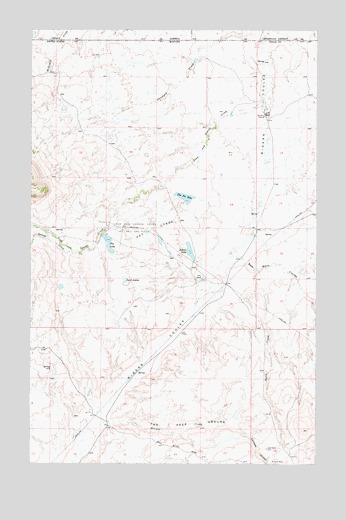
Fey Lakes, MT USGS Topographic Map
Click on map above to begin viewing in our Map Viewer.

This topographic map contains these locations and features:
Feature Name Type Latitude Longitude GNIS ID View Map
36N02E01BCBA01 WellWellN48.9095°W111.4241°1637011View Map
36N02E03ADAB01 WellWellN48.9095°W111.4489°1637012View Map
36N02E03DD01__ SpringSpringN48.9010°W111.4504°1636975View Map
36N02E09DBDA01 SpringSpringN48.8897°W111.4764°1636939View Map
37N02E11DBBD01 WellWellN48.9775°W111.4328°1637274View Map
37N02E23CDAC01 WellWellN48.9447°W111.4369°1637142View Map
37N02E25BBA01_ WellWellN48.9422°W111.4211°1637129View Map
37N02E25DDAB01 WellWellN48.9314°W111.4041°1637089View Map
37N02E26BDAC01 WellWellN48.9381°W111.4375°1637111View Map
37N02E26DCDD01 SpringSpringN48.9295°W111.4305°1637076View Map
37N02E26DDDB01 WellWellN48.9297°W111.4264°1637078View Map
37N02E35AABA01 WellWellN48.9281°W111.4278°1637072View Map
37N03E06CBD01_ WellWellN48.9906°W111.3986°1637329View Map
37N03E07BBBA01 WellWellN48.9861°W111.3989°1637305View Map
37N03E07CBAC01 WellWellN48.9783°W111.3983°1637277View Map
37N03E07CBAC02 WellWellN48.9770°W111.3983°1637263View Map
37N03E07CBCD01 WellWellN48.9753°W111.3989°1637253View Map
37N03E19CBCC01 WellWellN48.9470°W111.4011°1637146View Map
37N03E30BBAC01 WellWellN48.9411°W111.3980°1637126View Map
A and A Fey DamDamN48.9750°W111.4125°806349View Map
A Fey RanchLocaleN48.9758°W111.3989°768098View Map
Alkali DamDamN48.9333°W111.4291°795440View Map
Alkali LakeReservoirN48.9363°W111.4310°795441View Map
Barnes CouleeValleyN48.9528°W111.4480°1749980View Map
Big LakeReservoirN48.9384°W111.4667°795577View Map
Big Lake DamDamN48.9350°W111.4658°795576View Map
Dead Horse CouleeValleyN48.9667°W111.4286°1749982View Map
Eclipse CreekStreamN48.8820°W111.4772°771130View Map
Eclipse GulchValleyN48.8842°W111.4083°771131View Map
Fey LakesLakeN48.9411°W111.4466°771331View Map
Fred and George CreekStreamN48.9795°W111.3986°771617View Map
Fred and George Creek Oil and Gas FieldOilfieldN48.9431°W111.4569°771618View Map
Gold Butte CemeteryCemeteryN48.8794°W111.3970°771831View Map
Gold Butte MineMineN48.8750°W111.3758°805389View Map
Him DamDamN48.9800°W111.4675°798676View Map
J Fey RanchLocaleN48.9283°W111.4253°772751View Map
Jones LakeLakeN48.9871°W111.4672°1749984View Map
Moltz LakeLakeN48.9259°W111.4874°1749987View Map
North CreekStreamN48.9308°W111.4016°774692View Map
Prichard CreekStreamN48.9989°W111.3980°775461View Map
Ruby Johnson LakeLakeN48.9394°W111.4442°1749986View Map
Sam Ross CouleeValleyN48.9361°W111.4119°776150View Map
Spring CreekStreamN48.9356°W111.4808°777062View Map
Swan LakeLakeN48.9809°W111.4674°1749985View Map
Telephone CouleeValleyN48.9431°W111.4064°1749983View Map
The Deep GroundBasinN48.8872°W111.4308°777500View Map
The Pot HoleReservoirN48.9517°W111.4333°777532View Map
The Pot Hole DamDamN48.9517°W111.4325°798763View Map
Twin LakesLakeN48.9269°W111.4588°777858View Map

Note: Coordinates in the location and feature list above are referenced to NAD83 datum.


Copyright (C) 2008-2025 Ryan Niemi / Sunset Dynamics ... All Rights Reserved