TopoQuest Logo
Do you find TopoQuest useful?
Help keep TopoQuest running and adding new maps/features by donating!
Bitcoin:  19c7KJd3qBynnjoSw5npx9KScwjBe4ifkT
Litecoin:  LXs6TkuXGGXo1vDsWCkWVdjQX94eUKd6ui
Home View Maps Find Maps Find Places Resources & Links


Grassy Butte, Montana Topographic Map

USGS Map Title: Grassy Butte, MT
USGS Map MRC: 48111G3
DRG (GeoTIFF) Download: o48111g3.tif


Neighboring USGS Topographic Map Quads:


  Fey Lakes, MT  
48111H4
 

  Whitlash, MT  
48111H3
 

  Hawley Hill, MT  
48111H2
 

  Cameron Lake, MT  
48111G4
 

  Grassy Butte, MT  
48111G3
 

  Haystack Butte, MT  
48111G2
 

  Hawthorne School, MT  
48111F4
 

  Berkholder Reservoir, MT  
48111F3
 

  Blair Ranch, MT  
48111F2


Map MRC Location:

N49°
W112°
N49°
W111°
H8 H7 H6 H5 H4 H3 H2 H1
G8 G7 G6 G5 G4 G3 G2 G1
F8 F7 F6 F5 F4 F3 F2 F1
E8 E7 E6 E5 E4 E3 E2 E1
D8 D7 D6 D5 D4 D3 D2 D1
C8 C7 C6 C5 C4 C3 C2 C1
B8 B7 B6 B5 B4 B3 B2 B1
A8 A7 A6 A5 A4 A3 A2 A1
N48°
W112°
N48°
W111°

Grassy Butte, MT USGS 1:24K Topographic Map Preview:
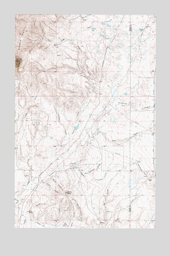
Grassy Butte, MT USGS Topographic Map
Click on map above to begin viewing in our Map Viewer.

This topographic map contains these locations and features:
Feature Name Type Latitude Longitude GNIS ID View Map
35N03E10ABBD01 WellWellN48.8111°W111.3269°1636666View Map
35N03E20AACC01 SpringSpringN48.7803°W111.3661°1636508View Map
35N03E21BDCD01 WellWellN48.7767°W111.3536°1636490View Map
36N03E14CCCB01 WellWellN48.8722°W111.3166°1636882View Map
36N03E14CCCC01 WellWellN48.8708°W111.3166°1636876View Map
36N03E27BCB01_ SpringSpringN48.8514°W111.3375°1636816View Map
Alkali SpringSpringN48.7597°W111.3630°768199View Map
Capacity DamDamN48.8450°W111.2825°798664View Map
Chicago LakeLakeN48.8660°W111.2642°769807View Map
Chicago Lake DamDamN48.8667°W111.2641°798526View Map
Furnell RanchLocaleN48.8575°W111.3369°771659View Map
Grassy ButteSummitN48.7714°W111.3286°771933View Map
Hartsook RanchLocaleN48.7789°W111.2567°772187View Map
Henry Dam Number 1DamN48.8283°W111.2775°795423View Map
Henry Dam Number 2DamN48.7933°W111.3225°795452View Map
Hofer 1 DamDamN48.8050°W111.2692°796703View Map
Hofer 2 DamDamN48.8017°W111.2775°796704View Map
Jack McDonald CouleeValleyN48.7819°W111.3139°772767View Map
Johnson CouleeValleyN48.7781°W111.3469°772861View Map
La Plante CouleeValleyN48.7986°W111.3314°773162View Map
Middle ButteSummitN48.8653°W111.3667°774139View Map
Morris Number 2 DamDamN48.8083°W111.3208°795419View Map
Morris ReservoirReservoirN48.8092°W111.3204°795420View Map
Oh Henrys Place DamDamN48.7567°W111.2942°798663View Map
Old Indian CemeteryCemeteryN48.8681°W111.2594°774930View Map
Sleeper CouleeValleyN48.7850°W111.3264°776635View Map
Snow CouleeValleyN48.8056°W111.3030°776706View Map
Spring CouleeValleyN48.7803°W111.3436°776964View Map
Strawberry CreekStreamN48.7769°W111.3589°777258View Map
Swanp Cooler DamDamN48.8550°W111.2758°798665View Map
T C Morris RanchLocaleN48.8719°W111.3155°777388View Map
Toole County Waterfowl Production AreaParkN48.8605°W111.2950°2765531View Map
Triple L and ER Fritz DamDamN48.8500°W111.2608°798545View Map
Wescott CouleeValleyN48.7511°W111.3147°778185View Map

Note: Coordinates in the location and feature list above are referenced to NAD83 datum.


Copyright (C) 2008-2025 Ryan Niemi / Sunset Dynamics ... All Rights Reserved