TopoQuest Logo
Do you find TopoQuest useful?
Help keep TopoQuest running and adding new maps/features by donating!
Bitcoin:  19c7KJd3qBynnjoSw5npx9KScwjBe4ifkT
Litecoin:  LXs6TkuXGGXo1vDsWCkWVdjQX94eUKd6ui
Home View Maps Find Maps Find Places Resources & Links


Fields Basin, Oregon Topographic Map

USGS Map Title: Fields Basin, OR
USGS Map MRC: 42118C7
DRG (GeoTIFF) Download: o42118c7.tif


Neighboring USGS Topographic Map Quads:


  Garrison Lake, OR  
42118D8
 

  Skull Creek Butte, OR  
42118D7
 

  V Lake, OR  
42118D6
 

  Square Mountain, OR  
42118C8
 

  Fields Basin, OR  
42118C7
 

  Fields, OR  
42118C6
 

  Robbers Roost, OR  
42118B8
 

  Rincon Flat, OR  
42118B7
 

  Ladycomb Peak, OR  
42118B6


Map MRC Location:

N43°
W119°
N43°
W118°
H8 H7 H6 H5 H4 H3 H2 H1
G8 G7 G6 G5 G4 G3 G2 G1
F8 F7 F6 F5 F4 F3 F2 F1
E8 E7 E6 E5 E4 E3 E2 E1
D8 D7 D6 D5 D4 D3 D2 D1
C8 C7 C6 C5 C4 C3 C2 C1
B8 B7 B6 B5 B4 B3 B2 B1
A8 A7 A6 A5 A4 A3 A2 A1
N42°
W119°
N42°
W118°

Fields Basin, OR USGS 1:24K Topographic Map Preview:
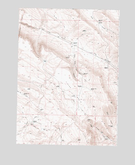
Fields Basin, OR USGS Topographic Map
Click on map above to begin viewing in our Map Viewer.

This topographic map contains these locations and features:
Feature Name Type Latitude Longitude GNIS ID View Map
Antelope LakeLakeN42.2820°W118.8458°1116983View Map
Antelope SpringsSpringN42.3006°W118.8631°1116999View Map
Babes Canyon SpringSpringN42.2681°W118.7553°1117118View Map
Big Basin ReservoirReservoirN42.3627°W118.7759°1117584View Map
Blair CanyonValleyN42.3235°W118.8038°1117797View Map
Blair Canyon ReservoirReservoirN42.3154°W118.7935°1117798View Map
Bradley LakeLakeN42.3263°W118.8415°1118031View Map
Cone ReservoirReservoirN42.2952°W118.8031°1119199View Map
East Square Mountain ReservoirReservoirN42.2957°W118.8671°1120354View Map
Eightmile ReservoirReservoirN42.3211°W118.7633°1120413View Map
Eleven Horse ReservoirReservoirN42.3647°W118.7763°1120434View Map
Fields BasinBasinN42.3002°W118.8038°1142083View Map
Fields Basin Seep ReservoirReservoirN42.3013°W118.7838°1120704View Map
Long Hollow ReservoirReservoirN42.3439°W118.8072°1123429View Map
Long Hollow SummitGapN42.3174°W118.7505°1123430View Map
Mahogany PointRidgeN42.2688°W118.8588°1123685View Map
Mahogany ReservoirReservoirN42.2706°W118.8544°1123686View Map
Mahogany RimCliffN42.2652°W118.8499°1123688View Map
McDade SpringsSpringN42.2550°W118.7989°1123934View Map
Middle ReservoirReservoirN42.3035°W118.8227°1124126View Map
Mud SpringSpringN42.2859°W118.7811°1124474View Map
Pearl Wise CanyonValleyN42.3360°W118.8063°1125262View Map
Pearl Wise SpringsSpringN42.3299°W118.8159°1125263View Map
Rincon LakeLakeN42.2639°W118.8430°1126034View Map
Rincon SpringsSpringN42.2541°W118.8194°1126035View Map
Rocky Gorge ReservoirReservoirN42.3041°W118.7952°1126238View Map
Rocky SpringSpringN42.2732°W118.7870°1126249View Map
Sidehill ReservoirReservoirN42.3551°W118.7917°1126946View Map
The Beef TrailTrailN42.3732°W118.8274°1127950View Map
Williams SpringSpringN42.2568°W118.7621°1160497View Map

Note: Coordinates in the location and feature list above are referenced to NAD83 datum.


Copyright (C) 2008-2024 Ryan Niemi / Sunset Dynamics ... All Rights Reserved