TopoQuest Logo
Do you find TopoQuest useful?
Help keep TopoQuest running and adding new maps/features by donating!
Bitcoin:  19c7KJd3qBynnjoSw5npx9KScwjBe4ifkT
Litecoin:  LXs6TkuXGGXo1vDsWCkWVdjQX94eUKd6ui
Home View Maps Find Maps Find Places Resources & Links


Fighting Butte, Montana Topographic Map

USGS Map Title: Fighting Butte, MT
USGS Map MRC: 45105C3
DRG (GeoTIFF) Download: o45105c3.tif


Neighboring USGS Topographic Map Quads:


  Broadus, MT  
45105D4
 

  Monday Creek, MT  
45105D3
 

  Little Pilgrim Butte, MT  
45105D2
 

  Eldon Mountain, MT  
45105C4
 

  Fighting Butte, MT  
45105C3
 

  Dry Creek Butte, MT  
45105C2
 

  Bear Skull Mountain, MT  
45105B4
 

  Pine Creek, MT  
45105B3
 

  Sanburn Reservoir, MT  
45105B2


Map MRC Location:

N46°
W106°
N46°
W105°
H8 H7 H6 H5 H4 H3 H2 H1
G8 G7 G6 G5 G4 G3 G2 G1
F8 F7 F6 F5 F4 F3 F2 F1
E8 E7 E6 E5 E4 E3 E2 E1
D8 D7 D6 D5 D4 D3 D2 D1
C8 C7 C6 C5 C4 C3 C2 C1
B8 B7 B6 B5 B4 B3 B2 B1
A8 A7 A6 A5 A4 A3 A2 A1
N45°
W106°
N45°
W105°

Fighting Butte, MT USGS 1:24K Topographic Map Preview:
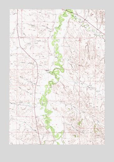
Fighting Butte, MT USGS Topographic Map
Click on map above to begin viewing in our Map Viewer.

This topographic map contains these locations and features:
Feature Name Type Latitude Longitude GNIS ID View Map
01S52E33ACCB01 WellWellN45.3742°W105.3130°809173View Map
04S52E23DCBB01 WellWellN45.3678°W105.2669°809126View Map
05S51E25BDDB01 WellWellN45.3708°W105.3719°809146View Map
05S52E31BBCA01 WellWellN45.3605°W105.3580°809086View Map
05S52E32ACD_01 WellWellN45.3536°W105.3189°809059View Map
05S52E35ADCA01 WellWellN45.3572°W105.2600°809070View Map
06S52E03ACAB01 WellWellN45.3453°W105.3392°809027View Map
06S52E10BADB01 WellWellN45.3314°W105.3361°808962View Map
06S52E13DCAD01 WellWellN45.3069°W105.2900°808838View Map
06S52E21DABA01 WellWellN45.2972°W105.3480°808793View Map
06S52E22ABDA01 WellWellN45.2994°W105.3303°808803View Map
06S52E22BC__01 WellWellN45.2967°W105.3397°808789View Map
06S52E22DDDD01 WellWellN45.2908°W105.3247°808750View Map
06S52E26AABA01 WellWellN45.2897°W105.3080°808744View Map
06S52E34CCD_01 WellWellN45.2605°W105.3378°808621View Map
06S53E17DBB_01 WellWellN45.3147°W105.2517°808884View Map
06S53E20CB__01 WellWellN45.2972°W105.2586°808794View Map
07S52E02CA__01 WellWellN45.2508°W105.3142°808585View Map
30N49E26DADA01 WellWellN45.3217°W105.3003°808924View Map
Antelope CreekStreamN45.3580°W105.3147°768285View Map
Antelope CreekStreamN45.3625°W105.3080°1690028View Map
Dogie CreekStreamN45.2653°W105.3208°770708View Map
Dry CreekStreamN45.3150°W105.3117°770778View Map
East Powder River DivisionCivilN45.2860°W105.3161°1940604View Map
Fighting ButteSummitN45.3183°W105.3275°771345View Map
Fighting Butte CreekStreamN45.3192°W105.3211°771346View Map
Flat CreekStreamN45.3628°W105.3153°1690013View Map
Hockey CreekStreamN45.3008°W105.3303°772437View Map
Little Rough CreekStreamN45.2678°W105.3114°773482View Map
Plum CreekStreamN45.2908°W105.3389°775304View Map
Rough CreekStreamN45.2917°W105.3228°775966View Map
Skunk CreekStreamN45.2867°W105.3022°1689971View Map
South Dogie CreekStreamN45.2583°W105.3305°1690022View Map
Spring CreekStreamN45.3469°W105.3178°776995View Map
Spring CreekStreamN45.2883°W105.3358°777015View Map
Tiret CreekStreamN45.3361°W105.3167°1689972View Map
Waite DitchCanalN45.3669°W105.2858°778075View Map

Note: Coordinates in the location and feature list above are referenced to NAD83 datum.


Copyright (C) 2008-2025 Ryan Niemi / Sunset Dynamics ... All Rights Reserved