TopoQuest Logo
Do you find TopoQuest useful?
Help keep TopoQuest running and adding new maps/features by donating!
Bitcoin:  19c7KJd3qBynnjoSw5npx9KScwjBe4ifkT
Litecoin:  LXs6TkuXGGXo1vDsWCkWVdjQX94eUKd6ui
Home View Maps Find Maps Find Places Resources & Links


Eldon Mountain, Montana Topographic Map

USGS Map Title: Eldon Mountain, MT
USGS Map MRC: 45105C4
DRG (GeoTIFF) Download: o45105c4.tif


Neighboring USGS Topographic Map Quads:


  Epsie NE, MT  
45105D5
 

  Broadus, MT  
45105D4
 

  Monday Creek, MT  
45105D3
 

  Lonesome Peak, MT  
45105C5
 

  Eldon Mountain, MT  
45105C4
 

  Fighting Butte, MT  
45105C3
 

  Baldy Peak, MT  
45105B5
 

  Bear Skull Mountain, MT  
45105B4
 

  Pine Creek, MT  
45105B3


Map MRC Location:

N46°
W106°
N46°
W105°
H8 H7 H6 H5 H4 H3 H2 H1
G8 G7 G6 G5 G4 G3 G2 G1
F8 F7 F6 F5 F4 F3 F2 F1
E8 E7 E6 E5 E4 E3 E2 E1
D8 D7 D6 D5 D4 D3 D2 D1
C8 C7 C6 C5 C4 C3 C2 C1
B8 B7 B6 B5 B4 B3 B2 B1
A8 A7 A6 A5 A4 A3 A2 A1
N45°
W106°
N45°
W105°

Eldon Mountain, MT USGS 1:24K Topographic Map Preview:
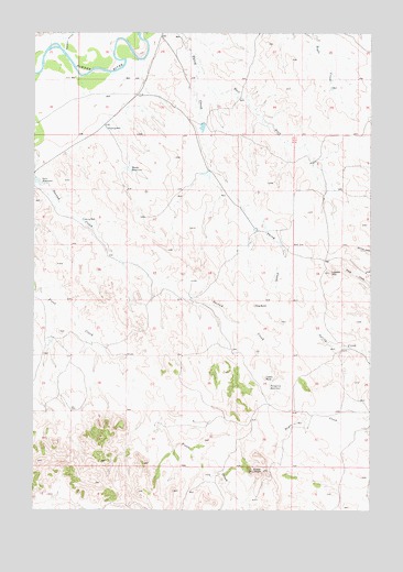
Eldon Mountain, MT USGS Topographic Map
Click on map above to begin viewing in our Map Viewer.

This topographic map contains these locations and features:
Feature Name Type Latitude Longitude GNIS ID View Map
05S50E25AADB01 WellWellN45.3747°W105.4855°809177View Map
05S51E27ABB_01 WellWellN45.3725°W105.4042°809155View Map
05S51E29AADC01 WellWellN45.3739°W105.4464°809170View Map
05S51E33ADAC01 WellWellN45.3578°W105.4242°809073View Map
05S51E35ACAC01 WellWellN45.3578°W105.3869°809072View Map
06S51E15BDCB01 WellWellN45.3133°W105.4600°808878View Map
06S51E20CDDD01 WellWellN45.2908°W105.4967°808751View Map
06S51E27CBCC01 WellWellN45.2800°W105.4567°808704View Map
06S52E07CB__01 WellWellN45.3233°W105.3975°808929View Map
06S52E17BDDC01 WellWellN45.3125°W105.3939°808868View Map
06S52E29CDBA01 WellWellN45.2789°W105.3792°808699View Map
Castle RockSummitN45.2850°W105.4139°769657View Map
Dog ButteSummitN45.3039°W105.4180°770694View Map
East Fork Third CreekStreamN45.3705°W105.4411°771078View Map
Eldon MountainSummitN45.2605°W105.4147°771166View Map
Forsgreen ReservoirReservoirN45.2824°W105.4131°771500View Map
Garr ReservoirReservoirN45.3354°W105.4977°771718View Map
Hondu ReservoirReservoirN45.3393°W105.4657°772504View Map
Lideen HillSummitN45.3128°W105.3908°773330View Map
Russell Number 1 DamDamN45.3517°W105.4389°796936View Map

Note: Coordinates in the location and feature list above are referenced to NAD83 datum.


Copyright (C) 2008-2025 Ryan Niemi / Sunset Dynamics ... All Rights Reserved