TopoQuest Logo
Do you find TopoQuest useful?
Help keep TopoQuest running and adding new maps/features by donating!
Bitcoin:  19c7KJd3qBynnjoSw5npx9KScwjBe4ifkT
Litecoin:  LXs6TkuXGGXo1vDsWCkWVdjQX94eUKd6ui
Home View Maps Find Maps Find Places Resources & Links


Findlay, Illinois Topographic Map

USGS Map Title: Findlay, IL
USGS Map MRC: 39088E7
DRG (GeoTIFF) Download: o39088e7.tif


Neighboring USGS Topographic Map Quads:


  Macon East, IL  
39088F8
 

  Dalton City, IL  
39088F7
 

  Lovington, IL  
39088F6
 

  Obed, IL  
39088E8
 

  Findlay, IL  
39088E7
 

  Kirksville, IL  
39088E6
 

  Tower Hill, IL  
39088D8
 

  Shelbyville, IL  
39088D7
 

  Middlesworth, IL  
39088D6


Map MRC Location:

N40°
W89°
N40°
W88°
H8 H7 H6 H5 H4 H3 H2 H1
G8 G7 G6 G5 G4 G3 G2 G1
F8 F7 F6 F5 F4 F3 F2 F1
E8 E7 E6 E5 E4 E3 E2 E1
D8 D7 D6 D5 D4 D3 D2 D1
C8 C7 C6 C5 C4 C3 C2 C1
B8 B7 B6 B5 B4 B3 B2 B1
A8 A7 A6 A5 A4 A3 A2 A1
N39°
W89°
N39°
W88°

Findlay, IL USGS 1:24K Topographic Map Preview:
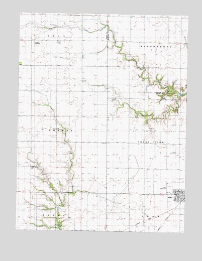
Findlay, IL USGS Topographic Map
Click on map above to begin viewing in our Map Viewer.

This topographic map contains these locations and features:
Feature Name Type Latitude Longitude GNIS ID View Map
Brunswick CemeteryCemeteryN39.5027°W88.8421°1725242View Map
Brunswick School (historical)SchoolN39.5006°W88.8409°405008View Map
Budward School (historical)SchoolN39.5220°W88.8087°405149View Map
Cropper School (historical)SchoolN39.5956°W88.7923°406823View Map
Enoch AirportAirportN39.5225°W88.7644°427280View Map
Eureka School (historical)SchoolN39.5078°W88.7798°408089View Map
FindlayPopulated PlaceN39.5225°W88.7537°408374View Map
Findlay Elementary SchoolSchoolN39.5234°W88.7537°1821164View Map
Findlay Fire Department and Ambulance ServiceBuildingN39.5198°W88.7543°2681816View Map
Findlay High SchoolSchoolN39.5223°W88.7603°1725260View Map
Findlay Post OfficePost OfficeN39.5199°W88.7528°2788342View Map
Foster CemeteryCemeteryN39.5595°W88.7778°1725262View Map
Foster School (historical)SchoolN39.5511°W88.7834°408570View Map
Howell Airport (historical)AirportN39.5454°W88.7565°427279View Map
Kroenlein AirportAirportN39.6096°W88.8478°427586View Map
Prairie HomeLocaleN39.6095°W88.8473°416146View Map
Prairie Home CemeteryCemeteryN39.6178°W88.8481°1725310View Map
Saint Marys ChurchChurchN39.5509°W88.8098°417593View Map
Todds PointPopulated PlaceN39.5770°W88.7659°419755View Map
Todds Point CemeteryCemeteryN39.5810°W88.7662°1721106View Map
Township of PennCivilN39.6238°W88.8652°429545View Map
Township of PickawayCivilN39.5582°W88.8640°429560View Map
Township of Todds PointCivilN39.5508°W88.7628°429834View Map
Union CemeteryCemeteryN39.5356°W88.8648°1725337View Map
Union School (historical)SchoolN39.5359°W88.8656°420106View Map
Village of FindlayCivilN39.5223°W88.7546°2398878View Map
WEJT-FM (Shelbyville)TowerN39.5942°W88.8456°428546View Map
Younger School (historical)SchoolN39.6245°W88.7926°421604View Map

Note: Coordinates in the location and feature list above are referenced to NAD83 datum.


Copyright (C) 2008-2025 Ryan Niemi / Sunset Dynamics ... All Rights Reserved