TopoQuest Logo
Do you find TopoQuest useful?
Help keep TopoQuest running and adding new maps/features by donating!
Bitcoin:  19c7KJd3qBynnjoSw5npx9KScwjBe4ifkT
Litecoin:  LXs6TkuXGGXo1vDsWCkWVdjQX94eUKd6ui
Home View Maps Find Maps Find Places Resources & Links


Tower Hill, Illinois Topographic Map

USGS Map Title: Tower Hill, IL
USGS Map MRC: 39088D8
DRG (GeoTIFF) Download: o39088d8.tif


Neighboring USGS Topographic Map Quads:


  Assumption, IL  
39089E1
 

  Obed, IL  
39088E8
 

  Findlay, IL  
39088E7
 

  Pana, IL  
39089D1
 

  Tower Hill, IL  
39088D8
 

  Shelbyville, IL  
39088D7
 

  Oconee, IL  
39089C1
 

  Lakewood, IL  
39088C8
 

  Fancher, IL  
39088C7


Map MRC Location:

N40°
W89°
N40°
W88°
H8 H7 H6 H5 H4 H3 H2 H1
G8 G7 G6 G5 G4 G3 G2 G1
F8 F7 F6 F5 F4 F3 F2 F1
E8 E7 E6 E5 E4 E3 E2 E1
D8 D7 D6 D5 D4 D3 D2 D1
C8 C7 C6 C5 C4 C3 C2 C1
B8 B7 B6 B5 B4 B3 B2 B1
A8 A7 A6 A5 A4 A3 A2 A1
N39°
W89°
N39°
W88°

Tower Hill, IL USGS 1:24K Topographic Map Preview:
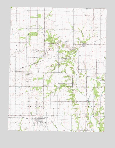
Tower Hill, IL USGS Topographic Map
Click on map above to begin viewing in our Map Viewer.

This topographic map contains these locations and features:
Feature Name Type Latitude Longitude GNIS ID View Map
Angel BranchStreamN39.4656°W88.9454°403523View Map
Armstrong CemeteryCemeteryN39.4614°W88.9376°1725234View Map
Center School (historical)SchoolN39.4781°W88.9790°405807View Map
Champion School (historical)SchoolN39.4489°W88.9767°405939View Map
Craig CemeteryCemeteryN39.4514°W88.8754°406719View Map
DollvillePopulated PlaceN39.4370°W88.9917°407293View Map
Empire School (historical)SchoolN39.4959°W88.9729°408019View Map
Frogpond School (historical)SchoolN39.3917°W88.9373°408776View Map
HentonPopulated PlaceN39.4637°W88.9045°410086View Map
Henton CemeteryCemeteryN39.4650°W88.9059°1821171View Map
Knobs Baptist CemeteryCemeteryN39.4323°W88.9740°1821175View Map
Knobs Baptist ChurchChurchN39.4320°W88.9734°411583View Map
Knobs School (historical)SchoolN39.4156°W88.9731°411584View Map
Methodist CemeteryCemeteryN39.4245°W88.9745°1725286View Map
Middlesworth CemeteryCemeteryN39.4156°W88.9573°1725287View Map
Mud CreekStreamN39.4078°W88.8959°414165View Map
Ragweed School (historical)SchoolN39.4773°W88.9426°416350View Map
Redbud School (historical)SchoolN39.4492°W88.9379°416470View Map
Ridge School (historical)SchoolN39.4992°W88.8917°416638View Map
Robinson Creek CemeteryCemeteryN39.3928°W88.8990°1821189View Map
Robinson Creek ChurchChurchN39.3931°W88.8990°1725315View Map
Robinson Creek School (historical)SchoolN39.3900°W88.8987°416774View Map
Robinson Creek Station (historical)LocaleN39.3925°W88.8904°1821190View Map
Rural TownhallBuildingN39.4778°W88.9790°1725320View Map
Saint Johns CemeteryCemeteryN39.4278°W88.8759°1821191View Map
Saint Johns ChurchChurchN39.4284°W88.8762°417399View Map
Saint Paul CemeteryCemeteryN39.4495°W88.9923°1967253View Map
Saint Paul CemeteryCemeteryN39.4328°W88.9751°1725322View Map
Saint Pauls United Church of ChristChurchN39.4498°W88.9926°1988596View Map
Sandy Hill School (historical)SchoolN39.4209°W88.8851°417998View Map
Smith School (historical)SchoolN39.4175°W88.9356°418643View Map
Stoune RLA Airport (historical)AirportN39.4734°W88.9598°427915View Map
Tower HillPopulated PlaceN39.3878°W88.9606°419794View Map
Tower Hill CemeteryCemeteryN39.3824°W88.9671°1821203View Map
Tower Hill Christian ChurchChurchN39.3884°W88.9587°1988594View Map
Tower Hill Elementary SchoolSchoolN39.3845°W88.9598°1821204View Map
Tower Hill Fire Protection DistrictBuildingN39.3877°W88.9607°2682592View Map
Tower Hill High SchoolSchoolN39.3842°W88.9592°1821205View Map
Tower Hill Post OfficePost OfficeN39.3874°W88.9605°2788777View Map
Tower Hill United Methodist ChurchChurchN39.3887°W88.9606°1988595View Map
Township of RuralCivilN39.4784°W88.9716°429683View Map
Township of Tower HillCivilN39.3908°W88.9718°429840View Map
Victory School (historical)SchoolN39.4450°W88.9020°420300View Map
Village of Tower HillCivilN39.3868°W88.9592°2399998View Map

Note: Coordinates in the location and feature list above are referenced to NAD83 datum.


Copyright (C) 2008-2025 Ryan Niemi / Sunset Dynamics ... All Rights Reserved