TopoQuest Logo
Do you find TopoQuest useful?
Help keep TopoQuest running and adding new maps/features by donating!
Bitcoin:  19c7KJd3qBynnjoSw5npx9KScwjBe4ifkT
Litecoin:  LXs6TkuXGGXo1vDsWCkWVdjQX94eUKd6ui
Home View Maps Find Maps Find Places Resources & Links


Lovington, Illinois Topographic Map

USGS Map Title: Lovington, IL
USGS Map MRC: 39088F6
DRG (GeoTIFF) Download: o39088f6.tif


Neighboring USGS Topographic Map Quads:


  Long Creek, IL  
39088G7
 

  La Place, IL  
39088G6
 

  Hammond, IL  
39088G5
 

  Dalton City, IL  
39088F7
 

  Lovington, IL  
39088F6
 

  Cadwell, IL  
39088F5
 

  Findlay, IL  
39088E7
 

  Kirksville, IL  
39088E6
 

  Sullivan, IL  
39088E5


Map MRC Location:

N40°
W89°
N40°
W88°
H8 H7 H6 H5 H4 H3 H2 H1
G8 G7 G6 G5 G4 G3 G2 G1
F8 F7 F6 F5 F4 F3 F2 F1
E8 E7 E6 E5 E4 E3 E2 E1
D8 D7 D6 D5 D4 D3 D2 D1
C8 C7 C6 C5 C4 C3 C2 C1
B8 B7 B6 B5 B4 B3 B2 B1
A8 A7 A6 A5 A4 A3 A2 A1
N39°
W89°
N39°
W88°

Lovington, IL USGS 1:24K Topographic Map Preview:
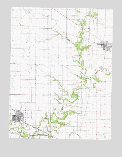
Lovington, IL USGS Topographic Map
Click on map above to begin viewing in our Map Viewer.

This topographic map contains these locations and features:
Feature Name Type Latitude Longitude GNIS ID View Map
American School (historical)SchoolN39.6514°W88.7184°403484View Map
BethanyPopulated PlaceN39.6456°W88.7381°404241View Map
Bethany CemeteryCemeteryN39.6435°W88.7357°1934574View Map
Bethany Elementary SchoolSchoolN39.6478°W88.7390°1822136View Map
Bethany Fire Protection District and Ambulance ServiceBuildingN39.6456°W88.7332°2681703View Map
Bethany High SchoolSchoolN39.6409°W88.7423°1721066View Map
Bethany Police DepartmentBuildingN39.6454°W88.7402°2758939View Map
Bethany Post OfficePost OfficeN39.6448°W88.7397°1721067View Map
Bland Landing Strip (historical)AirportN39.6306°W88.7459°1721068View Map
Bohler School (historical)SchoolN39.7106°W88.7287°404655View Map
Brush CreekStreamN39.6406°W88.7492°405030View Map
DunnPopulated PlaceN39.6261°W88.6917°422642View Map
East Stringtown School (historical)SchoolN39.7250°W88.6790°407704View Map
First Christian Church of BethanyChurchN39.6442°W88.7412°2043690View Map
Forest Hill School (historical)SchoolN39.6928°W88.6356°408507View Map
Forest View School (historical)SchoolN39.6778°W88.6756°408531View Map
Free Methodist ChurchChurchN39.6453°W88.7412°2043691View Map
Hewitt CemeteryCemeteryN39.7405°W88.6462°1721080View Map
Hewitt School (historical)SchoolN39.7406°W88.6465°410129View Map
Jonathan BranchStreamN39.6820°W88.6587°411197View Map
Keller CemeteryCemeteryN39.6945°W88.6378°1721086View Map
LovingtonPopulated PlaceN39.7156°W88.6326°412701View Map
Lovington Community Ambulance ServiceBuildingN39.7153°W88.6339°2673941View Map
Lovington Elementary SchoolSchoolN39.7111°W88.6267°1822148View Map
Lovington High School (historical)SchoolN39.7134°W88.6267°1721087View Map
Lovington Police DepartmentBuildingN39.7155°W88.6327°2759093View Map
Lovington Post OfficePost OfficeN39.7154°W88.6324°2724906View Map
Lovington Volunteer Fire Protection DistrictBuildingN39.7152°W88.6340°2681830View Map
Mayflower School (historical)SchoolN39.6992°W88.6817°413160View Map
Mitchell CemeteryCemeteryN39.6447°W88.7054°1721094View Map
Moultrie County Memorial Park CemeteryCemeteryN39.6288°W88.6977°1934578View Map
Mount Pleasant School (historical)SchoolN39.6598°W88.6606°414064View Map
New Castle School (historical)SchoolN39.6278°W88.6334°414388View Map
Okaw Valley OrchardLocaleN39.6600°W88.6772°2556428View Map
Pea CemeteryCemeteryN39.6633°W88.6670°421524View Map
Pulltight School (historical)SchoolN39.6634°W88.6903°416288View Map
Saint Isadora CemeteryCemeteryN39.6967°W88.7462°1934577View Map
Saint Isadore ChurchChurchN39.6973°W88.7440°417323View Map
Souther CemeteryCemeteryN39.6391°W88.6772°418854View Map
Stringtown BranchStreamN39.7131°W88.6678°419222View Map
Stringtown School (historical)SchoolN39.7325°W88.7198°419224View Map
Township of DoraCivilN39.7282°W88.7478°428902View Map
Township of LovingtonCivilN39.7294°W88.6438°429287View Map
UllrichPopulated PlaceN39.7409°W88.6815°423262View Map
Village of BethanyCivilN39.6445°W88.7409°2398109View Map
Village of LovingtonCivilN39.7144°W88.6318°2399193View Map
White School (historical)SchoolN39.6809°W88.7187°421073View Map

Note: Coordinates in the location and feature list above are referenced to NAD83 datum.


Copyright (C) 2008-2024 Ryan Niemi / Sunset Dynamics ... All Rights Reserved