TopoQuest Logo
Do you find TopoQuest useful?
Help keep TopoQuest running and adding new maps/features by donating!
Bitcoin:  19c7KJd3qBynnjoSw5npx9KScwjBe4ifkT
Litecoin:  LXs6TkuXGGXo1vDsWCkWVdjQX94eUKd6ui
Home View Maps Find Maps Find Places Resources & Links


Fingerville East, South Carolina Topographic Map

USGS Map Title: Fingerville East, SC
USGS Map MRC: 35081B8
DRG (GeoTIFF) Download: o35081b8.tif


Neighboring USGS Topographic Map Quads:


  Pea Ridge, NC  
35082C1
 

  Rutherfordton South, NC  
35081C8
 

  Forest City, NC  
35081C7
 

  Fingerville West, SC  
35082B1
 

  Fingerville East, SC  
35081B8
 

  Chesnee, SC  
35081B7
 

  Inman, SC  
35082A1
 

  Valley Falls, SC  
35081A8
 

  Cowpens, SC  
35081A7


Map MRC Location:

N36°
W82°
N36°
W81°
H8 H7 H6 H5 H4 H3 H2 H1
G8 G7 G6 G5 G4 G3 G2 G1
F8 F7 F6 F5 F4 F3 F2 F1
E8 E7 E6 E5 E4 E3 E2 E1
D8 D7 D6 D5 D4 D3 D2 D1
C8 C7 C6 C5 C4 C3 C2 C1
B8 B7 B6 B5 B4 B3 B2 B1
A8 A7 A6 A5 A4 A3 A2 A1
N35°
W82°
N35°
W81°

Fingerville East, SC USGS 1:24K Topographic Map Preview:
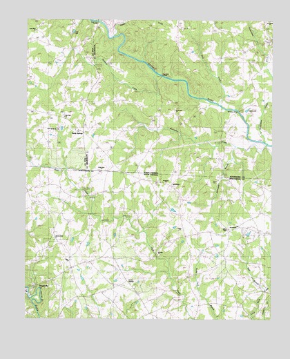
Fingerville East, SC USGS Topographic Map
Click on map above to begin viewing in our Map Viewer.

This topographic map contains these locations and features:
Feature Name Type Latitude Longitude GNIS ID View Map
Alverson Grove ChurchChurchN35.1587°W81.9851°1245670View Map
Arrow Wood School (historical)SchoolN35.1640°W81.8926°1248093View Map
Arrowood Baptist ChurchChurchN35.1640°W81.8920°1245675View Map
Arrowood Baptist GraveyardCemeteryN35.1648°W81.8917°1808603View Map
Arrowood BranchStreamN35.1976°W81.8934°1023797View Map
ArrowwoodPopulated PlaceN35.1673°W81.8845°1248094View Map
Big Island BridgeBridgeN35.2271°W81.9321°981411View Map
Broad River ChurchChurchN35.2123°W81.9243°1019309View Map
Broad River Church CemeteryCemeteryN35.2131°W81.9242°2779027View Map
Brookland School (historical)SchoolN35.1812°W81.9290°1248133View Map
Brookland School (historical)SchoolN35.1523°W81.9323°1248134View Map
BrooklynPopulated PlaceN35.1807°W81.9257°1248135View Map
Brooklyn ChurchChurchN35.1523°W81.9326°1245691View Map
Brooklyn ChurchChurchN35.1765°W81.9223°1245692View Map
Cedar Grove ChurchChurchN35.1873°W81.9618°982839View Map
Chesnee Community Fire Department Station 2BuildingN35.1620°W81.8967°2578233View Map
Chesnee DivisionCivilN35.1485°W81.9224°1938226View Map
Cooley Pond Dam D-2718DamN35.1735°W81.9282°1240507View Map
Cooley SpringsPopulated PlaceN35.1412°W81.9484°1221734View Map
Cooley Springs - Fingerville Fire DepartmentBuildingN35.1498°W81.9622°2578675View Map
Cooley Springs Baptist ChurchChurchN35.1379°W81.9443°1248213View Map
Cooley Springs School (historical)SchoolN35.1385°W81.9546°1248214View Map
Cooley Springs-Fingerville Elementary SchoolSchoolN35.1473°W81.9754°1248215View Map
Dills CreekStreamN35.2143°W81.9020°984194View Map
Eden ChurchChurchN35.1501°W81.9773°1222230View Map
Ezell BranchStreamN35.1371°W81.8787°1222325View Map
Gaffney ChapelChurchN35.1626°W81.8970°1245730View Map
Gethsemane CemeteryCemeteryN35.1440°W81.8765°1248286View Map
Glenwood School (historical)SchoolN35.1996°W81.9546°1008498View Map
Green River ChurchChurchN35.2460°W81.9948°986083View Map
Hayes LakeLakeN35.2126°W81.8877°986545View Map
Hensons CreekStreamN35.2268°W81.9332°1024031View Map
Jarretts CreekStreamN35.2435°W81.9565°987527View Map
L B Davidson Pond Dam D-3321DamN35.1435°W81.9715°1240508View Map
L Keeney Pond Dam D-2722DamN35.1618°W81.8865°1240509View Map
Little Buck CreekStreamN35.1690°W81.9657°1248372View Map
Lyles LakeLakeN35.2451°W81.9761°989141View Map
McKinney BridgeBridgeN35.2118°W81.8937°989597View Map
McKinney CreekStreamN35.1982°W81.8779°1024136View Map
New Bethel ChurchChurchN35.2498°W81.8765°1024185View Map
New Hope ChurchChurchN35.2087°W81.9801°991003View Map
Piney Grove School (historical)SchoolN35.1762°W81.9773°1248502View Map
Pores Ford BridgeBridgeN35.2496°W81.9640°992718View Map
Providence ChurchChurchN35.1818°W81.9290°1225699View Map
Richardson CreekStreamN35.1993°W81.8790°1024259View Map
Robbins CemeteryCemeteryN35.1823°W81.8957°1248537View Map
Sandy SpringsPopulated PlaceN35.2029°W81.9709°1024741View Map
Sandy Springs ChurchChurchN35.2040°W81.9840°994332View Map
Strickland School (historical)SchoolN35.2143°W81.9521°1008520View Map
Thorne CemeteryCemeteryN35.1823°W81.9062°1227112View Map
Township of Sulphur SpringsCivilN35.2401°W81.9120°1027166View Map
Trinity United Methodist CemeteryCemeteryN35.1626°W81.9205°1248636View Map
Trinity United Methodist ChurchChurchN35.1632°W81.9212°1251219View Map
UnknownBuildingN35.1604°W81.9171°2578876View Map
Vance Memorial Church (historical)ChurchN35.2285°W81.8832°1008523View Map

Note: Coordinates in the location and feature list above are referenced to NAD83 datum.


Copyright (C) 2008-2025 Ryan Niemi / Sunset Dynamics ... All Rights Reserved