TopoQuest Logo
Do you find TopoQuest useful?
Help keep TopoQuest running and adding new maps/features by donating!
Bitcoin:  19c7KJd3qBynnjoSw5npx9KScwjBe4ifkT
Litecoin:  LXs6TkuXGGXo1vDsWCkWVdjQX94eUKd6ui
Home View Maps Find Maps Find Places Resources & Links


Pea Ridge, North Carolina Topographic Map

USGS Map Title: Pea Ridge, NC
USGS Map MRC: 35082C1
DRG (GeoTIFF) Download: o35082c1.tif


Neighboring USGS Topographic Map Quads:


  Lake Lure, NC  
35082D2
 

  Shingle Hollow, NC  
35082D1
 

  Rutherfordton North, NC  
35081D8
 

  Mill Spring, NC  
35082C2
 

  Pea Ridge, NC  
35082C1
 

  Rutherfordton South, NC  
35081C8
 

  Landrum, SC  
35082B2
 

  Fingerville West, SC  
35082B1
 

  Fingerville East, SC  
35081B8


Map MRC Location:

N36°
W83°
N36°
W82°
H8 H7 H6 H5 H4 H3 H2 H1
G8 G7 G6 G5 G4 G3 G2 G1
F8 F7 F6 F5 F4 F3 F2 F1
E8 E7 E6 E5 E4 E3 E2 E1
D8 D7 D6 D5 D4 D3 D2 D1
C8 C7 C6 C5 C4 C3 C2 C1
B8 B7 B6 B5 B4 B3 B2 B1
A8 A7 A6 A5 A4 A3 A2 A1
N35°
W83°
N35°
W82°

Pea Ridge, NC USGS 1:24K Topographic Map Preview:
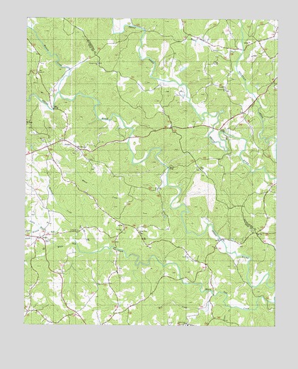
Pea Ridge, NC USGS Topographic Map
Click on map above to begin viewing in our Map Viewer.

This topographic map contains these locations and features:
Feature Name Type Latitude Longitude GNIS ID View Map
Bell LakeReservoirN35.3351°W82.0298°998822View Map
Bell Lake DamDamN35.3351°W82.0298°998823View Map
BeulahPopulated PlaceN35.2854°W82.1171°1003984View Map
Beulah ChurchChurchN35.2846°W82.1126°981264View Map
Byars ChurchChurchN35.3254°W82.1157°1003790View Map
Cox BridgeBridgeN35.2851°W82.0273°983665View Map
Cox StorePopulated PlaceN35.2751°W82.0351°1023573View Map
Fox Haven Plantation AirportAirportN35.3484°W82.0557°2679252View Map
Grays ChapelChurchN35.3146°W82.0393°1020531View Map
Green CreekStreamN35.2579°W82.0212°1024005View Map
Green Creek ChurchChurchN35.2507°W82.0451°986054View Map
Lebanon ChurchChurchN35.3529°W82.1190°988263View Map
Little White Oak CreekStreamN35.2837°W82.0996°988801View Map
Machine CreekStreamN35.2807°W82.0862°1024125View Map
Mack (historical)Populated PlaceN35.3665°W82.0098°1008502View Map
Maple CreekStreamN35.3610°W82.0184°1024130View Map
Mill CreekStreamN35.2623°W82.0301°1024150View Map
Miller Creek QuarryMineN35.3597°W82.0114°2649226View Map
Mills BridgeBridgeN35.3379°W82.1112°990021View Map
New Zion ChurchChurchN35.2887°W82.0762°1024739View Map
Pea RidgePopulated PlaceN35.3218°W82.0984°1021840View Map
Pea Ridge Lookout TowerTowerN35.3329°W82.1246°1024554View Map
Pleasant Grove ChurchChurchN35.3562°W82.0904°992472View Map
Pleasant Hill ChurchChurchN35.3451°W82.0265°1022010View Map
Salem ChurchChurchN35.3204°W82.0465°994165View Map
Shehan Crossroads (historical)Populated PlaceN35.3123°W82.0259°1008517View Map
South Branch Little White Oak CreekStreamN35.2893°W82.1165°995129View Map
Twitty BridgeBridgeN35.3290°W82.0262°996390View Map
Walker CemeteryCemeteryN35.3471°W82.0287°996695View Map
Walnut CreekStreamN35.3448°W82.1084°1024388View Map
Wheat CreekStreamN35.2990°W82.0526°997100View Map
Wheat Creek ChurchChurchN35.2890°W82.0679°997101View Map
Wilkins BridgeBridgeN35.3146°W82.0540°997338View Map
Zion ChurchChurchN35.3571°W82.0309°997765View Map
Zion Grove ChurchChurchN35.2782°W82.0426°1024421View Map

Note: Coordinates in the location and feature list above are referenced to NAD83 datum.


Copyright (C) 2008-2024 Ryan Niemi / Sunset Dynamics ... All Rights Reserved