TopoQuest Logo
Do you find TopoQuest useful?
Help keep TopoQuest running and adding new maps/features by donating!
Bitcoin:  19c7KJd3qBynnjoSw5npx9KScwjBe4ifkT
Litecoin:  LXs6TkuXGGXo1vDsWCkWVdjQX94eUKd6ui
Home View Maps Find Maps Find Places Resources & Links


Fingerville West, South Carolina Topographic Map

USGS Map Title: Fingerville West, SC
USGS Map MRC: 35082B1
DRG (GeoTIFF) Download: o35082b1.tif


Neighboring USGS Topographic Map Quads:


  Mill Spring, NC  
35082C2
 

  Pea Ridge, NC  
35082C1
 

  Rutherfordton South, NC  
35081C8
 

  Landrum, SC  
35082B2
 

  Fingerville West, SC  
35082B1
 

  Fingerville East, SC  
35081B8
 

  Campobello, SC  
35082A2
 

  Inman, SC  
35082A1
 

  Valley Falls, SC  
35081A8


Map MRC Location:

N36°
W83°
N36°
W82°
H8 H7 H6 H5 H4 H3 H2 H1
G8 G7 G6 G5 G4 G3 G2 G1
F8 F7 F6 F5 F4 F3 F2 F1
E8 E7 E6 E5 E4 E3 E2 E1
D8 D7 D6 D5 D4 D3 D2 D1
C8 C7 C6 C5 C4 C3 C2 C1
B8 B7 B6 B5 B4 B3 B2 B1
A8 A7 A6 A5 A4 A3 A2 A1
N35°
W83°
N35°
W82°

Fingerville West, SC USGS 1:24K Topographic Map Preview:
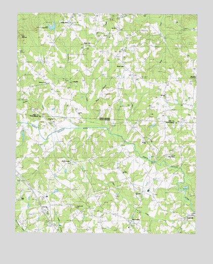
Fingerville West, SC USGS Topographic Map
Click on map above to begin viewing in our Map Viewer.

This topographic map contains these locations and features:
Feature Name Type Latitude Longitude GNIS ID View Map
Africa School (historical)SchoolN35.1729°W82.0151°1248076View Map
August HillSummitN35.1401°W82.0834°1245678View Map
Bear CreekStreamN35.1662°W82.0226°1023807View Map
Bryants Store (historical)Populated PlaceN35.1493°W82.0368°1248141View Map
Burns Mill (historical)LocaleN35.1673°W82.0251°1248146View Map
C Barre PondReservoirN35.1451°W82.1132°1240474View Map
C Barre Pond Dam D-3301DamN35.1451°W82.1132°1240473View Map
Camps BridgeBridgeN35.1657°W82.0279°1221286View Map
Carpenter BridgeBridgeN35.1843°W82.0615°1248173View Map
CollinsvillePopulated PlaceN35.2115°W82.0873°1019741View Map
Collinsville CreekStreamN35.1846°W82.0612°1245054View Map
D Honey Incorporated PondReservoirN35.1487°W82.0969°1240478View Map
D Honey Number One PondReservoirN35.1401°W82.1148°1240476View Map
D Honey Number One Pond Dam D-3302DamN35.1401°W82.1148°1240475View Map
D Honey Pond Dam Number Three D-3303DamN35.1484°W82.0965°1240477View Map
Fairview AirportAirportN35.1589°W82.1245°1251926View Map
Fairview ChurchChurchN35.1696°W82.0184°1245722View Map
Fairview Farms PondReservoirN35.1818°W82.1232°1238679View Map
FingervillePopulated PlaceN35.1340°W82.0065°1231283View Map
Fingerville Census Designated PlaceCensusN35.1351°W82.0004°2629826View Map
Fingerville DivisionCivilN35.1468°W82.0371°1938266View Map
Green CreekPopulated PlaceN35.2204°W82.0507°986052View Map
Green Creek Volunteer Fire Department Station 1BuildingN35.2261°W82.0565°2638173View Map
Green Creek Volunteer Fire Department Station 2BuildingN35.2107°W82.0048°2639294View Map
Greens Creek SchoolSchoolN35.2296°W82.0523°986109View Map
Hickory GrovePopulated PlaceN35.2101°W82.1040°1008287View Map
Hooper CreekStreamN35.1848°W82.0818°1024041View Map
Hughes CreekStreamN35.1896°W82.0757°987229View Map
Interchange 5CrossingN35.1376°W82.1054°1228172View Map
Jackson Grove CemeteryCemeteryN35.1887°W82.1007°1248344View Map
Jackson Grove United Methodist ChurchChurchN35.1882°W82.1009°1246144View Map
Jackson Memorial ChurchChurchN35.1384°W82.1023°1246139View Map
Kross KeysPopulated PlaceN35.2323°W82.0782°1004041View Map
Lake Sandy PlainsReservoirN35.2415°W82.1009°994297View Map
Little AfricaPopulated PlaceN35.1673°W82.0268°1231483View Map
Little MountainSummitN35.2376°W82.1240°988709View Map
Marys BranchStreamN35.1968°W82.0746°1004039View Map
McGinnis CrossroadsPopulated PlaceN35.2123°W82.0001°989582View Map
Melvin Hill ChurchChurchN35.2037°W82.0215°989720View Map
Mill Creek ChurchChurchN35.2421°W82.0559°989962View Map
New Bedford School (historical)SchoolN35.1473°W82.0421°1248438View Map
New Pilgrim School (historical)SchoolN35.1604°W82.0512°1248443View Map
New ProspectPopulated PlaceN35.1323°W82.0440°1225016View Map
New Prospect Baptist ChurchChurchN35.1310°W82.0451°1248445View Map
New Prospect Elementary SchoolSchoolN35.1285°W82.0459°1248447View Map
New Prospect Fire DepartmentBuildingN35.1691°W82.0886°2578874View Map
North PacoletPopulated PlaceN35.1657°W82.0848°1231601View Map
North Pacolet ChurchChurchN35.1651°W82.0837°1248450View Map
North Pacolet School (historical)SchoolN35.1651°W82.0829°1248451View Map
Obed (historical)Populated PlaceN35.1532°W82.0932°1248469View Map
Riverside ChurchChurchN35.1779°W82.0351°1225901View Map
Rutledge BridgeBridgeN35.1826°W82.0976°1248545View Map
Sandy PlainsPopulated PlaceN35.2440°W82.0896°994293View Map
Sandy Plains DamDamN35.2418°W82.0998°998651View Map
Smith ChapelChurchN35.1443°W82.1212°1248576View Map
Smiths Chapel School (historical)SchoolN35.1465°W82.1187°1248578View Map
South Carolina Noname 42020 D-1682 DamDamN35.1818°W82.1232°1238678View Map
Stateline ChurchChurchN35.1929°W82.0818°1004040View Map
Steppes PondReservoirN35.1835°W82.0298°1240514View Map
T Steppe Pond Dam D-3299DamN35.1835°W82.0298°1240513View Map
Township of Greens CreekCivilN35.2373°W82.0383°1027070View Map
Wakeforest School (historical)SchoolN35.1729°W82.0304°1248656View Map
Wheat Field AirportAirportN35.2069°W82.0335°2679274View Map

Note: Coordinates in the location and feature list above are referenced to NAD83 datum.


Copyright (C) 2008-2025 Ryan Niemi / Sunset Dynamics ... All Rights Reserved