TopoQuest Logo
Do you find TopoQuest useful?
Help keep TopoQuest running and adding new maps/features by donating!
Bitcoin:  19c7KJd3qBynnjoSw5npx9KScwjBe4ifkT
Litecoin:  LXs6TkuXGGXo1vDsWCkWVdjQX94eUKd6ui
Home View Maps Find Maps Find Places Resources & Links


Finley Butte, Oregon Topographic Map

USGS Map Title: Finley Butte, OR
USGS Map MRC: 43121F4
DRG (GeoTIFF) Download: o43121f4.tif


Neighboring USGS Topographic Map Quads:


  Pistol Butte, OR  
43121G5
 

  Anns Butte, OR  
43121G4
 

  Lava Cast Forest, OR  
43121G3
 

  La Pine, OR  
43121F5
 

  Finley Butte, OR  
43121F4
 

  Paulina Peak, OR  
43121F3
 

  Masten Butte, OR  
43121E5
 

  Moffitt Butte, OR  
43121E4
 

  Spring Butte, OR  
43121E3


Map MRC Location:

N44°
W122°
N44°
W121°
H8 H7 H6 H5 H4 H3 H2 H1
G8 G7 G6 G5 G4 G3 G2 G1
F8 F7 F6 F5 F4 F3 F2 F1
E8 E7 E6 E5 E4 E3 E2 E1
D8 D7 D6 D5 D4 D3 D2 D1
C8 C7 C6 C5 C4 C3 C2 C1
B8 B7 B6 B5 B4 B3 B2 B1
A8 A7 A6 A5 A4 A3 A2 A1
N43°
W122°
N43°
W121°

Finley Butte, OR USGS 1:24K Topographic Map Preview:
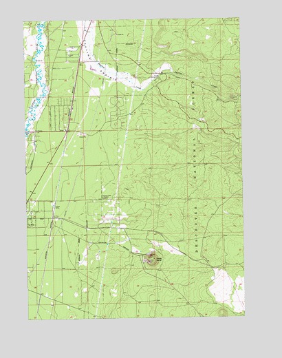
Finley Butte, OR USGS Topographic Map
Click on map above to begin viewing in our Map Viewer.

This topographic map contains these locations and features:
Feature Name Type Latitude Longitude GNIS ID View Map
Breese CemeteryCemeteryN43.7265°W121.4388°1153033View Map
Cascades East Transit La Pine Park and RideLocaleN43.7037°W121.4773°2699193View Map
City of La PineCivilN43.6865°W121.4856°2411579View Map
Finley ButteSummitN43.6501°W121.4295°1142101View Map
Improved Order of Redmen CemeteryCemeteryN43.6748°W121.4572°1144010View Map
La Pine Siding (historical)LocaleN43.6725°W121.4847°2725633View Map
La Pine Special Sewer DistrictLocaleN43.6789°W121.4848°2697138View Map
La Pine StationLocaleN43.6721°W121.4850°1144725View Map
McKay Crossing Recreation SiteLocaleN43.7170°W121.3778°1159318View Map
Ogden Group CampLocaleN43.7273°W121.4225°1167090View Map
Paulina PrairieFlatN43.7301°W121.4603°1147507View Map
Pengra Post Office (historical)Post OfficeN43.7248°W121.4847°1164589View Map
Prairie Recreation SiteLocaleN43.7251°W121.4242°1147974View Map
Six Mile Sno-ParkLocaleN43.7029°W121.3945°1167091View Map

Note: Coordinates in the location and feature list above are referenced to NAD83 datum.


Copyright (C) 2008-2025 Ryan Niemi / Sunset Dynamics ... All Rights Reserved