TopoQuest Logo
Do you find TopoQuest useful?
Help keep TopoQuest running and adding new maps/features by donating!
Bitcoin:  19c7KJd3qBynnjoSw5npx9KScwjBe4ifkT
Litecoin:  LXs6TkuXGGXo1vDsWCkWVdjQX94eUKd6ui
Home View Maps Find Maps Find Places Resources & Links


Fish Point, Michigan Topographic Map

USGS Map Title: Fish Point, MI
USGS Map MRC: 43083F5
DRG (GeoTIFF) Download: o43083f5.tif


Neighboring USGS Topographic Map Quads:


  Bay Port West, MI  
43083G4


  Fish Point, MI  
43083F5
 

  Sebewaing, MI  
43083F4
 

  Quanicassee, MI  
43083E6
 

  Fairgrove, MI  
43083E5
 

  Colling, MI  
43083E4


Map MRC Location:

N44°
W84°
N44°
W83°
H8 H7 H6 H5 H4 H3 H2 H1
G8 G7 G6 G5 G4 G3 G2 G1
F8 F7 F6 F5 F4 F3 F2 F1
E8 E7 E6 E5 E4 E3 E2 E1
D8 D7 D6 D5 D4 D3 D2 D1
C8 C7 C6 C5 C4 C3 C2 C1
B8 B7 B6 B5 B4 B3 B2 B1
A8 A7 A6 A5 A4 A3 A2 A1
N43°
W84°
N43°
W83°

Fish Point, MI USGS 1:24K Topographic Map Preview:
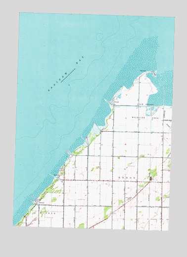
Fish Point, MI USGS Topographic Map
Click on map above to begin viewing in our Map Viewer.

This topographic map contains these locations and features:
Feature Name Type Latitude Longitude GNIS ID View Map
Ackerman DrainCanalN43.6492°W83.5164°619798View Map
Bay ParkPopulated PlaceN43.6547°W83.5891°620786View Map
Fish PointCapeN43.7170°W83.5227°626048View Map
Hickory Highland CemeteryCemeteryN43.6425°W83.5322°628192View Map
OakhurstPopulated PlaceN43.6397°W83.6061°633872View Map
Oakhurst Park Marina AssociationLocaleN43.6386°W83.6058°1618645View Map
Sunset Bay Marina IncorporatedLocaleN43.6686°W83.5777°1618641View Map
ThomasPopulated PlaceN43.7006°W83.5480°1614750View Map
Thomas MarinaLocaleN43.7009°W83.5391°1618640View Map
Township of AkronCivilN43.6377°W83.5240°1625807View Map
Wiscoggin DrainStreamN43.7111°W83.5069°1616655View Map

Note: Coordinates in the location and feature list above are referenced to NAD83 datum.


Copyright (C) 2008-2025 Ryan Niemi / Sunset Dynamics ... All Rights Reserved