TopoQuest Logo
Do you find TopoQuest useful?
Help keep TopoQuest running and adding new maps/features by donating!
Bitcoin:  19c7KJd3qBynnjoSw5npx9KScwjBe4ifkT
Litecoin:  LXs6TkuXGGXo1vDsWCkWVdjQX94eUKd6ui
Home View Maps Find Maps Find Places Resources & Links


Flat Creek, Missouri Topographic Map

USGS Map Title: Flat Creek, MO
USGS Map MRC: 39093F7
DRG (GeoTIFF) Download: o39093f7.tif


Neighboring USGS Topographic Map Quads:


  Nettleton, MO  
39093G8
 

  Breckenridge, MO  
39093G7
 

  Sampsel, MO  
39093G6
 

  Hamilton East, MO  
39093F8
 

  Flat Creek, MO  
39093F7
 

  Utica West, MO  
39093F6
 

  Cowgill, MO  
39093E8
 

  Braymer, MO  
39093E7
 

  Plymouth, MO  
39093E6


Map MRC Location:

N40°
W94°
N40°
W93°
H8 H7 H6 H5 H4 H3 H2 H1
G8 G7 G6 G5 G4 G3 G2 G1
F8 F7 F6 F5 F4 F3 F2 F1
E8 E7 E6 E5 E4 E3 E2 E1
D8 D7 D6 D5 D4 D3 D2 D1
C8 C7 C6 C5 C4 C3 C2 C1
B8 B7 B6 B5 B4 B3 B2 B1
A8 A7 A6 A5 A4 A3 A2 A1
N39°
W94°
N39°
W93°

Flat Creek, MO USGS 1:24K Topographic Map Preview:
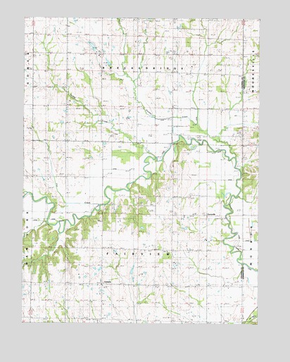
Flat Creek, MO USGS Topographic Map
Click on map above to begin viewing in our Map Viewer.

This topographic map contains these locations and features:
Feature Name Type Latitude Longitude GNIS ID View Map
Braymer LakeReservoirN39.6750°W93.7627°735958View Map
CatawbaPopulated PlaceN39.6408°W93.8335°738620View Map
Catawba SchoolSchoolN39.6403°W93.8413°715490View Map
Flat CreekStreamN39.6939°W93.8091°717985View Map
Grand View ChurchChurchN39.6981°W93.8369°718680View Map
Guffey CemeteryCemeteryN39.7024°W93.8269°2681364View Map
Kampen Lake Section 20 DamDamN39.7383°W93.8385°761144View Map
Layton SchoolSchoolN39.6556°W93.8138°720851View Map
Locust Grove School (historical)SchoolN39.6256°W93.7977°721390View Map
Niehaus Brothers Lake DamDamN39.7300°W93.8302°761138View Map
Number 167 ReservoirReservoirN39.7300°W93.8302°761139View Map
Otter CreekStreamN39.6772°W93.8738°723878View Map
Owens LakeReservoirN39.7383°W93.8388°761145View Map
Panther CreekStreamN39.6925°W93.7635°723992View Map
ProctorvillePopulated PlaceN39.6692°W93.7777°738619View Map
Proctorville SchoolSchoolN39.6686°W93.7797°724947View Map
Sieck LakeReservoirN39.6642°W93.8117°762705View Map
Sieck Lake DamDamN39.6650°W93.8135°762704View Map
Township of BreckenridgeCivilN39.7423°W93.8148°766358View Map
Township of FairviewCivilN39.6554°W93.8143°766360View Map
Turkey CreekStreamN39.6922°W93.8063°727851View Map
Turkey Creek SchoolSchoolN39.7208°W93.8344°727868View Map
Unity Chapel (historical)ChurchN39.6731°W93.8313°728056View Map
Victory School (historical)SchoolN39.6411°W93.7788°730238View Map
Wolf Grove School (historical)SchoolN39.7267°W93.7885°729058View Map
Wright SchoolSchoolN39.6839°W93.8480°729166View Map

Note: Coordinates in the location and feature list above are referenced to NAD83 datum.


Copyright (C) 2008-2024 Ryan Niemi / Sunset Dynamics ... All Rights Reserved