TopoQuest Logo
Do you find TopoQuest useful?
Help keep TopoQuest running and adding new maps/features by donating!
Bitcoin:  19c7KJd3qBynnjoSw5npx9KScwjBe4ifkT
Litecoin:  LXs6TkuXGGXo1vDsWCkWVdjQX94eUKd6ui
Home View Maps Find Maps Find Places Resources & Links


Hamilton East, Missouri Topographic Map

USGS Map Title: Hamilton East, MO
USGS Map MRC: 39093F8
DRG (GeoTIFF) Download: o39093f8.tif


Neighboring USGS Topographic Map Quads:


  Kidder, MO  
39094G1
 

  Nettleton, MO  
39093G8
 

  Breckenridge, MO  
39093G7
 

  Hamilton West, MO  
39094F1
 

  Hamilton East, MO  
39093F8
 

  Flat Creek, MO  
39093F7
 

  Polo, MO  
39094E1
 

  Cowgill, MO  
39093E8
 

  Braymer, MO  
39093E7


Map MRC Location:

N40°
W94°
N40°
W93°
H8 H7 H6 H5 H4 H3 H2 H1
G8 G7 G6 G5 G4 G3 G2 G1
F8 F7 F6 F5 F4 F3 F2 F1
E8 E7 E6 E5 E4 E3 E2 E1
D8 D7 D6 D5 D4 D3 D2 D1
C8 C7 C6 C5 C4 C3 C2 C1
B8 B7 B6 B5 B4 B3 B2 B1
A8 A7 A6 A5 A4 A3 A2 A1
N39°
W94°
N39°
W93°

Hamilton East, MO USGS 1:24K Topographic Map Preview:
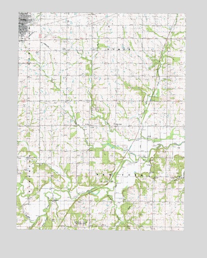
Hamilton East, MO USGS Topographic Map
Click on map above to begin viewing in our Map Viewer.

This topographic map contains these locations and features:
Feature Name Type Latitude Longitude GNIS ID View Map
Baker Hill School (historical)SchoolN39.6267°W93.9547°713572View Map
BonanzaPopulated PlaceN39.6442°W93.9727°748957View Map
Bonanza School (historical)SchoolN39.6417°W93.9730°747006View Map
Brown Jug School (historical)SchoolN39.7131°W93.8902°714782View Map
Brush CreekStreamN39.6333°W93.9799°714858View Map
Caldwell CountyCivilN39.6558°W93.9828°758467View Map
Cliff Scott Airport (historical)AirportN39.7386°W93.9891°758709View Map
Cottonwood CreekStreamN39.6681°W93.9160°716361View Map
Crabapple CreekStreamN39.6475°W93.9327°716443View Map
EastervillePopulated PlaceN39.6272°W93.8991°739615View Map
Easterville School (historical)SchoolN39.6275°W93.8985°717358View Map
Excelsior SchoolSchoolN39.7131°W93.9272°717708View Map
Gould FarmPopulated PlaceN39.6561°W93.9019°739614View Map
Gould Farm BridgeBridgeN39.6647°W93.9022°755190View Map
HamiltonPopulated PlaceN39.7436°W93.9983°719026View Map
Hamilton Accelerated Elementary SchoolSchoolN39.7450°W93.9950°2545265View Map
Hamilton Fire DepartmentBuildingN39.7410°W93.9985°2621710View Map
Hamilton Post OfficePost OfficeN39.7440°W93.9989°2783010View Map
Hopewell CemeteryCemeteryN39.6419°W93.9193°2681365View Map
Hopewell ChurchChurchN39.6422°W93.9180°719808View Map
Liberty Bell SchoolSchoolN39.7131°W93.9647°720955View Map
Liberty Eagle SchoolSchoolN39.6539°W93.8997°720980View Map
Little Otter CreekStreamN39.6789°W93.9080°721287View Map
Log CreekStreamN39.6289°W93.9861°721408View Map
New YorkPopulated PlaceN39.6853°W93.9269°738618View Map
New York Elementary SchoolSchoolN39.6851°W93.9261°747007View Map
Pleasant Ridge School (historical)SchoolN39.6842°W93.9441°724597View Map
Radical School (historical)SchoolN39.6847°W93.8938°725056View Map
ShoalPopulated PlaceN39.6531°W93.9330°738617View Map
Spring Hill School (historical)SchoolN39.6839°W93.9827°726928View Map
Spring Valley School (historical)SchoolN39.6589°W93.9566°726959View Map
Tom CreekStreamN39.6475°W93.9624°727705View Map
Township of GomerCivilN39.7428°W93.9271°766361View Map
Township of New YorkCivilN39.6561°W93.9268°766368View Map
Van Note SchoolSchoolN39.7431°W93.9549°728123View Map

Note: Coordinates in the location and feature list above are referenced to NAD83 datum.


Copyright (C) 2008-2024 Ryan Niemi / Sunset Dynamics ... All Rights Reserved